George Owens Nature Park: An urban getaway in Independence
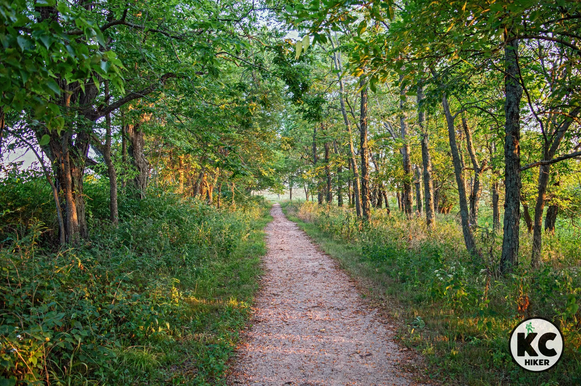
Hidden in the middle of suburban Independence, George Owens Nature Park features three miles of trails around lakes, across streams and through forested rolling terrain. Hikers will encounter several footbridges and can fish in two lakes. An organized group campground is also available on the property. In addition to the outdoors, the park includes an educational center oriented toward children. It’s an excellent place to view birds and other wildlife.

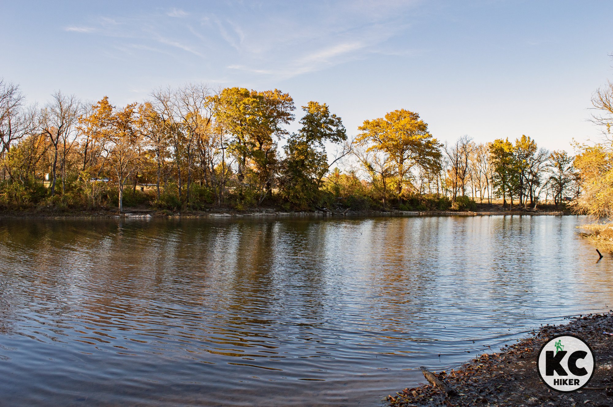
Multiple bridges crisscross streams at George Owens Nature Park in Independence, Mo.
Explore 86 acres of woods, streams and forest in suburban Jackson County.
Overview
Hidden in the middle of suburban Independence, George Owens Nature Park features three miles of trails around lakes, across streams and through forested rolling terrain. Hikers will encounter several footbridges and can fish in two lakes. An organized group campground is also available on the property. In addition to the outdoors, the park includes an educational center oriented toward children. It’s an excellent place to view birds and other wildlife.
Length There are three miles of trails in the park.
Conditions There are both natural surface and paved trails in George Owens Nature Park. Trails are well marked, but can be muddy after a rain and experience some overgrowth during summer months. There are moderate elevation changes.
Kid Friendly? Kids who can carry their own weight will enjoy this hike. There is a picnic area and children’s education center.
Address George Owens Nature Park, 1601 Speck Rd., Independence, MO 64057.
Pets Dogs Yes, on a leash.
Bikes No.
Restrooms are available in the park’s visitors center when it is open. There is also a compost toilet near the picnic area.


Larry’s Trail: An off-the-grid hike at Lake Jacomo
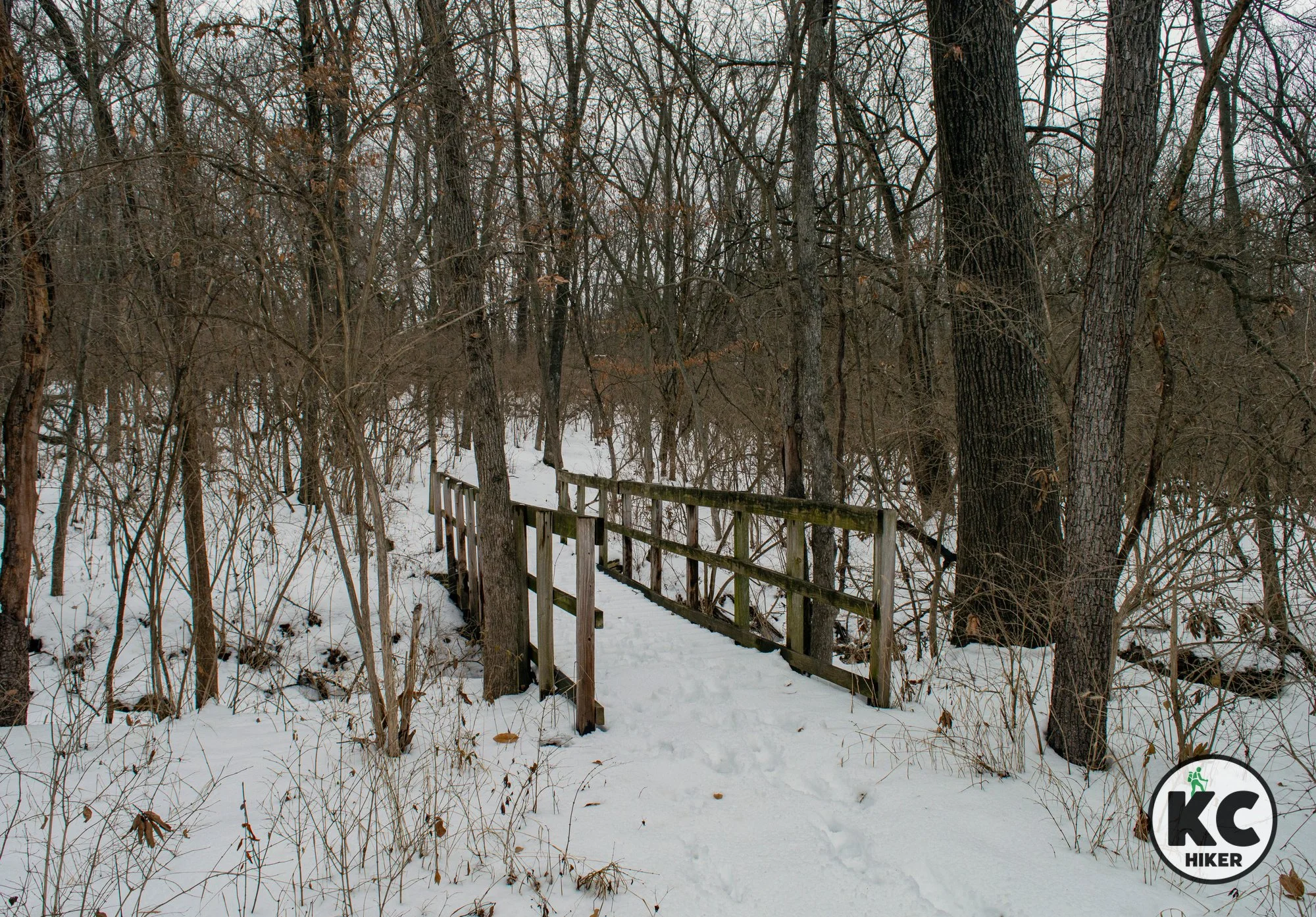
Navigation is difficult and maintenance minimal, but hikers are rewarded with solitude and lakeside scenery on Larry’s Trail at Lake Jacomo in Lee’s Summit, Mo.

Navigation is difficult and maintenance minimal, but hikers are rewarded with solitude and lakeside scenery.
Overview
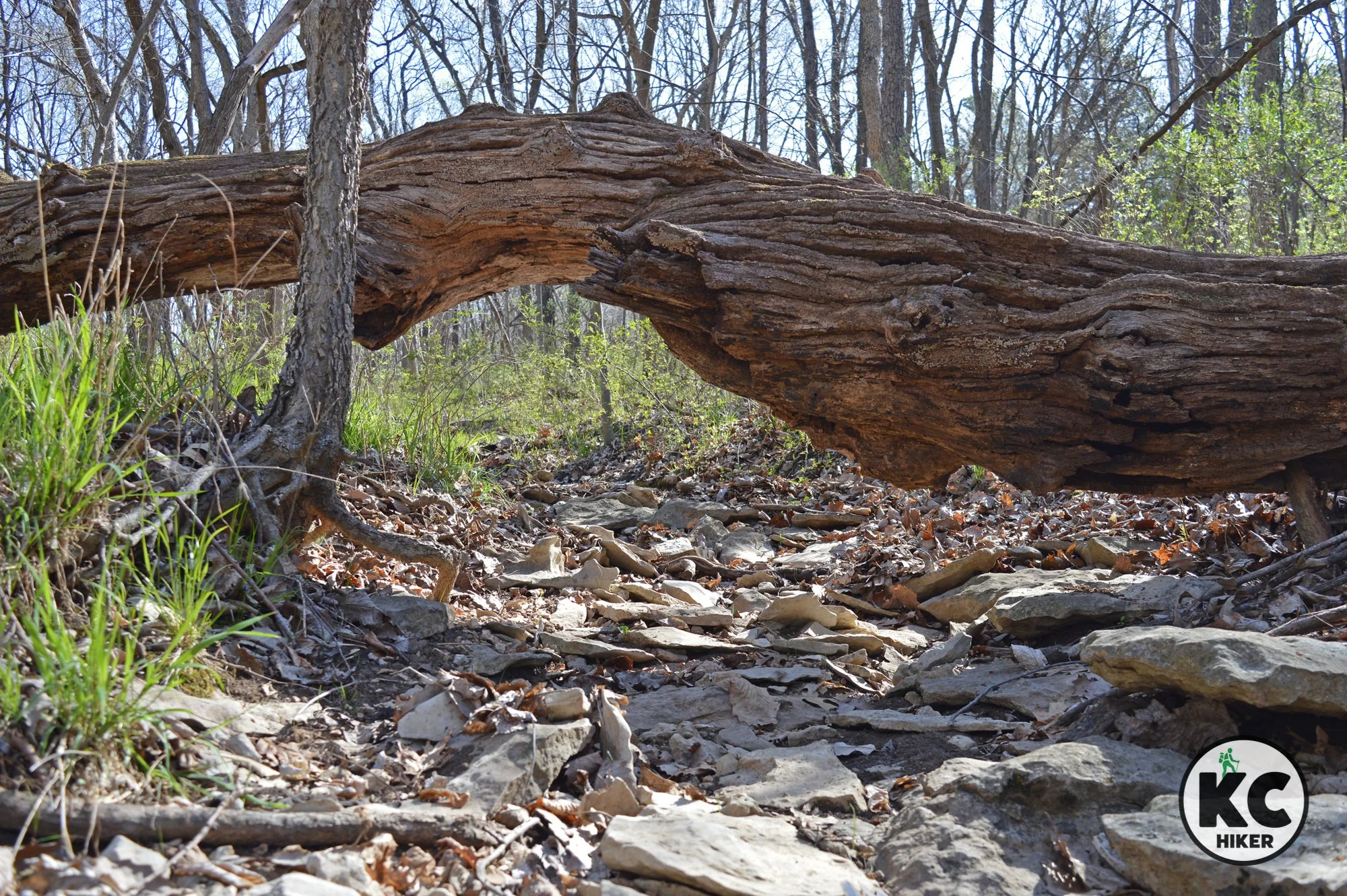
Larry’s Trail is an old, unmaintained trail that does not appear on most trail maps. However, it’s still there and provides a less-traveled alternative to other popular trails at Lake Jacomo (not that they are ever crowded). Larry’s Trail provides near complete solitude and also remains open when mountain biking trails at the lake are closed due to rain or melting snow. Finally, if you like a navigational challenge, this is the trail for you! There does not appear to be a publicly available complete map of Larry’s Trail, which is bordered by many confusing side trails that may or may not have been part of the original trail. A GPS device of some sort will be necessary to make sure you are at least going in the right general direction. Because this trail is faintly marked – if at all – in some places, you’re going to hit some brushy areas. In general, the further south you go, the less visible the trail becomes. This means winter is the best time to tackle this trail. With leaves off, you have a better perspective and won’t be harassed by chiggers, ticks, spiderwebs and poison ivy. With that said, this is a serene trail that follows bluffs above the lake, descends into steep ravines and passes many dry creek beds and clear pools. The trail intersects Jackson County’s Larry Mattonen Trail (a gravel trail that is different from Larry’s Trail) and the Tcha-To-Ga Trail. There is no actual trailhead for Larry’s Trail, which means you’ll need to access it via one of these trails. Enjoy Larry’s Trail, but know what you’re signing up for!
Length You’ll hike at least 3 miles each direction (for a total of 6 miles), but total mileage can vary depending on whether or not you take side loops.
Conditions This dirt trail’s condition varies from easy to see to faint memories of a trail that was once visible. Don’t hike this without a GPS directional device of some sort. It’s extremely easy to get lost, partially because of the presence of many unmarked side trails. The topography is moderately challenging, with some hilly and rocky areas.
Kid Friendly? Kids who can carry their own weight will enjoy this hike.
Address Larry’s Trail can only be accessed via the Larry Mattonen Trail or the Tcha-To-Ga Trail, both at Lake Jacomo. You can park at the trailheads for either of those trails. Download the trail map for more details.
The Larry Mattonen Trailhead is at the intersections of Park Road and Cyclone School Road at Lake Jacomo.
The Tcha-To-Ga Trailhead is near the Native Hoofed Animal Enclosure on Park Road.
Pets Dogs Yes, on a leash. Read the regulations here.
Bikes This trail is rugged but passable for mountain bikers.
Restrooms are not available.


Longview Nature Trail explores the lake’s backcountry
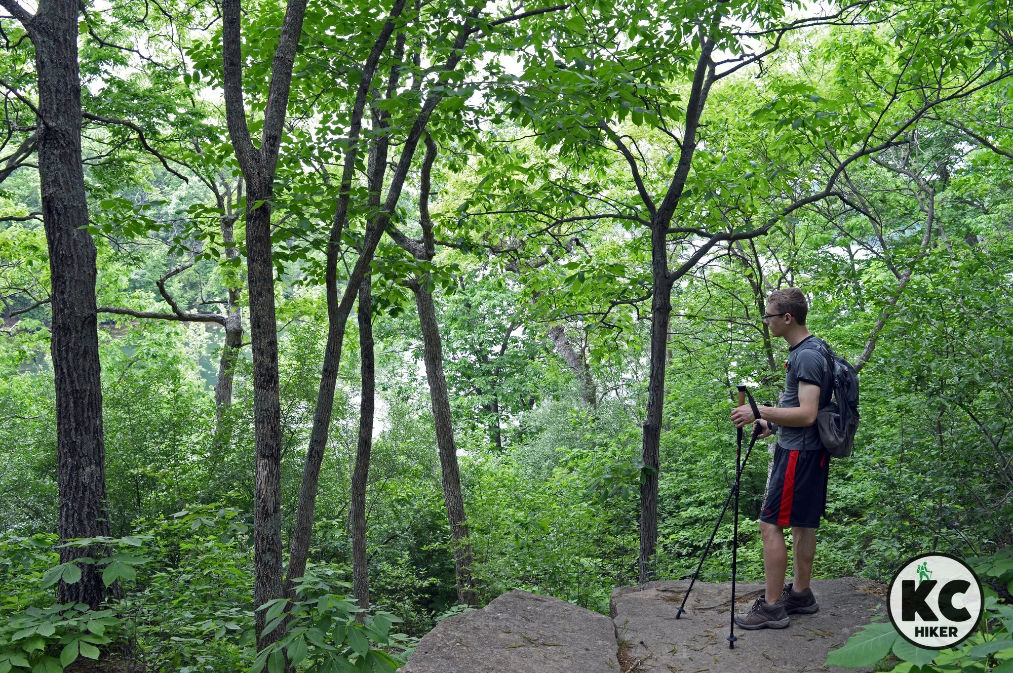
The Longview Nature Trail, also known as the Shin-Ga-Wa-Sa Trail, is a 1.2-mile, natural surface loop that begins and ends at Longview’s Primitive Youth Campground. This little-known trail near Longview Lake explores rugged terrain and leads to a rocky streambed.

Explore the “back country” of the Longview Lake area on the rugged Longview Nature Trail.
The Longview Nature Trail isn’t easy to find and it’s rugged to hike. But it holds rewards.
Overview
The Longview Nature Trail, also known as the Shin-Ga-Wa-Sa Trail, is a 1.2-mile, natural surface loop that begins and ends at Longview’s Primitive Youth Campground. There are many reasons why you may not have heard of it. For one, the entrance is nearly always gated. That doesn’t mean it’s closed, but merely that vehicle traffic is blocked. Just park on Highgrove Road and make the short walk to the trailhead. Second, it has a funky name. Finally, the trail is in mediocre shape, to put it nicely. It’s a dirt path and there is overgrowth and erosion that makes the footing a little dicey. Navigation is not intuitive. With that said, this trail takes hikers through an upland forest, past a serene pond and down to the highlight: the broad limestone shelf and valley cut by Lumpkins Fork Creek. The elevation drops 150 feet from the camping area to the creek bottom. Lumpkins Fork can range from a trickle that is easily forded to a rampaging, impassable torrent. It’s a scenic valley in either state. We’ve created a trail map below, but the AllTrails app is recommended. If you are up to bushwhacking, there are several small streams, rock outcroppings and bottomland forest to explore. You can also reach the Little Blue River and backwater lagoons of Longview Lake.
Length 1.2-mile loop.
Conditions This trail is in fairly poor shape, but there’s enough of a path to follow that you can still enjoy it with a little determination. The AllTrails app will help. After a rain it will be extremely sloppy and slippery. Some of the trail is overgrown, so it’s best not to walk it during tick and chigger season.
Kid Friendly? Kids who can carry their own weight will enjoy this hike. The stream at the bottom of the trail can provide hours of enjoyment.
Address 9105 Highgrove Rd, Kansas City, MO 64149. Look for the gate and driveway on the south side of Highgrove. Park on the shoulder and walk down the driveway. Once you reach the parking lot, it’s not immediately apparent where the trailhead is. In fact, there are three. The nearest access point is a semi-paved road heading down the hill. Enter it through an open gate. You can also access the trail by heading southeast where you’ll find a marked entrance, and further down, entrance via a utility easement. For clarity, download our trail map. Photos of each trail entrance are posted below.

Pets Dogs Yes, on a leash. Read the regulations here.
Bikes Not recommended because of conditions.
Restrooms are not available.


Roanoke Park: A forested urban gem
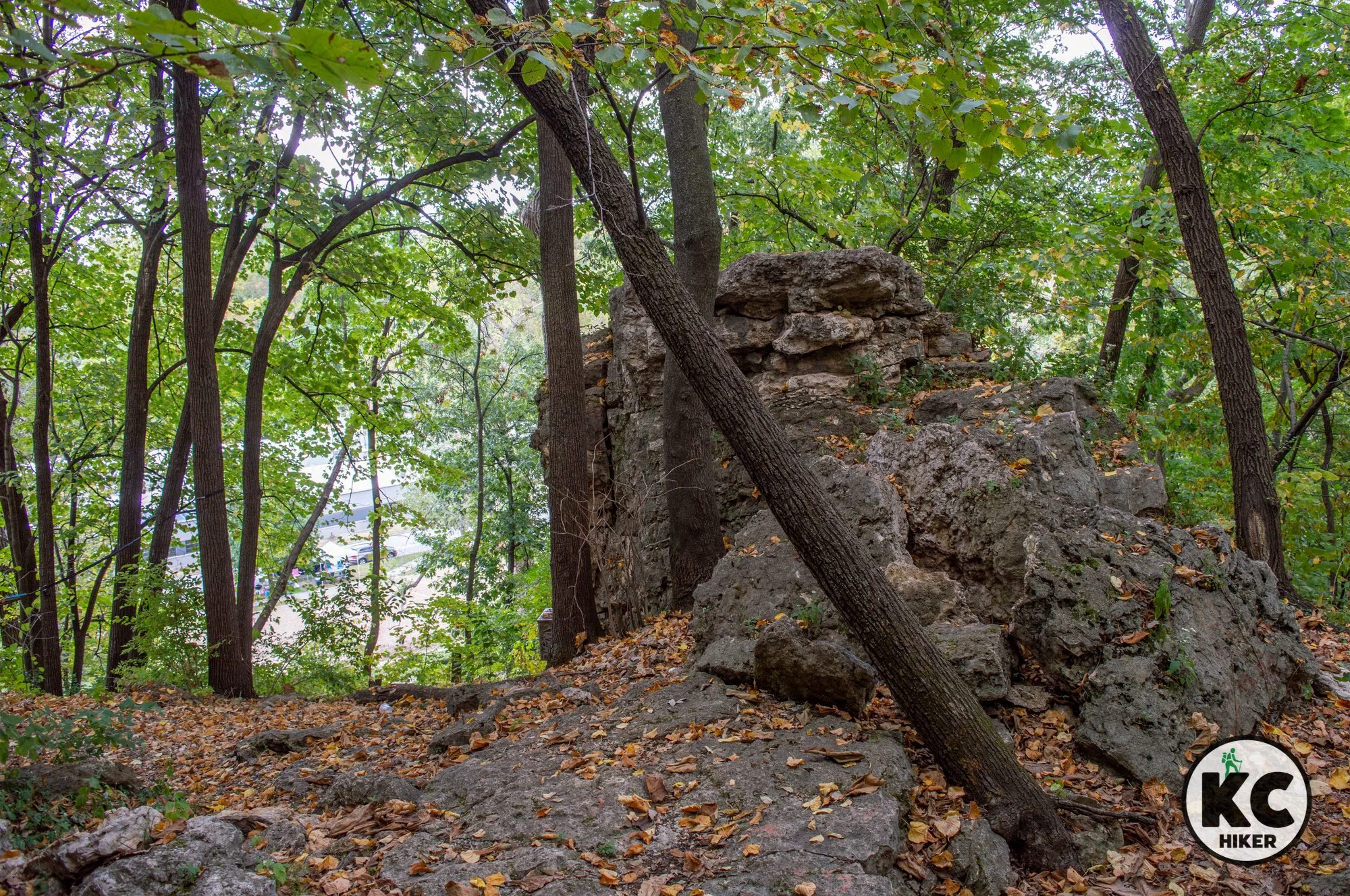
The 37-acre Roanoke Park has been a fixture of Kansas City, Mo., for more than 100 years. However, its mountain bike/hiking trails are a more recent addition. More than two miles of trails wind through rocky bluffs and woodlands in the urban core of KC.

More than two miles of trails wind through rocky bluffs and woodlands in the urban core of KC.
The 37-acre Roanoke Park has been a fixture of Kansas City, Mo., for more than 100 years. However, its mountain bike/hiking trails are a more recent addition. The park preserves some of the best of the area’s limestone outcroppings and forest – smack in the middle of urban Kansas City. If you are looking for a geographic point of reference, the park is east of the University of Kansas Medical Center and northwest of Westport. It’s a nearby and pleasant walking experience on a single-track trail. Note: Please avoid this trail when muddy to avoid injury and damage to the trail.
Length 2.5 miles.
Condition This is a well-maintained dirt pathway suitable for hiking and mountain biking. It’s hilly, but there are no extreme elevation changes. The ground is rocky, so if you struggle with balance, bring a walking stick.
Kid Friendly? This is an excellent trail for children to enjoy nature. However, they’ll need to walk or be carried. In addition, there are several steep hills and sharp drop-offs, so parents will want to be mindful of small children and cliffsides.
Address Park at the community center at 3601 Roanoke Rd, Kansas City, Mo., 64111.
Pets Yes, on a leash, unless otherwise designated.
Busy? This is a moderately-trafficked trail.
Bikes Yes.
Restrooms are available at the Roanoke Community Center when it’s open.


Kessler Park and Cliff Drive trails hug forested bluffs in historic KC
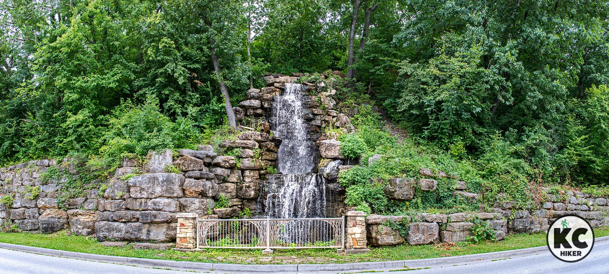
Kansas Citians have been enjoying the river bluff environment that is now Cliff Drive and Kessler Park for more than a century. Forested, rocky bluffs rise about 250 feet above the Missouri River below. The centerpiece for hikers and bikers today is a two-lane parkway closed to vehicles.

Cliff Drive is closed to vehicles and open to walkers and bikers in Kansas City, Mo. Pictured here is Carl Dicapo Fountain.
This urban walk hugs forested bluffs in a historic part of Kansas City.
Kansas Citians have been enjoying the river bluff environment that is now Kessler Park for more than a century. Forested, rocky bluffs rise about 250 feet above the Missouri River below. There are ups and downs to the park, both metaphorically and literally.
On the upside, Cliff Drive is the centerpiece of the park and runs about four miles along the base of towering cliffs. The drive is usually closed to vehicles, which means you, your stroller and your bike have an entire two-lane roadway to yourself. No need to look over your shoulders for an oncoming truck! There’s nothing else like this in Greater Kansas City. The walk (or bike) is serene, with wooded cliffsides shooting upward on the south and bluffs fading off to the Missouri River on the north. A highlight is the Kessler Park (or Cliff Drive) Waterfall. It’s a man-made fall, but beautiful nonetheless. Officially, it’s known as the Carl Dicapo Fountain. There is also a spur, The Cliff Drive Trail, which takes you 0.4-miles down the steep river bluff on a paved path. Stairs also lead off the drive to Lookout Point, which provides a bird’s eye view of riverfront. Finally, Missouri’s largest tree is found in the park, just below Lookout Point (learn more below).
On the downside, the area is showing some wear and tear after a century of use. The surrounding buildings and structures that were grand a century ago are cracking and falling apart. There’s still grandeur there, but it’s faded. In addition to the excellent walkway on Cliff Drive, there is an extensive mountain bike trail system that cuts through the highlands of the park. The route, created by the Urban Trail Co., is well marked and maintained. But it’s nearly spoiled by illegal dumping that has occurred over years. The woods, sadly, are full of trash. But this is not the case for the parkway along Cliff Drive, which is mowed and well maintained. So unless you’re a hard core biker and you don’t care about the debris, stick to the street.
A note with safety in mind
I’ve posted about Cliff Drive many times on social media. I’ve walked it multiple times and never had anything weird or disconcerting happen. If my experience had been otherwise, I would never recommend it (or any trail that appeared unsafe). But I’ve learned something new: Others have had a much different experience. In six years of publishing KC Hiker, I have never received more comments about safety than I have about Cliff Drive after a recent post. And they aren’t vague concerns: They are very specific and detailed. Others, however, say they have walked it daily for years without incident. Can both views be true? I believe so. This topic is obviously polarizing. I’m not here to tell you whether to walk Cliff Drive or not, but you should be fully informed if you do. One of the reasons Kansas City Hiker was created was to provide information about trails in a spirit of transparency. And that’s what I want to do here.
Thanks to all who have shared their experiences about this walk.
– Roy Harryman, Publisher
Length The paved walkway (Cliff Drive) is about four miles each way. If you walk the full length, then return, your total will be 8 miles.
Condition This roadway is a National Scenic Byway, but it’s closed to vehicles (unless otherwise noted). You just walk and follow the road, which is in great shape.
Kid Friendly? Since the road is closed to vehicles, most safety issues are removed. Parents will want to be mindful of passing cyclists.
Address The Cliff Drive byway is about four miles long. Parking can be accessed along the route, including at:
West entrance, Paseo 1801 Cliff Drive, Kansas City, Mo., 64106
East entrance, Gladstone Blvd. 4398 Cliff Drive, Kansas City, Mo., 64123
Middle entrance (walk the access road to Cliff Drive after parking) Walrond Ave. and Gladstone Blvd. intersection
Lookout Point access 192 N Garfield Dr, Kansas City, Mo., 64124
Pets Yes, on a leash, unless otherwise designated.
Busy? This is a moderately-trafficked trail, but there’s plenty of room across two lanes of roadway.
Bikes Yes.
Restrooms are available at the nearby Museum of Kansas City during business hours. Portable toilets may be available in Kessler Park.
Bonus features in and around Kessler Park (Cliff Drive area):
Lookout Point (can be accessed from the walking tour or by vehicle)

Map courtesy of OpenStreetMap.


Waterfall Park: An anchor of nature amid the bustle of suburbia
Waterfall Park, in Independence, is an anchor of nature amid the bustle of suburbia. This busy lakeside loop trail includes a waterfall, wildflowers and woods – all in the shadow of Bass Pro.

Waterfall Park and Trail, Independence, Mo.
This busy lakeside loop includes a waterfall, wildflowers and woods – all in the shadow of Bass Pro.
What could be more natural than hiking in the shadow of the behemoth Bass Pro outdoors store in Independence, Mo.? Waterfall Park is a paradox of sorts. There’s an epic waterfall — but it was built by a construction crew. There’s a reed-encircled lake – that borders Bass Pro and other commercial establishments. Yet for all the busyness, there is tranquility to be found at Waterfall Park. The waterfall, though man made, is still beautiful and it cascades several stories into the lake. Wildflowers and birds are abundant. There are ample spots to throw in a fishing line. Plus places for kids to play. You won’t “get away from it all” at Waterfall Park, but you can experience nature in the midst of it all.
Length The loop surrounding the lake is 1.2 miles if you begin at the parking area at Waterfall Park (4501 S. Bass Pro Drive, Independence, Mo., 64055). However, if you’d like a longer walk, you can begin at the parking area at Lee’s Summit Road and Bass Pro Drive. From there, a 0.9 mile paved path follows the road to the park. So your mileage options are:
1.2-mile loop.
3-miles if you begin at the Lee’s Summit Road/Bass Pro Drive parking area.
Condition This is a paved trail and it’s easy to follow. Note that the footpath merges with E. Bluff Drive immediately south of the main parking area. This can appear dangerous and confusing to walkers and bikers. But have no fear. Although Bluff Drive is two lanes, one of the lanes is closed to vehicle traffic. That means you can walk in it without fearing for your life (although situational awareness is always a good thing). After a short stint on Bluff Drive, the trail returns to a paved footpath at the intersection of Bass Pro Drive. In terms of difficulty, this trail is easy with minimal elevation changes.
Kid Friendly? This paved trail is suitable for strollers and bikes. Awareness is required on the section that merges with Bluff Drive. (Although there is a walking lane, it’s still a road with moving vehicles.) Parents will want to be mindful of water safety if children play near the lake. In addition, the trail and park are popular and busy destinations, so general awareness is advised.
Address Waterfall Park, 4501 S Bass Pro Drive, Independence, Mo., 64055
Pets Yes, on a leash, unless otherwise designated.
Busy? This is a heavily-trafficked trail.
Bikes Yes.
Restrooms are available near the public parking area.
Official website Independence, Mo., Parks and Recreation


Landahl Park: Explore forest uplands in Eastern Jackson County
Landahl Park offers a sprawling network of trails, with 20 miles winding through ridges, valleys and pastoral settings. Topographically, the area is centered on a ridge that rises about 150 feet above surrounding farmland. Trails wind up, down and all around the park, making it a destination to return to again and again.

Landahl Park features 20 miles of trails through woodlands and uplands on 1,400 acres near Blue Springs, Mo.
Bikers and hikers can roam nearly 1,400 acres of ridges and valleys near Blue Springs.
Landahl Park offers a sprawling network of trails, with 20 miles winding through ridges, valleys and pastoral settings. The Urban Trail Co. has partnered with Jackson County Parks and Recreation to create one of the pre-eminent trail experiences in the Kansas City area. Topographically, the area is centered on a ridge that rises about 150 feet above surrounding farmland. Trails wind up, down and all around the park, making it a destination to return to again and again. While the area is rural and rustic, it is not completely removed from humanity. There is a nearby Department of Conservation Shooting Range, so gunfire is a frequent background noise (though not a physical danger).
Length There are 20 miles of single-track mountain bike trails.
Condition This is a narrow, single-track mountain bike trail system (though it’s also open to walkers). Although extreme elevation changes are rare, there are moderately challenging sections for walkers. The ground is either hard-packed dirt or rock. From a biking point of view, the trail is highly technical and challenging. There are numerous loops and alternative pathways, so a map is a must (one is available below). The AllTrails app is also helpful. Most of the trail is covered by a forest canopy, so be aware of poison ivy and apply insect repellent in season. Note: This is a public trail maintained by a private organization. Walking or biking on the trail under muddy conditions is prohibited. Check the Urban Trail Co. website for trail closure information.
Kid Friendly? This is a trail for children who can generally carry themselves and enjoy the outdoors – in other words, hearty kids.
Address and getting there Landahl Mountain Bike Park, E. Argo Rd, Independence, Mo., 64057. The nearest intersection is Argo Road and Slaughter Road. The northern boundary of the park is Truman Road. Landahl Park is a few minutes north of Blue Springs, Mo.
Pets Yes, on a leash. Read the regulations here.
Bikes Yes, but check trail advisories after rain or snow. Biking on muddy trails is prohibited.
Restrooms are not available.
Official websites


Get off the beaten path at Ferguson-Herold Conservation Area
At Ferguson-Herold Conservation Area, you can explore 175 acres of prairie, lowland forest and upland timber in Lafayette County, just east of Oak Grove, Mo.

Ferguson-Herold Conservation Area, Lafayette County, Mo., near Oak Grove.
Explore 175 acres of prairie, lowland forest and upland timber.
The Ferguson-Herold Conservation Area is actually in Lafayette County, though we’re listing it here under Jackson County, Mo. It’s only about a mile over the border and is near Oak Grove. Its size is ideal for a few hours of exploring via the refuge’s mowed grass service roads. At first blush, it seems to be mostly reclaimed fields. But this conservation area merits a second look. Little Horseshoe Creek is a crystalline prairie stream that cuts through the middle of the park, leaving a deep gash in the earth. It’s worth exploring in and of itself, though you’ll have to do some off-trail bushwhacking. Wildflowers are abundant throughout the park. Despite first impressions, the area is not flat. In fact, there’s 200-foot vertical elevation change from the north end of the park to its southern end. There, a steep, forested hill gives way to a prairie plateau. Near its summit is the historic family cemetery of the Ferguson family, who once owned and farmed the land in the late 1800s. There are a few headstones and most are still legible. In addition to the topography, wildlife – including turkey and deer – are abundant. Note: This is a Missouri Conservation Area, so seasonal hunting is allowed.
Length The mowed service roads provide about 2 miles of rough pathways in several loops. This is more of a self-navigating experience.
Condition Although there are mowed service roads, this is a hike for people who are comfortable not having a well-marked, designated trail. It’s easy to find your way around and the area is small enough that it’s unlikely you’ll get disoriented. Because of high grasses, wear insect repellent and long pants to protect your skin.
Kid Friendly? This is a trail for children who can generally carry themselves and enjoy the outdoors – in other words, hearty kids.
Address and getting there Ferguson Herold Conservation Area is off the beaten path, but not difficult to find. It can be approached from I-70 or less-traveled backroads. The address is: Ferguson-Herold Conservation Area, 2201 Walton Ext. Rd, Bates City, Mo., 64011.
Pets Yes, on a leash. Read the regulations here.
Bikes Prohibited.
Restrooms are not available.


Scratch out a hike on Lake Jacomo’s Bobcat Trail
The Bobcat Trail (and its Hoot Owl Trail extension) explore the forest and prairie in the hills above Jacomo. It connects to the Prickly Pear Trail and the Rock Ledges Loop Trail.

Lake Jacomo Trail System, Bobcat Trail, Lee’s Summit, Mo., Jackson County.
Explore the forest and prairie in the hills above Lake Jacomo.
The Bobcat Trail (and its Hoot Owl Trail extension) explore the forest and prairie in the hills above Jacomo. It connects to the Prickly Pear Trail and the Rock Ledges Loop Trail.
The Bobcat Trail can be accessed on Beach Road, just north of the Lake Jacomo Campground.
If you head west from the trailhead, it zigzags back and forth as it gains elevation and heads west. Topography ranges from a high, forested plateau to ravines with moderate grades. The trail has a wild and remote feel to it, although you see remains of commercial buildings that are lost to history. A highlight of the Hoot Owl extension is a towering grove of Douglas Fir trees, origin unknown. Note: The Bobcat Trail doesn’t have a “hard” ending, but simply merges with the Prickly Pear Trail at the Lake Jacomo Campground. If the campground is open, you can also begin your walk there.
If you head east from the trailhead, you’ll ascend bluffs overlooking Lake Jacomo, including some massive boulders, before connecting with the Rock Ledges Loop.
Length 2.5 miles
Condition These trails are well worn, well-marked dirt paths maintained by the Urban Trail Co. They are publicly owned and privately maintained. These single-track trails are challenging and rigorous with many elevation changes and plenty of rocky steps. Trail rules mandate staying off the trail when it’s muddy. Check the Urban Trail Co. website for closure updates.
Kid Friendly? This is a well-marked but rough path impassable for strollers. Children will need to walk or be carried. Children (and adults) will also need to yield to passing mountain bikers.
Address and getting there The main trailhead for the Hatchet Job and Bobcat Trails is an improvised gravel parking lot along the east side of Beach Road. It’s just north of the entrance to the South Boat Dock and Campground. The campground address is 9200 Beach Rd, Lee's Summit, Mo., 64086. Below you’ll find a Google Map and a detailed trail map. The Bobcat Trail can also be accessed from the Lake Jacomo Campground.
Pets Yes, on a leash. Read the regulations here.
Bikes Suitable for mountain bikes.
Restrooms are not available.


Beach Road trailhead for
Bobcat Trail at Lake Jacomo

Lake Jacomo: Rock Ledges Loop Trails
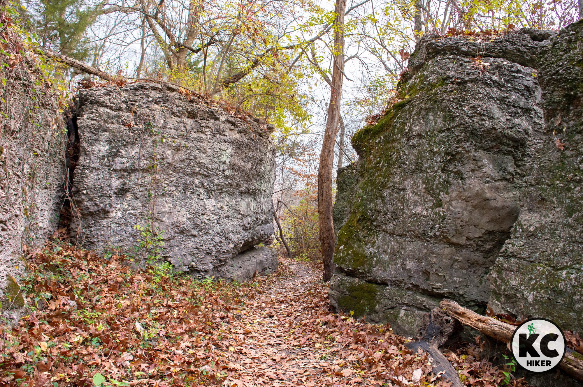
Lake Jacomo’s Rock Ledges Loop Trails follow a lake peninsula on the west side of the reservoir. The scenery is spectacular as the trail winds in and out of limestone boulders, rocky shelves and cliffs. Numerous sentinel-like rock formations appear throughout the landscape.

Lake Jacomo Trail System, Rock Ledges Loop Trails, Lee’s Summit, Mo., Jackson County.
Explore a natural wonderland of rock formations, water and woods.
Lake Jacomo’s Rock Ledges Loop Trails follow a lake peninsula on the west side of the reservoir. The scenery is spectacular as the trail winds in and out of limestone boulders, rocky shelves and cliffs. Numerous sentinel-like rock formations appear throughout the landscape. In addition, the Ledges Loops provide views of the lake and a broad inlet valley. The entire length of both trails is forested. There are two trails: lower and upper, plus an extension into a ravine. The lower trail sticks closer to the lakeshore while the upper follows rocky ridgetops. Both trails are in view of each other for most of their lengths. There are also several places to switch from one trail to another.
Length Upper Ledges Loop = 1 mile; Ledges Loop = 2.5 miles; Ledges Extension = 1 mile.
Condition These trails are well worn, well-marked dirt paths maintained by the Urban Trail Co. They are publicly owned and privately maintained. These single-track trails are challenging and rigorous with many elevation changes and plenty of rocky steps. Trail rules mandate staying off the trail when it’s muddy. Check the Urban Trail Co. website for closure updates.
Kid Friendly? This is a well-marked but rough path impassable for strollers. Children will need to walk or be carried. Children (and adults) will also need to yield to passing mountain bikers.
Address and getting there Look for the sign on Beach Road that says “Organized Youth Group Campground.” The closest coordinate is Lake Jacomo Shelter 14, Lee’s Summit, Mo., 64086. Shelter 14 is immediately south of the trail head. To reach the trail head, turn off of Beach Road at the Organized Youth Group Campground sign and drive to the end of the gravel road, where you will find a locked yellow gate. Park and walk past the gate and you’ll encounter access signs where the trail crosses the gravel road. Note: This is not the large campground open to motor homes and trailers that is more prominently known.

Pets Yes, on a leash. Read the regulations here.
Bikes Suitable for mountain bikes.
Restrooms are not available.


Lake Jacomo: The Tcha-To-Ga Trail is rustic and rugged
Lake Jacomo’s Tcha-To-Ga Trail transverses woods, streams and provides panoramic views of Lake Jacomo. It also features a glade with (in season) wildflowers and prickly pear cactus. The trail is often overgrown, so proceed with caution.

Lake Jacomo Trail System, Tcha-To-Ga Trail, Lee’s Summit, Mo., Jackson County.
Winter is the best time to walk this often overgrown trail.
Tcha-To-Ga Trail
This trail, with a name apparently translated “mad buffalo,” begins at a pond near the entrance to Missouri Town 1855. It transverses woods, streams and provides panoramic views of Lake Jacomo. It also features a glade with (in season) wildflowers and prickly pear cactus. You’ll be glad to know there are no mad buffalo roaming these woods.
Length Strictly speaking, this is a 1.2-mile loop. However, it connects with other area trails that are unmarked and do not appear on the trail map. If you aren't careful, you can stretch a one-mile loop into several miles and not be quite sure where you are. The path is easy to see and follow, but there are very few signs. Bring a compass and/or phone navigation system (and some water), just in case.
Conditions This is a dirt path of moderate difficulty. Hazards include exposed roots and mud after a rain. In summer, poison ivy and bugs will be a challenge. Trail maintenance seems to have been neglected for quite sometime, meaning overgrowth is an obstacle in warm months. For this reason, winter is a preferable season to walk this trail.
Kid Friendly? Although it’s not equipped for strollers, this is a relatively easy trail to walk.
Address Located on East Park Road, the trail head is near the Native Hooved Animal Enclosure at Lake Jacomo. It’s also near 1855 Missouri Town. There are a few parking spaces immediately in front of the trail head sign, which sits in front of a pond. Park at the Animal Enclosure across the street if those spaces are taken.
Pets Yes, on a leash. Read the regulations here.
Bikes Suitable for mountain bikes.
Restrooms are not available.


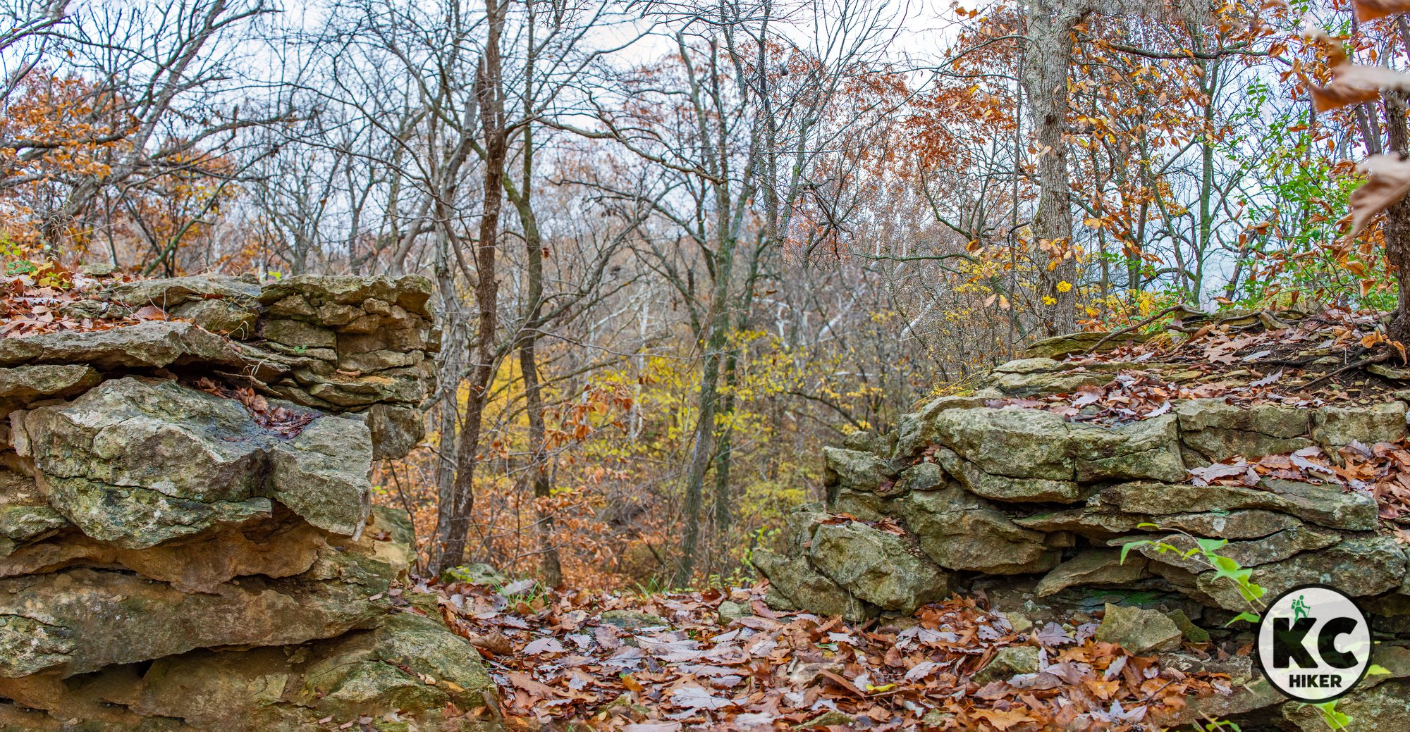
Lake Jacomo: Scale Lakeside Bluffs on the Prickly Pear Nature Trail
This trail explores the wooded bluffs that tower up to 90 feet over the south end of Lake Jacomo. You’ll walk among limestone outcroppings, giant boulders and take in vistas of the lake. The trail also features stone remains of old homes, century-old trees and a few ponds. There are two trail heads: One across the street from the Jacomo spillway and the other at the Jacomo campground. This trail also connects to the Bobcat Trail, which is maintained by the Urban Trail Co.

Lake Jacomo Trail System, Prickly Pear Nature Trail, Lee’s Summit, Mo., Jackson County.
Prickly Pear Nature Trail
This trail explores the wooded bluffs that tower up to 90 feet over the south end of Lake Jacomo. You’ll walk among limestone outcroppings, giant boulders and take in vistas of the lake. The trail also features stone remains of old homes, century-old trees and a few ponds. There are two trailheads: One across the street from the Jacomo spillway and the other at the Jacomo campground. This trail also connects to the Bobcat Trail. This trail is maintained by the Urban Trail Co. and can be closed when conditions are wet. Check the trail status here.
Length 1.5-mile loop
Condition This is a dirt path with several rocky steps and minor elevation changes. It is generally easy to follow.
Kid Friendly? Although there are few elevation changes, this is a rocky trail with steep cliffs. Caution is advised for small children. It’s impassable for strollers.
Address Intersection of Colbern and Beach roads, Lee’s Summit, MO 64086. Or enter at the Lake Jacomo Campground. Park at the Lake Jacomo spillway parking lot on the south side of Colbern Road. Colbern is busy, so be careful and help children to get across safely. The trail head is immediately across the street and is marked with a sign. You can also access it from the Lake Jacomo campground.
Pets Yes, on a leash. Read the regulations here.
Bikes Yes – but mountain bikes are recommended because the terrain is rough.
Restrooms are not available.


Colbern Road Trailhead

Lake Jacomo: Pa-Huska Nature Trail
There’s an unexpected wildness to Lake Jacomo’s Pa-Huska Nature Trail, which immediately takes you “off the grid” into a shallow valley cut by clear streams and limestone creek beds. Toward its end, the trail climbs a rocky ridge and then descends to a marsh near the parking area.

Lake Jacomo Trail System, Pa-Huska Nature Trail, Lee’s Summit, Mo., Jackson County.
A short loop quickly moves you into nature.
There’s an unexpected wildness to this little trail, which immediately takes you “off the grid” into a shallow valley cut by clear streams and limestone creek beds. Toward its end, the trail climbs a rocky ridge and then descends to a marsh near the parking area.
Length 1.2 miles
Condition This is a dirt trail with minor elevation changes. It’s important, though, that you be surefooted because there are many obstacles to stumble over. As with most Jacomo trails, this one has few markers. However, the trail is well worn and never ventures far from a roadway. In summer, bugs, cobwebs and poison ivy will be challenging. The trail is a loop. However, it’s easy to get confused because the Augie Trail also intersects with the Pa-Huska loop. So if you’re not careful, you could walk a long distance on another trail before you realize it.
Kid Friendly? This is a lightly trafficked dirt trail, so children who can carry their own weight should enjoy it.
Address Lake Jacomo Sail Boat Cove, 740 E Park Rd, Lee's Summit, Mo., 64086.
Finding it At our last check, there were no signs marking the entry to this trail, only a small gravel parking lot. If you are entering from the north, the parking lot is before you exit for Sailboat Cove. If you are coming from the south, the parking lot is after the exit.
Pets Yes, on a leash. Read the regulations here.
Bikes Yes
Restrooms are not available.


Lake Jacomo: Larry Mattonen Trail
The Larry Mattonen loop is Lake Jacomo’s most well-maintained trail. It’s essentially a gravel road that divides into two loops – like a giant figure 8. It’s a pleasant, quiet and mostly forested walk with pastoral scenes, limestone outcroppings and views of the lake.

Lake Jacomo Trail System, Larry Mattonen Trail, Lee’s Summit, Mo., Jackson County.
This 2-mile gravel loop is Lake Jacomo’s most accessible trail.
The Larry Mattonen loop is Lake Jacomo’s most well-maintained trail. It’s essentially a gravel road that divides into two loops – like a giant figure 8. It’s a pleasant, quiet and mostly forested walk with pastoral scenes, limestone outcroppings and views of the lake.
Length 2-mile loop (although you can bail out halfway through via a shortcut). A closed access gate provides an entrance to an old road that leads down to the lakeshore (it’s all public park property).
Conditions This is a gravel road (but restricted to bikers and hikers). It’s generally flat with few elevation changes. There are many spurs off of the main trail. These are poorly marked, however, and it’s easy to get lost, so wander at your own risk.
Kid and stroller friendly? Children should be able to walk on their own. Pushing a stroller will mean a bumpy ride.
Address Cyclone Road, Lee's Summit, MO 64086. See the map below for more specific location directions. This trail head is in the vicinity of Missouri Town 1855. A highly visible sign is posted next to the road.
Pets Yes, on a leash. Read the regulations here.
Bikes Yes.
Restrooms are not available.


Hartman Memorial Park & Winterset Nature Area
At first glance, Hartman Memorial Park looks like its set in the Missouri Ozarks. But, fortunately, it’s set in the heart of Lee’s Summit for the public to enjoy. The defining attribute of the park is Cedar Creek, which has carved its way through 50-foot-tall limestone bluffs. The result are cliffs, gigantic boulders and waterfalls. A trail follows the stream, but you’ll see many people exploring off trail. The north side of the park offers a pleasant excursion through grassland and forested groves. Trail extensions lead to an adjacent neighborhood a bluff overlooking the park. As a bonus, the Rock Island Rail Trail’s main trail head is also in Hartman Park.

Charles David Hartman Memorial Park and Winterset Nature Area, Lee’s Summit, Mo.
This small Lee’s Summit park adjoins the Rock Island Rail Trail and is home to waterfalls and rock outcroppings.
Trail Charles David Hartman Memorial Park and Winterset Nature Area
Overview
Lee’s Summit’s Hartman Memorial Park is one of the most popular trailheads for the Rock Island Rail Trail. But it’s also a destination in and of itself. About a mile worth of trails follow the waterfalls and 50-foot rocky bluffs along Cedar Creek. Trails also wind through an adjacent park called Winterset Nature Area. This park is home to cliffs, boulders and numerous small falls along the stream. In addition to exploring Hartman Park, it’s a great starting point for a Rock Island Rail Trail hike or bike.Length The official trail itself is only about three-fourths of a mile long. You can retrace your steps for a longer walk or jump onto the Rock Island Trail.
Address and location
700 S.W. Pryor Road , Lee’s Summit, Mo., 64081
Conditions The portion of the trail bordering the baseball fields is paved. The Winterset Nature Area trail and the trail extensions are surfaced with wood chips. The Rock Island Rail Trail is gravel.
Kid friendly? The paved trail is flat and easy. Trails in the adjacent Winterset Natural Area are made of wood chips. While children may enjoy playing in the stream, don’t leave them unsupervised. The Rock Island Rail Trail (gravel surface) is often busy so parents should be mindful of bike traffic. The park also includes a playground area.
How busy? The park can be busy and the parking lot can fill up on picturesque days. Choosing a morning visit or an off-season day will provide more seclusion.
Pets Yes, on a leash (unless otherwise designated)
Bikes Non-motorized bicycles are permitted on the Rock Island Rail Trail.
Restrooms Public restrooms are open seasonally.


Experience Lakeside Splendor on the Blue Springs Lake North Shore Trail
The Blue Springs Lake North Shore Trail brings you in constant contact with the lakefront and waterfowl, winds through craggy boulders and cliffs and cuts through deep woods. It’s a 4.5-mile one-way trip, meaning it’s 9 miles total.

The Blue Springs Lake North Shore Hiking Trail
Follow the lakefront through forest, cliffs and over stream crossings.
Trail Blue Springs Lake North Shore Trail
Overview The Blue Springs Lake North Shore Trail does not appear on most public park maps because it was created and is maintained by a local bike club (thanks!). However, it is expertly maintained, marked and easy to follow. Although it’s bike-oriented, hikers are welcome. This trail should not be confused with the Jackson County Lake Vista Trail, which follows the east and southern end of the lake and is much wider. The North Shore Trail (meaning the one you’re reading about now) is the more scenic of the two. It brings you in constant contact with the lakefront and waterfowl, winds through craggy boulders and cliffs and cuts through deep woods.
Length 4.5 miles each way. If you walk the entire trail out and back, the distance is 9 miles. In addition, there are up to three parallel routes of varying difficulty (easiest, more difficult, most difficult), so your mileage can vary if you decide to explore these alternative routes.
Address and location The north access is the parking lot on Lake Ridge Road, Lee’s Summit. Lake Ridge Road runs across the dam of Blue Springs Lake. It is near the Blue Springs Lake Boat Dock. Alternatively, you can enter from the south side by parking on the shoulder of southbound Woods Chapel Road, north of the bridge over Blue Springs Lake. There is no parking lot, but the shoulder is wide. You can also access the trail from Blue Springs Lake shelters B, C, D, E and F, but these entrances may be overgrown and unmarked.
Conditions This is a narrow, single track, hard-packed dirt trail. Some of it is rocky and there are mild elevation changes depending on which route you take. It is well-marked and easy to navigate.
Kid friendly? Parents will want to be mindful of bikers and of water safety near the lake. The trail is narrow.
How busy? This trail is moderately trafficked.
Pets Yes, on a leash (unless otherwise designated)
Bikes Non-motorized bicycles are permitted.
Restrooms may be seasonally available in picnic shelters adjacent to the trail.


Northern Trailhead: Blue Springs Lake North Shore Trail

Follow the Missouri River at Liberty Bend Conservation Area
Liberty Bend Conservation Area provides a unique degree of intimate access to the Missouri River. Often, we’re left to view the “Big Muddy” in ugly industrial settings along with cacophonous traffic noise. Although the river is always a spectacle, this sort of context does little to bring us closer to nature. But here, at Liberty Bend Conservation Area and the adjacent LaBenite Park, it’s just you and the Missouri.

Liberty Bend Conservation Area, in Jackson and Clay counties, and LaBenite Park, in Sugar Creek, Mo.
Begin at LaBenite Park and get a one-on-one experience with the mighty Missouri River.
Trail Liberty Bend Trail.
Overview
The Liberty Bend Trail provides a unique degree of intimate access to the Missouri River. Often, we’re left to view the “Big Muddy” in ugly industrial settings along with cacophonous traffic noise. Although the river is always a spectacle, this sort of context does little to bring us closer to nature. But here, at Liberty Bend Conservation Area and the adjacent LaBenite Park, it’s just you and the Missouri. Unless you’re adventurous and boat in, you begin the trail at the east end of the LaBenite parking lot. Then you follow a two-mile loop through bottomland forest populated with giant Cottonwoods and Black Willow trees. Unusual for Missouri, the path beneath your feet is sand. The river is home to eagles and waterfowl and the 140-acres of forest host the usual Missouri critters. The shoreline is strewn with gravel bars, allowing you to walk a few hundred feet out in the river’s channel. You’ll be passed by an occasional barge and tugboat. Although the site isn’t far from industry and population, you wouldn’t know except for the sight of the highway bridge to the west and the sound of trains to the south. Liberty Bend is a special place.
Length 2-mile loop
Address and location 3117 North, Route 291, Sugar Creek, Mo., 64058; LaBenite Park (the trail head), borders the Missouri River and Route 291. It is south, and across the river, from Liberty, Mo.
Conditions This trail is completely level but its surface is dirt and sand. It’s mostly shaded. Warning: When weather is warm, mosquitos swarm here.
Kid friendly? The trail is flat, but requires some trudging due to its sandy surface. Parents should be mindful of water safety since the river is at hand for half of the trail’s length.
How busy? This trail, and LaBenite Park, receive moderate traffic.
Pets Yes. On a leash.
Bikes Prohibited.
Restrooms are available in LaBenite Park.


Longview Lake Horse & Hike Trail
The Longview Horse/Hike Trail is a 1-mile, one-way path through bottomland forest that leads to the Longview Horse Park. It crisscrosses several small streams and backwater lagoons of Longview Lake. Wildlife, especially birds, is abundant. Near the lake you can see heron, ducks, geese and amphibians. It’s also home to deer, turkey and other local mammals.

The Longview Lake Horse & Hike Trail explores the “back country” of the lake area.
Get off the beaten path and explore the Longview Lake “back country.” No horse required.
Overview
The Longview Horse/Hike Trail is a 1-mile, one-way path through bottomland forest that leads to the Longview Horse Park. It crisscrosses several small streams and backwater lagoons of Longview Lake. Wildlife, especially birds, is abundant. Near the lake you can see heron, ducks, geese and amphibians. It’s also home to deer, turkey and other local mammals. The most accessible part of the trail begins immediately west of the Mouse Creek bridge on Scherer Parkway in Lee’s Summit. There is no trail head sign, but you’ll look down the shoulder to a mowed pathway. From there, you follow the path to the Longview Horse Park where it terminates. The Horse Park itself is vast (500 acres) and you can wander it and take in wide views of Longview Lake from a high vantage point. You’ll likely have the trail to yourself. (This trail should not be confused with the better-known Longview Lake Trail, which is for bikers and hikers and is usually busy.)
Length The trail, as described above, is one-mile, one way.
Conditions This is a mowed path through tall grass and forest. There are a few trail markers, but it’s generally clear where to walk. In the instances that there are “forks in the road,” either option will usually take you to the same ultimate location. In wet weather, the Longview Horse/Hike Trail is muddy. If you’re prone to twisting an ankle, beware. In summer, bring water and bug spray.
Kid Friendly? “Big kids” who love nature can handle this hike, with parental oversight. It is impassable for strollers and wheelchairs.
Address Begin immediately west of the Mouse Creek bridge on Scherer Parkway. It is between Sampson Road and Old Raytown Road. There is no trail head marker. Just look down from the shoulder and you’ll see a mowed path.
Pets Dogs Yes, on a leash. Read the regulations here.
Bikes No.
Restrooms are not available.


Lake Jacomo’s Augie Trail explores shorelines and rugged backcountry
On the Augie Trail, you’ll experience deep forest, numerous rock outcroppings, steep ascents and descents, views of the lake from 100 feet above and quiet coves that rarely get visitors. It rivals trails in the Ozarks you might drive three hours to reach.

The Augie Mountain Bike and Hiking Trail at Lake Jacomo, Lee’s Summit, Mo.
This 13.5-miler feels like the Ozarks, but it’s only minutes from home.
On the Augie Trail, you’ll experience deep forest, numerous rock outcroppings, steep ascents and descents, views of the lake from 100 feet above and quiet coves that rarely get visitors. It rivals trails in the Ozarks you might drive three hours to reach. The Augie, built and maintained by the Urban Trail Company, is a public trail open to mountain bikers and hikers. Please do not use the trail when it’s muddy. The Urban Trail Company’s website provides update on closures. Please check them if weather has been wet.
There are few markers, but the trail is in remarkably good shape and is simple to follow. That doesn’t mean it’s easy. The hardest part is finding where to start. The map below will help with that.
This trail was designed with mountain biking in mind. Still, there’s nothing here to dissuade walkers. The only minor issue is that it’s a single-track dirt trail. That means you can’t walk shoulder to shoulder, but must trek in single file.
Length The Augie trail is divided into four sections: 4 miles, 2.75 miles, 3.75 and 3 miles. That means if you traveled the entire length, it would equal 13.5 miles. Of course there’s no need to tackle the entire trail in a day. In fact, that’s not practical except for the most ambitious of hikers.
Augie 1 begins on Liggett Road and there is no place to park at the actual start of the trail. You can park at the Lake Vista Trailhead to the west, then walk or bike. When school is not in session, the trail can also be accessed at the Liggett Trail Education Center (3575 SW Liggett Rd, Blue Springs, Mo., 64015). If you don’t care about starting at the beginning, you can begin south on Liggett Cove Road. Augie 1 begins in a forested plateau and descends to a valley wall of limestone cliffs and boulders.
Augie 2 follows the bluffs above the lake and winds through ravines and streambeds.
Augie 3 follows a limestone rim along the lake before meandering through a forested plateau and plunging into a valley.
Augie 4 leads through a forested plateau, including a few groves of Douglas Fir Trees. It continues to near the Native Hoofed Animal Refuge before looping back to the area near Sailboat cove.
Conditions This is a single-track dirt path that ranges from an easy walk in the woods to a scramble up rocky hillsides – and everything in between. It’s well maintained, but there are few signs. That means you’ll need to rely on a map and compass (cell service is spotty). It’s also remote. So take safety precautions and make sure you can reach others if you twist an ankle.
Kid Friendly? “Big kids” who love nature can handle this hike, with parental oversight. Since this area is wild, there are plenty of natural hazards found in nature (cliffs, water, weather).
Address This trail cuts through the northeast section of Lake Jacomo, with it’s northernmost trail head on Liggett Road. Note that the actual trail heads often do not correspond with parking, so you’ll need to check the map and find out where to park. Then you can make your way to the trail.
Pets Yes, on a leash. Read the regulations here.
Restrooms are available in only one location along the trail’s 13.5-mile stretch. There are seasonal restrooms where the trail intersects the fishing area on Selvey Road.


Prairie Preserved: Jerry Smith Park and Saeger Woods Conservation Area
Jerry Smith Park and Trail, in South Kansas City, preserves acres of native prairie an abundance of wildflowers. It's also a prime location to observe birds and other wildlife. The park is home to a 3-acre lake on its northern end.

Jerry Smith Park and Trail, Kansas City, Mo.
Pioneer-era prairie is preserved in this Kansas City park and trail.
Trail Jerry Smith Park Trail.
Overview Jerry Smith Park is home to the largest remaining tract of native prairie on the Missouri side of the Kansas City area. It’s the site of intensive restoration efforts that have been going on for decades. Walk the winding trail through the 360-acre park and your senses will be deluged by colorful wildflowers and prairie plants of all sorts. Birds, even those sighted rarely in the city, make this area home (in addition to deer and the other usual suspects). Flower fans will be delighted to know that Jerry Smith Park contains Missouri’s largest population of eared false foxglove. In addition to prairie, the park contains forested groves and a 3-acre lake at its north end. Jerry Smith Park borders the 20-acre Missouri Saeger Woods Conservation Area.
Length 1.4 miles. You can accumulate more distance by repeating loops or wandering the park.
Address and location 139th St. and Prospect Ave., Kansas City, Mo., 64146. The park is in South Kansas City, near Martin City.
Conditions This is a crushed gravel trail with few elevation changes. It is mostly unshaded, so take precautions for sun, heat and wind.
Kid friendly? This gentle trail is perfect for small children to walk. Strollers may hit a few bumps. Native grasses are often 6-feet tall, so insect repellent may be warranted if you (or your kids) choose to wander off trail.
How busy? This is a moderately trafficked trail.
Pets Yes. On a leash.
Bikes Non-motorized bicycles are allowed.
Restrooms are not available.