History in motion: The Rock Island Rail Trail
Rock Island Rail Trail, Lee’s Summit-Kansas City, Mo., Jackson County
It’s “all aboard!” for hikers and bikers who want to explore the former train line.
Trail Rock Island Rail Trail
Overview
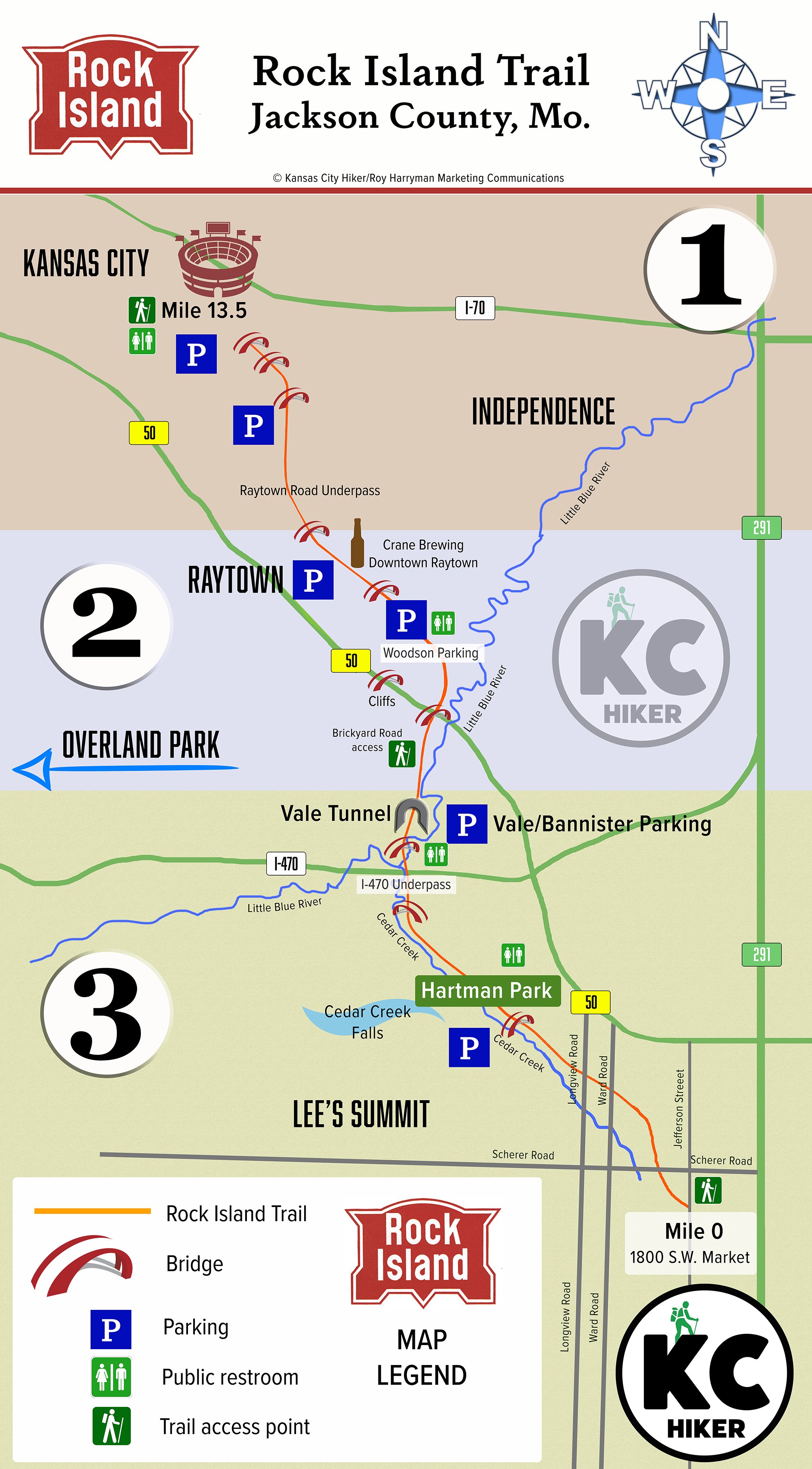
The Rock Island Line was a busy thoroughfare of train traffic running from St. Louis to Kansas City. It’s local route ran from Pleasant Hill to the Leeds manufacturing area of Kansas City, Mo. With a history dating to 1847, the Rock Island Railroad slowly stalled and finally hit the brakes for good in 1980. The tracks went dormant and trees grew up through the rail ties. It stayed that way until a Jackson County rail trail began to take shape, opening in 2019. It begins in Lee’s Summit, Mo., and extends 13.5 miles north to the Truman Sports Complex in Kansas City, Mo. The trail cuts through diverse environments from pastures, to backyards to urban streetscapes. See our detailed guide and map below to plan your trip.
Length 13.5 miles
Address and location Trail heads are located at (south to north):
Southernmost trail head (street parking only) 1831 SW Market St, Lee's Summit, Mo., 64082
Charles David Hartman Memorial Park 700 SW Pryor Rd., Lee's Summit, Mo., 64081
Vale Tunnel parking lot 12442 E 98th St, Kansas City, Mo., 64138
7130 Woodson Road, Raytown, Mo., 64133
6515 Railroad St., Raytown, Mo., 64133
5909 Raytown Trafficway, Raytown, Mo., 64133
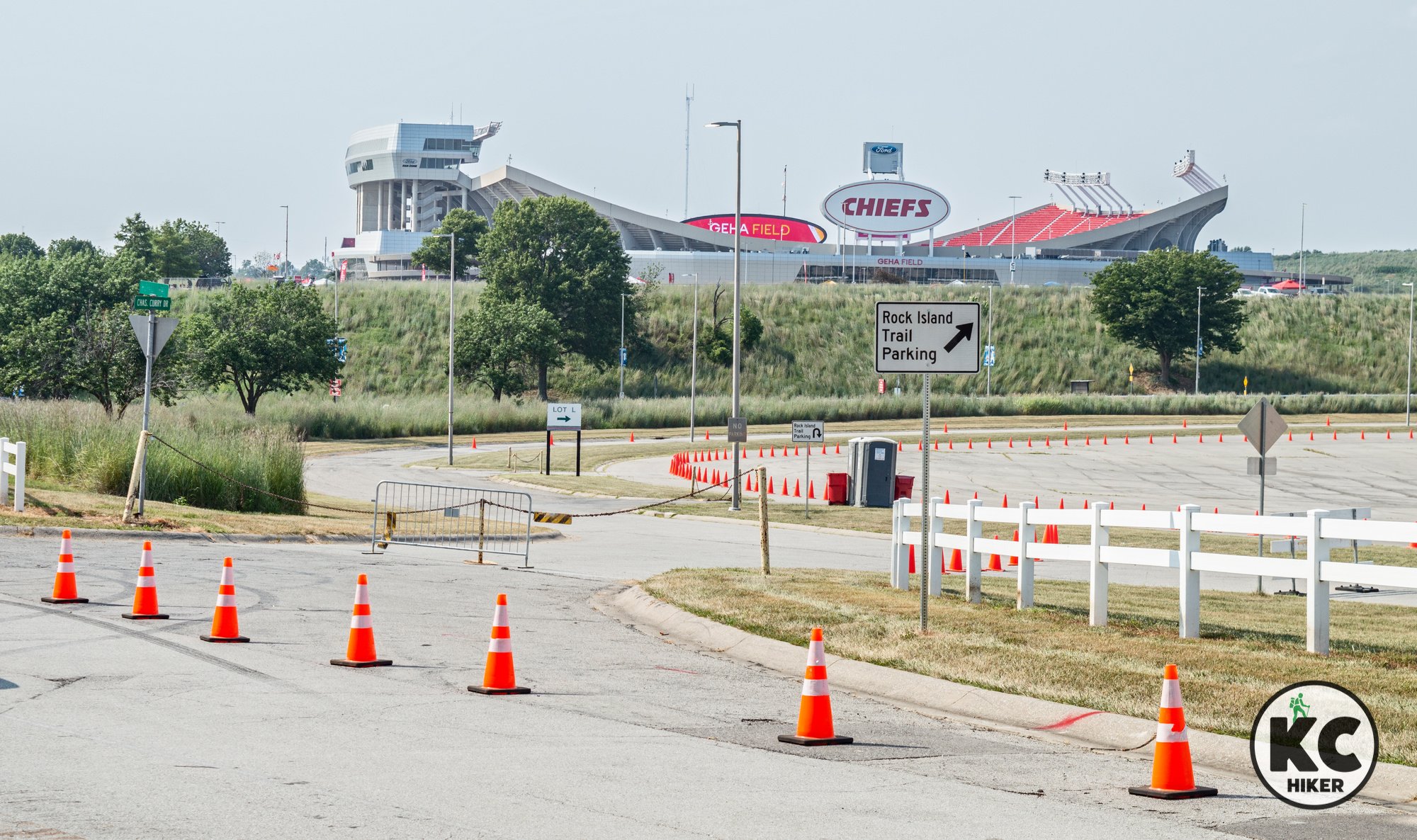
Truman Sports Complex, 1 Royal Way, Kansas City, Mo., 64129 (accessible through Gate 3 off Blue Ridge Cut-Off, with parking available in Lot L; Note: Parking is restricted for special events and Royals/Chiefs game days. You will be charged the full fee to park, which could be $60 or more).
Conditions This is a crushed gravel and paved trail with few elevation changes. It is easy to follow and much of it is shaded by forest canopy.
Kid friendly? This flat trail is great for parents pushing strollers or small children on bikes. Parents should be alert for passing bikers.
How busy? This is a popular and busy trail. To experience more solitude, go early in the morning or in a non-peak season.
Pets Yes. On a leash.
Bikes Non-motorized bicycles are allowed.
Rock Island Rail Trail Map and Guide
Because the Rock Island Rail Trail is 13.5 miles long, it’s easier to treat it as three different trails. Most people won’t ride or walk the entire length at once (though many do). This guide helps you to pick a section to explore one bite at a time. We’ve broken it into three zones, with photos and a description of each:
1. Northern Stadium Section
2. Middle Raytown Section
3. Southern Pastoral Section
Northern Stadium Section
The northernmost trailhead is located at the Truman Sports Complex, which has a portable toilet (might come in handy). There is free parking at the complex unless there is a game or an event. In that case, you’ll be charged full parking rates to leave your car at the stadiums. There are very few places to park between the stadiums and the next trail access point, so be sure to check on parking availability before planning your trip.
The northern section of the Rock Island Trail is its grittier, industrial section. That’s to be expected because the area has long been a center of manufacturing, warehousing and distribution. Yet it’s certainly worth traveling and it provides variety to the overall experience.
Photo highlights of the Northern Stadium Section
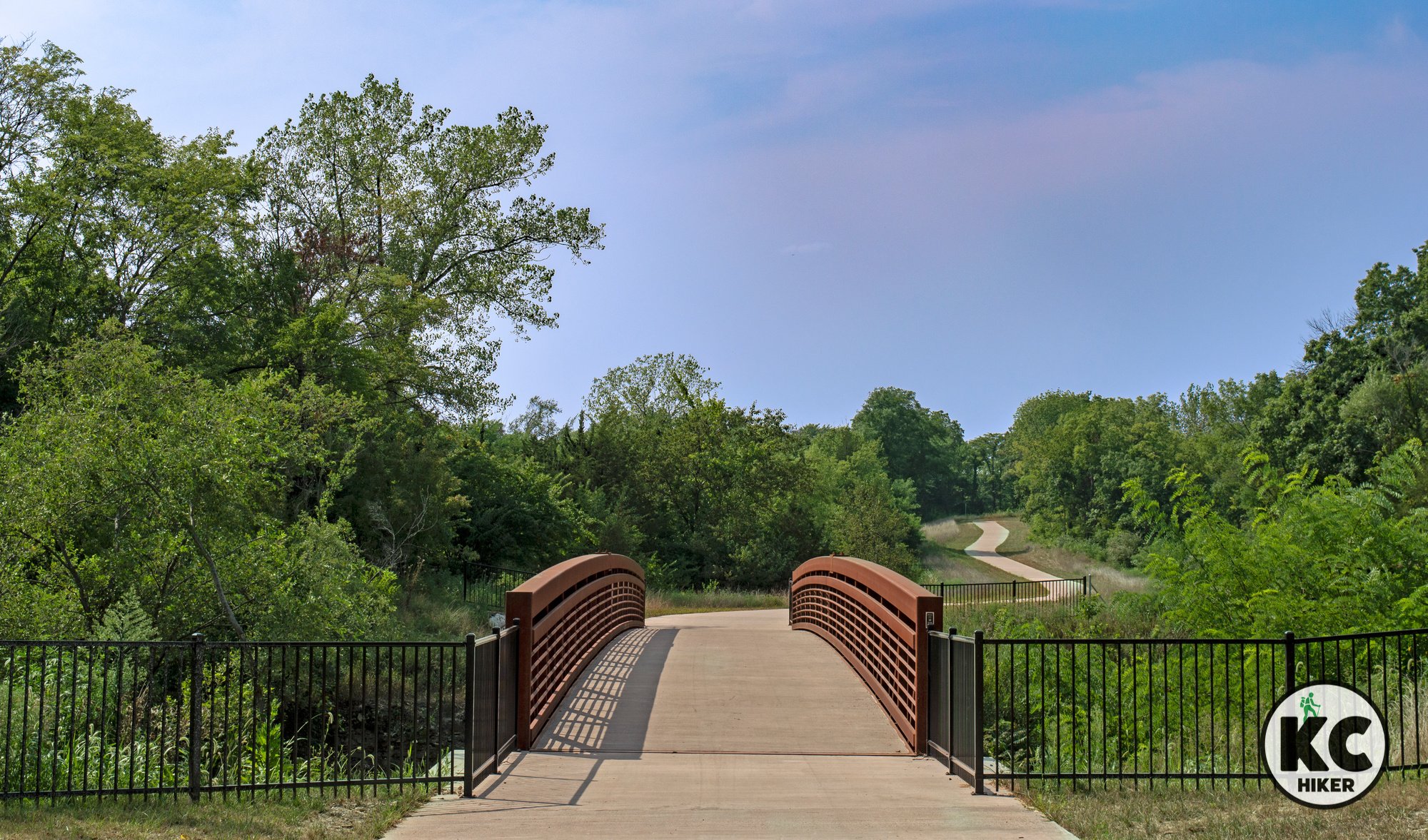
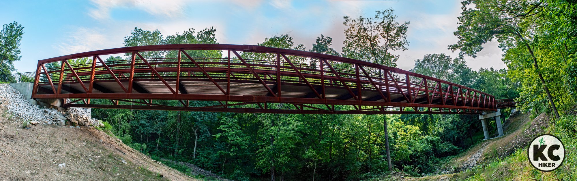
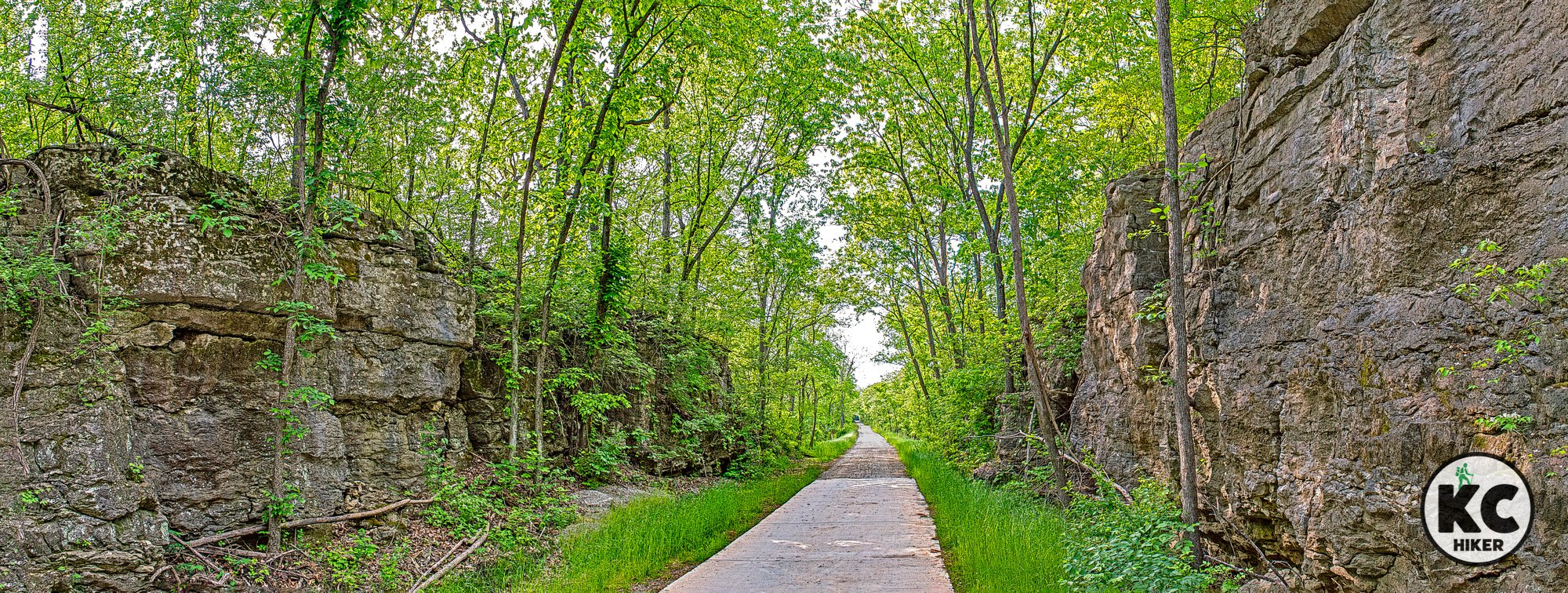
Middle Raytown Section
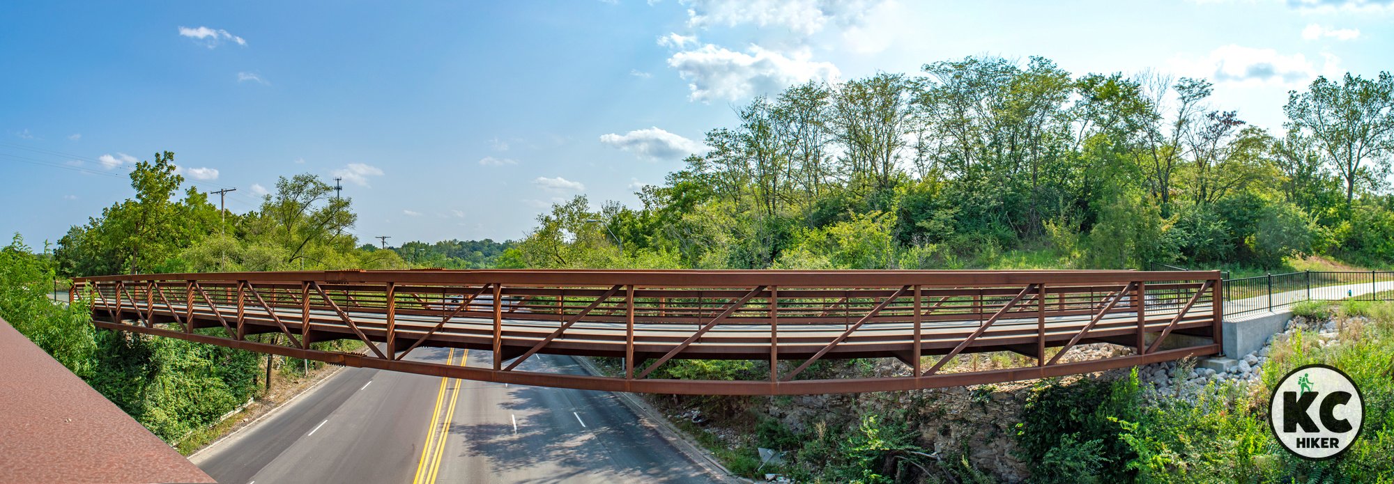
This trail covers diverse territory ranging from dense urban neighborhoods to downtown Raytown to suburban backyards. Between downtown and the Woodson access, the trail passes over a spectacular bridge that spans a stream and narrow valley. As it heads south, the trail cuts through wooded areas, passes farmland and under towering rock cuts that were made for the rail line.
Photo highlights of the Middle Raytown Section

Southern Pastoral Section
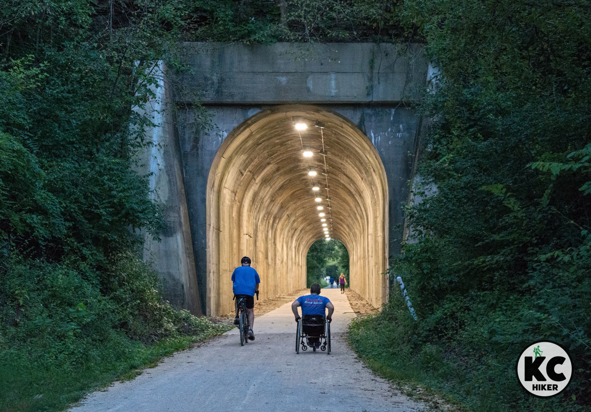
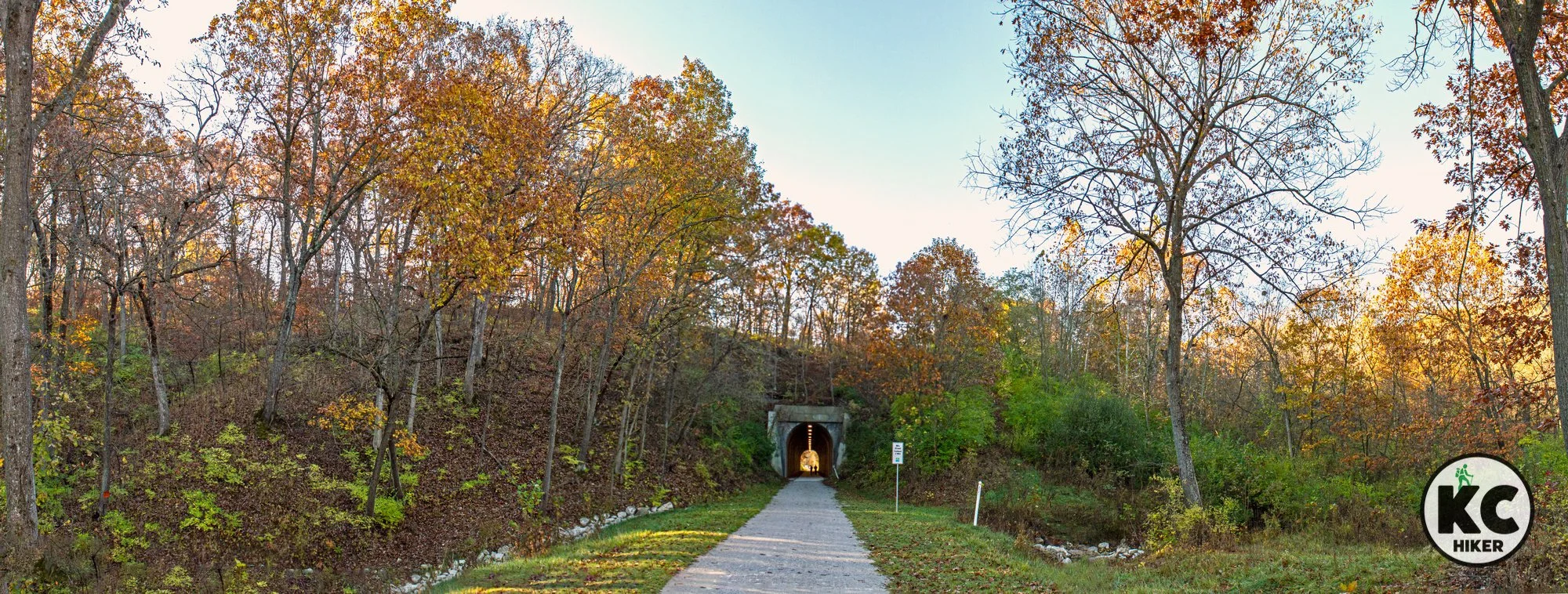
Although it passes through populated areas, this section is the most remote and “wild” region. After crossing 50 Highway, it begins a slow grade downward until it passes through the century-old Vale Tunnel. This 441-foot-long tunnel is a highlight for many. After cutting through the tunnel, the trail continues through rolling hills of southeast Jackson County, passes through Hartman Park and follows Cedar Creek for several miles. Neighborhood trails also intersect with the Rock Island Trail in this area. Hartman Park is the home to several waterfalls on Cedar Creek, as well as flush toilets. The trail ends (or begins, depending on your order) on Jefferson Street in Lee’s Summit. There is no designated parking area there, but street parking is available nearby.
Photo highlights of the Southern Pastoral Section


Cedar Creek Falls at the Hartman Park trailhead.