
History in motion: The Rock Island Rail Trail
The Rock Island Line was a busy thoroughfare of train traffic running from Pleasant Hill through the Leeds manufacturing area of Kansas City, Mo. With a history dating to 1847, the company slowly stalled and finally hit the brakes for good in 1980. The tracks went dormant and trees grew up through the rail ties. It stayed that way until a Jackson County rail trail began to take shape, opening in 2019. It begins in Lee’s Summit, Mo., and extends 13.5 miles north to the Truman Sports Complex in Kansas City, Mo. See our detailed guide and map to plan your trip.
Rock Island Rail Trail, Lee’s Summit-Kansas City, Mo., Jackson County

It’s “all aboard!” for hikers and bikers who want to explore the former train line.
Trail Rock Island Rail Trail
Overview
The Rock Island Line was a busy thoroughfare of train traffic running from St. Louis to Kansas City. It’s local route ran from Pleasant Hill to the Leeds manufacturing area of Kansas City, Mo. With a history dating to 1847, the Rock Island Railroad slowly stalled and finally hit the brakes for good in 1980. The tracks went dormant and trees grew up through the rail ties. It stayed that way until a Jackson County rail trail began to take shape, opening in 2019. It begins in Lee’s Summit, Mo., and extends 13.5 miles north to the Truman Sports Complex in Kansas City, Mo. The trail cuts through diverse environments from pastures, to backyards to urban streetscapes. See our detailed guide and map below to plan your trip.
Length 13.5 miles
Address and location Trail heads are located at (south to north):
Southernmost trail head (street parking only) 1831 SW Market St, Lee's Summit, Mo., 64082
Charles David Hartman Memorial Park 700 SW Pryor Rd., Lee's Summit, Mo., 64081
Vale Tunnel parking lot 12442 E 98th St, Kansas City, Mo., 64138
7130 Woodson Road, Raytown, Mo., 64133
6515 Railroad St., Raytown, Mo., 64133
5909 Raytown Trafficway, Raytown, Mo., 64133
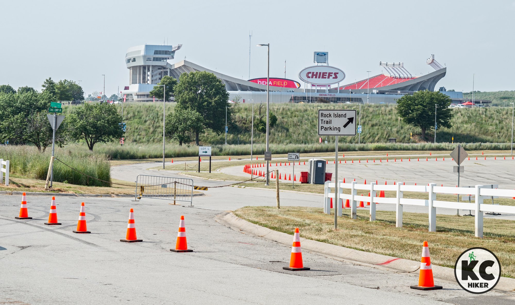
Truman Sports Complex, 1 Royal Way, Kansas City, Mo., 64129 (accessible through Gate 3 off Blue Ridge Cut-Off, with parking available in Lot L; Note: Parking is restricted for special events and Royals/Chiefs game days. You will be charged the full fee to park, which could be $60 or more).
Conditions This is a crushed gravel and paved trail with few elevation changes. It is easy to follow and much of it is shaded by forest canopy.
Kid friendly? This flat trail is great for parents pushing strollers or small children on bikes. Parents should be alert for passing bikers.
How busy? This is a popular and busy trail. To experience more solitude, go early in the morning or in a non-peak season.
Pets Yes. On a leash.
Bikes Non-motorized bicycles are allowed.
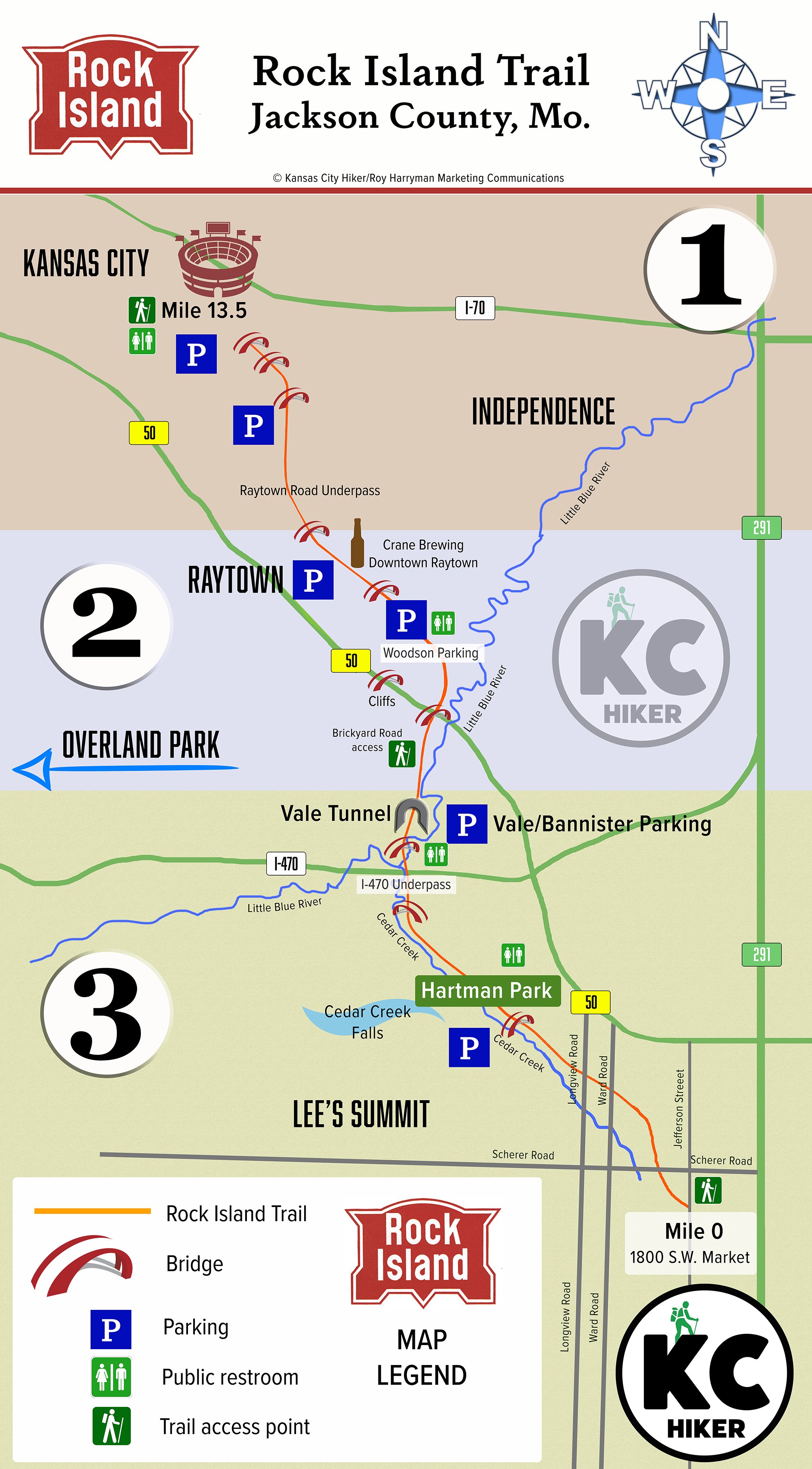
Rock Island Rail Trail Map and Guide
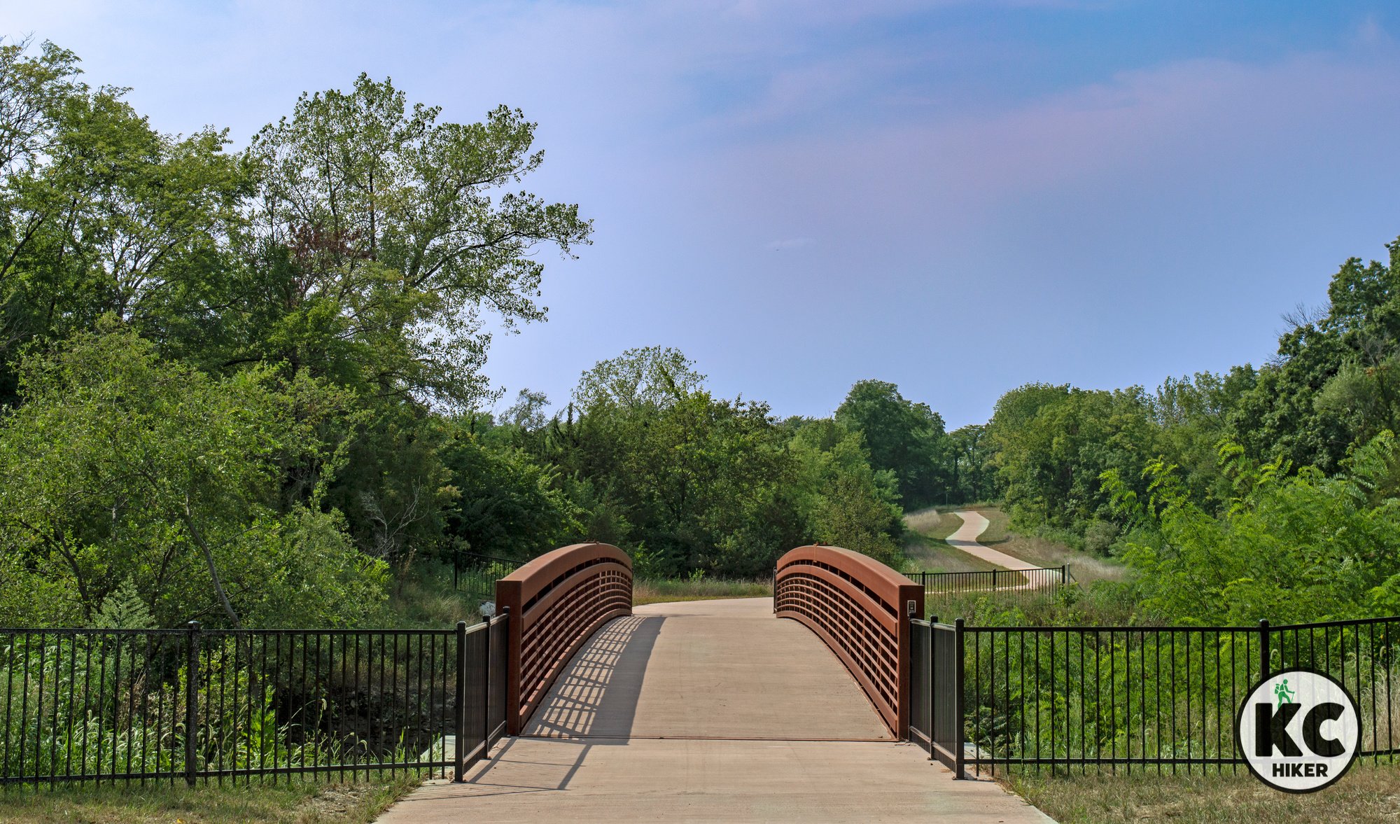
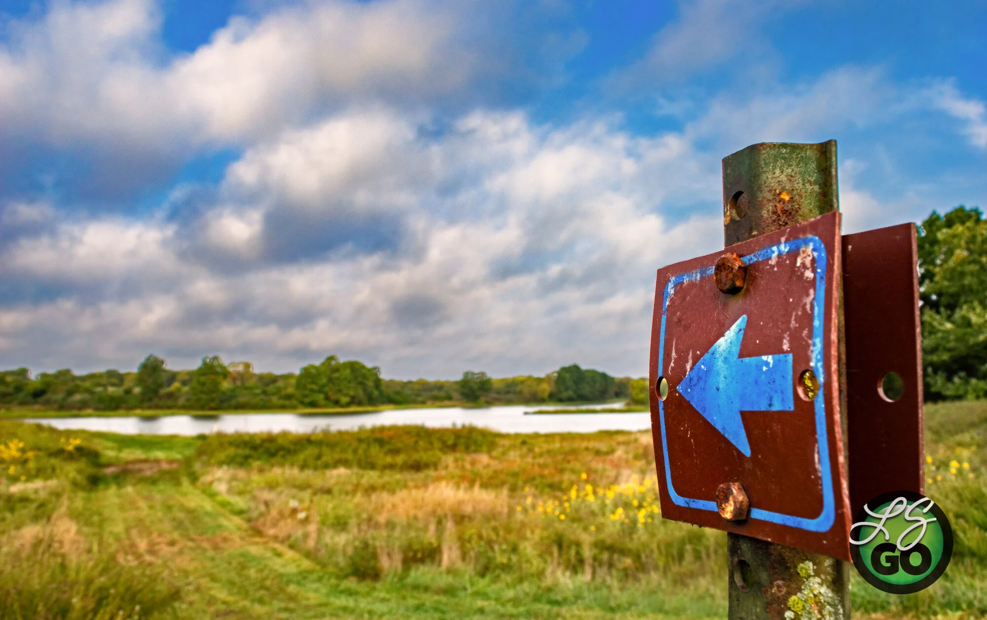
Because the Rock Island Rail Trail is 13.5 miles long, it’s easier to treat it as three different trails. Most people won’t ride or walk the entire length at once (though many do). This guide helps you to pick a section to explore one bite at a time. We’ve broken it into three zones, with photos and a description of each:
1. Northern Stadium Section
2. Middle Raytown Section
3. Southern Pastoral Section
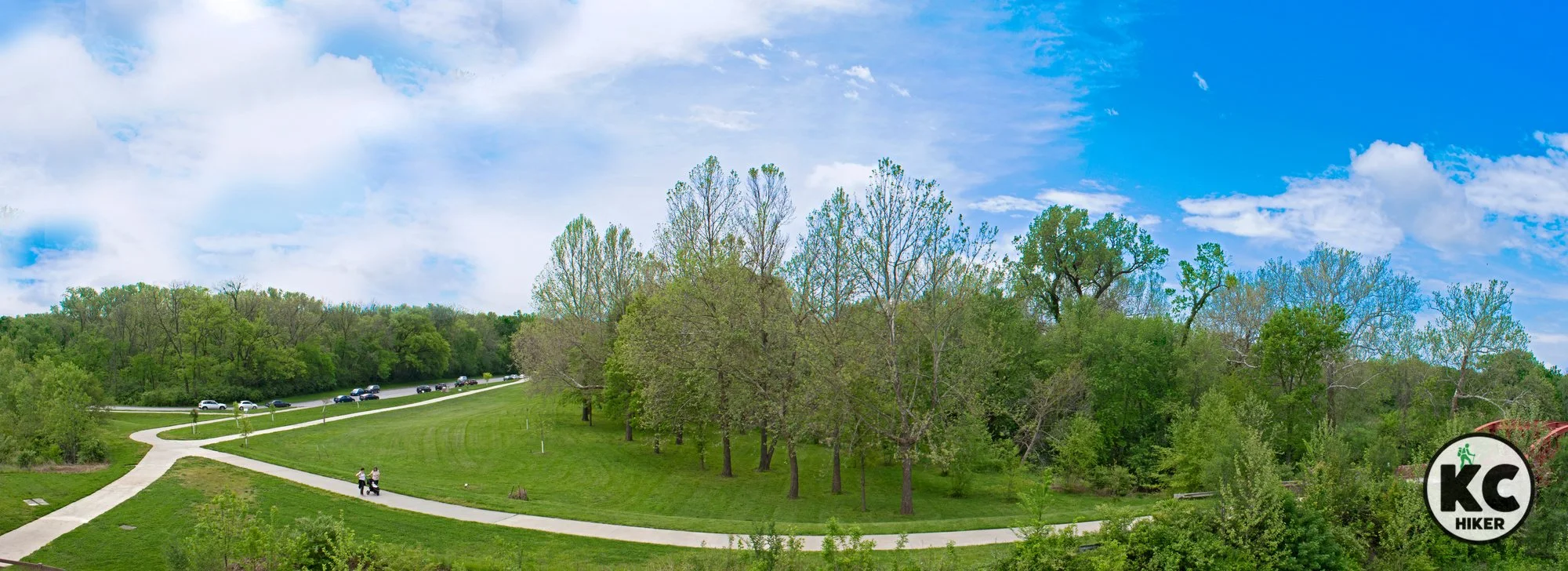
Northern Stadium Section
The northernmost trailhead is located at the Truman Sports Complex, which has a portable toilet (might come in handy). There is free parking at the complex unless there is a game or an event. In that case, you’ll be charged full parking rates to leave your car at the stadiums. There are very few places to park between the stadiums and the next trail access point, so be sure to check on parking availability before planning your trip.
The northern section of the Rock Island Trail is its grittier, industrial section. That’s to be expected because the area has long been a center of manufacturing, warehousing and distribution. Yet it’s certainly worth traveling and it provides variety to the overall experience.
Photo highlights of the Northern Stadium Section
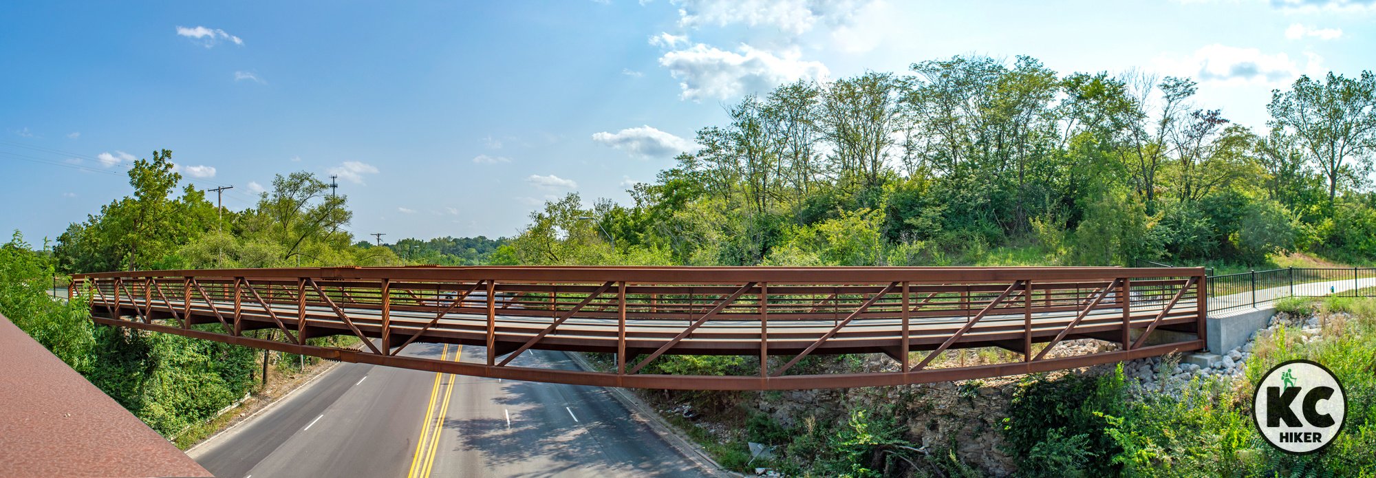
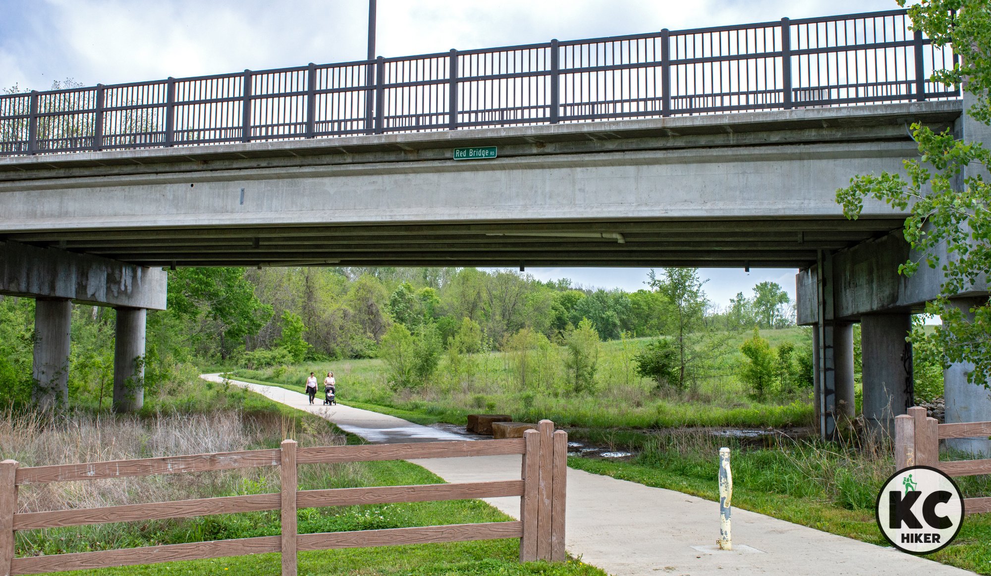
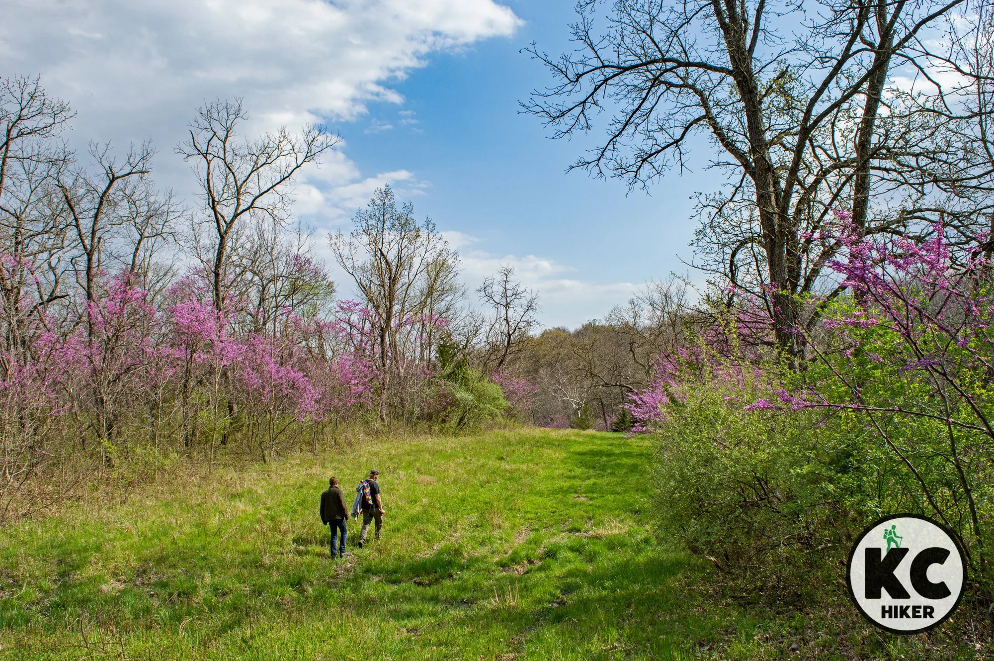
Middle Raytown Section
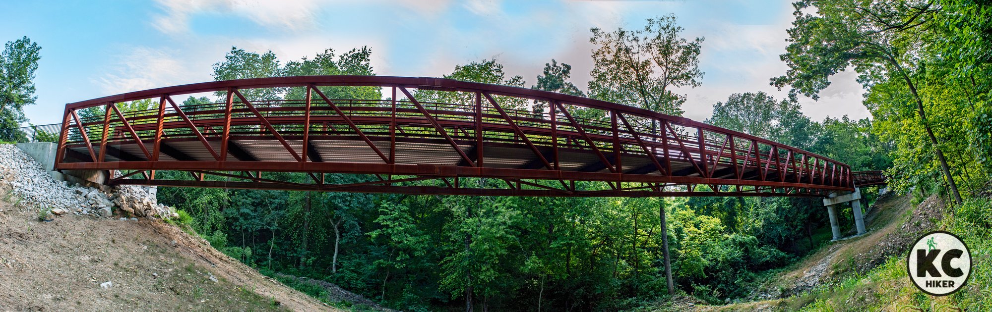
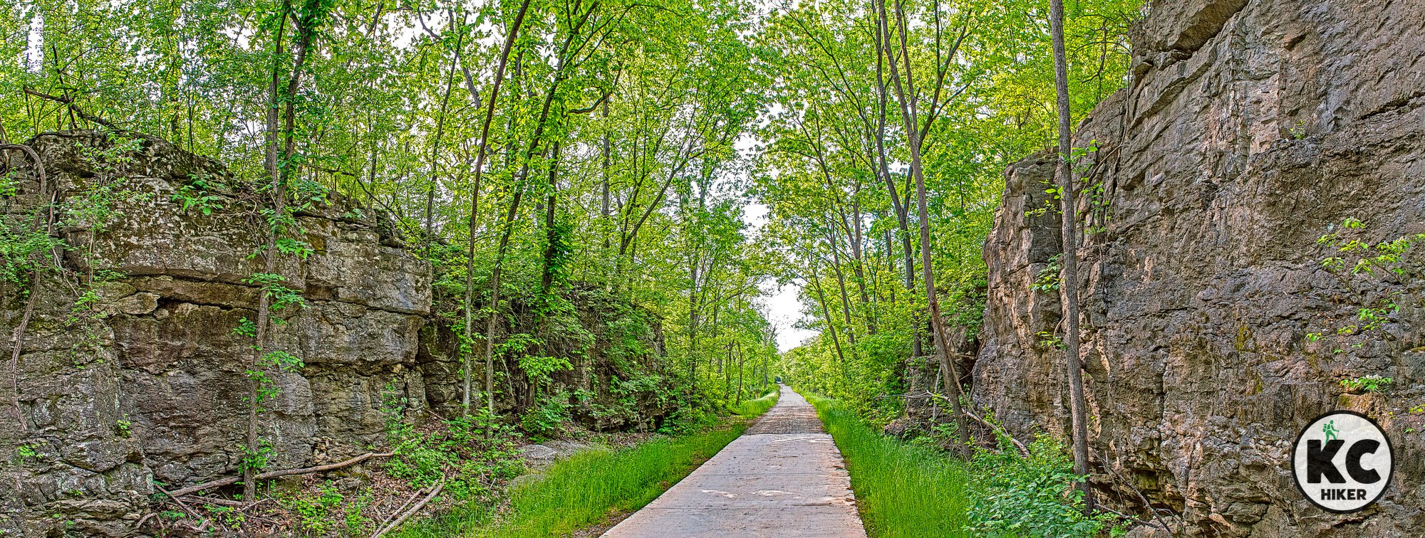
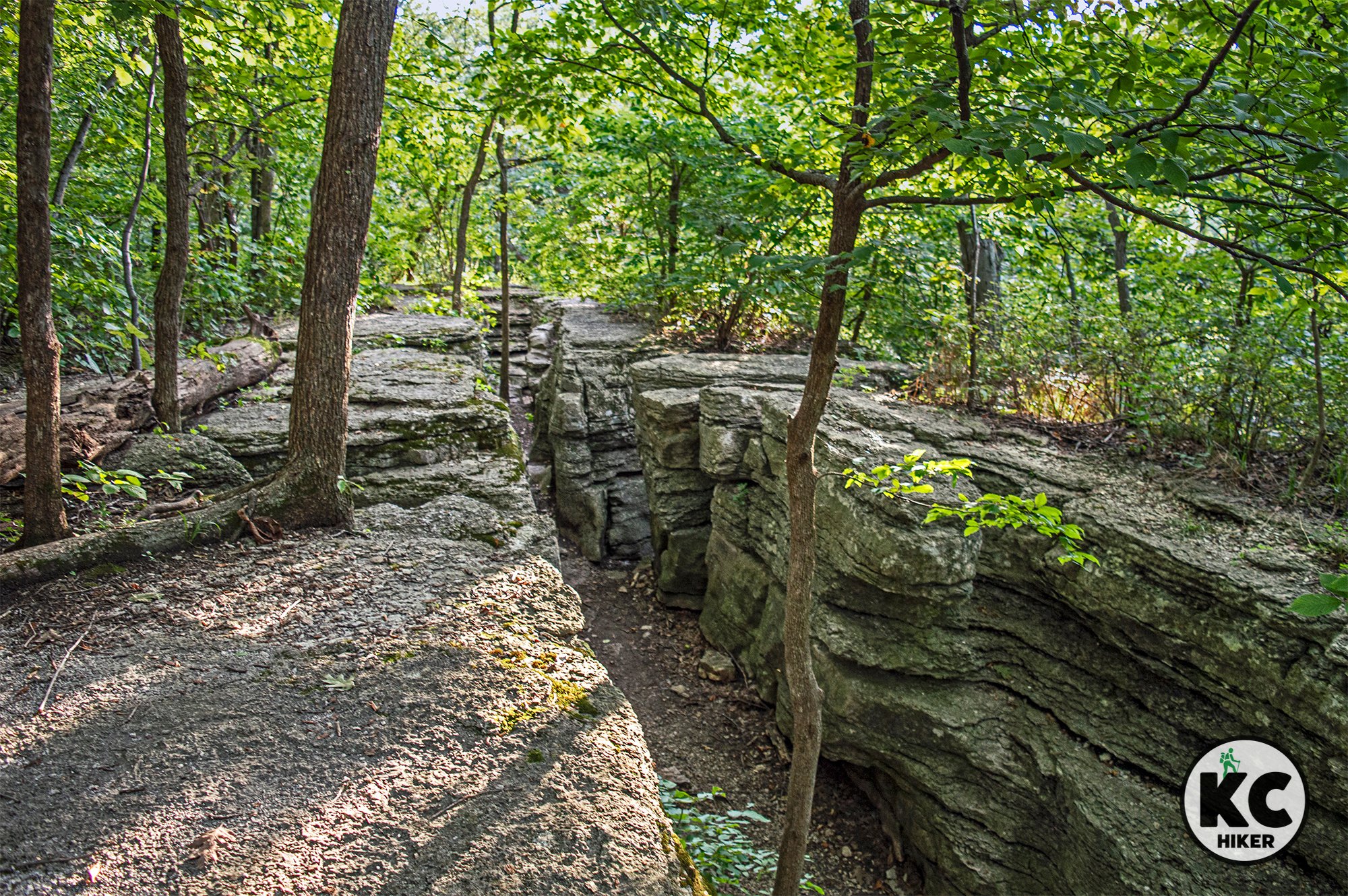
This trail covers diverse territory ranging from dense urban neighborhoods to downtown Raytown to suburban backyards. Between downtown and the Woodson access, the trail passes over a spectacular bridge that spans a stream and narrow valley. As it heads south, the trail cuts through wooded areas, passes farmland and under towering rock cuts that were made for the rail line.
Photo highlights of the Middle Raytown Section

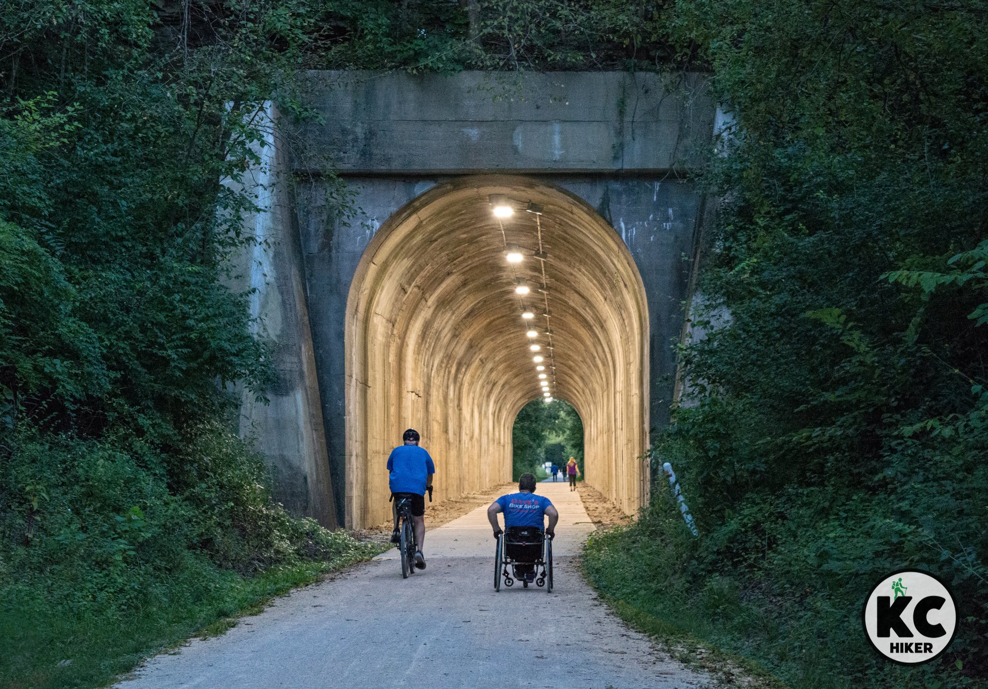
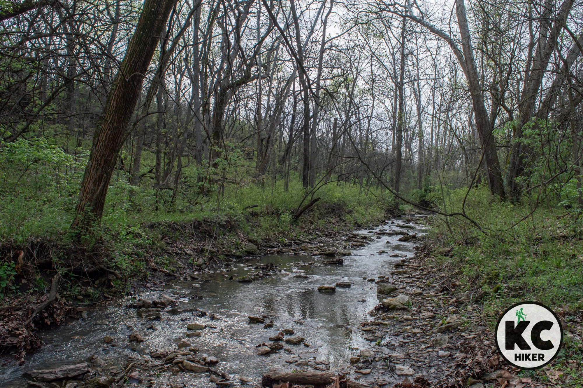
Southern Pastoral Section
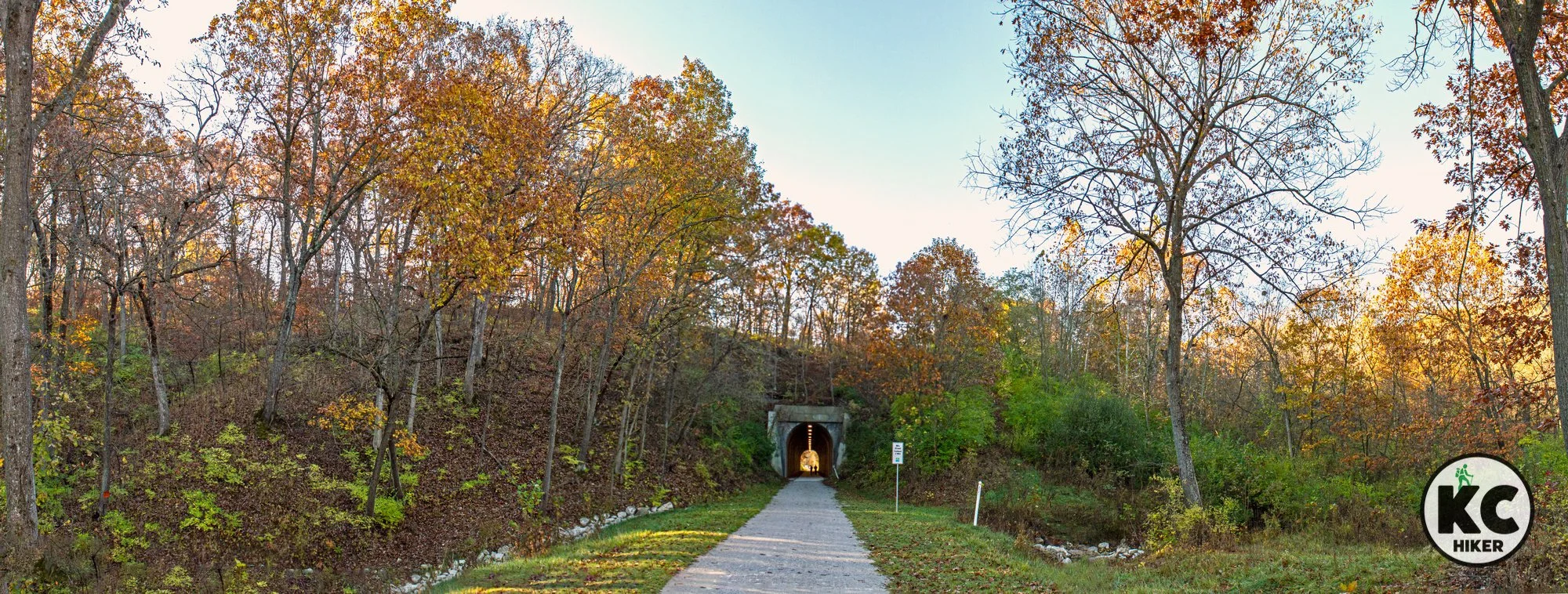
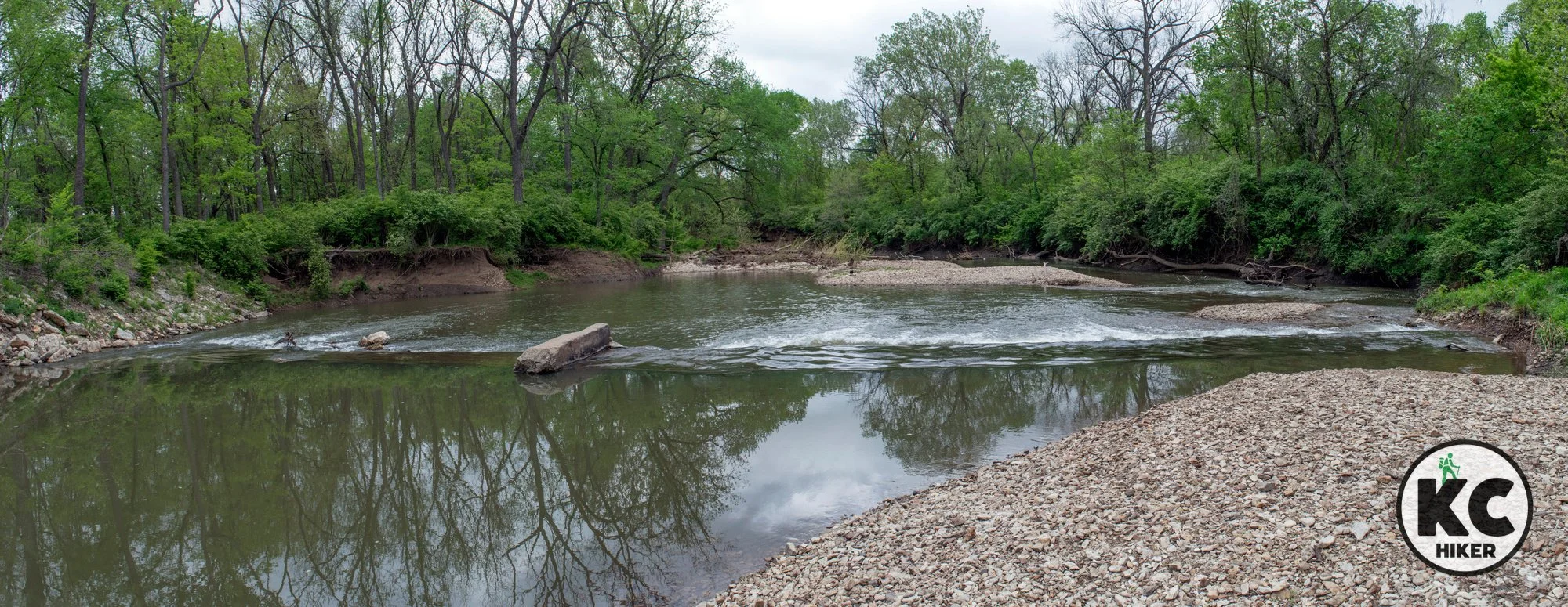
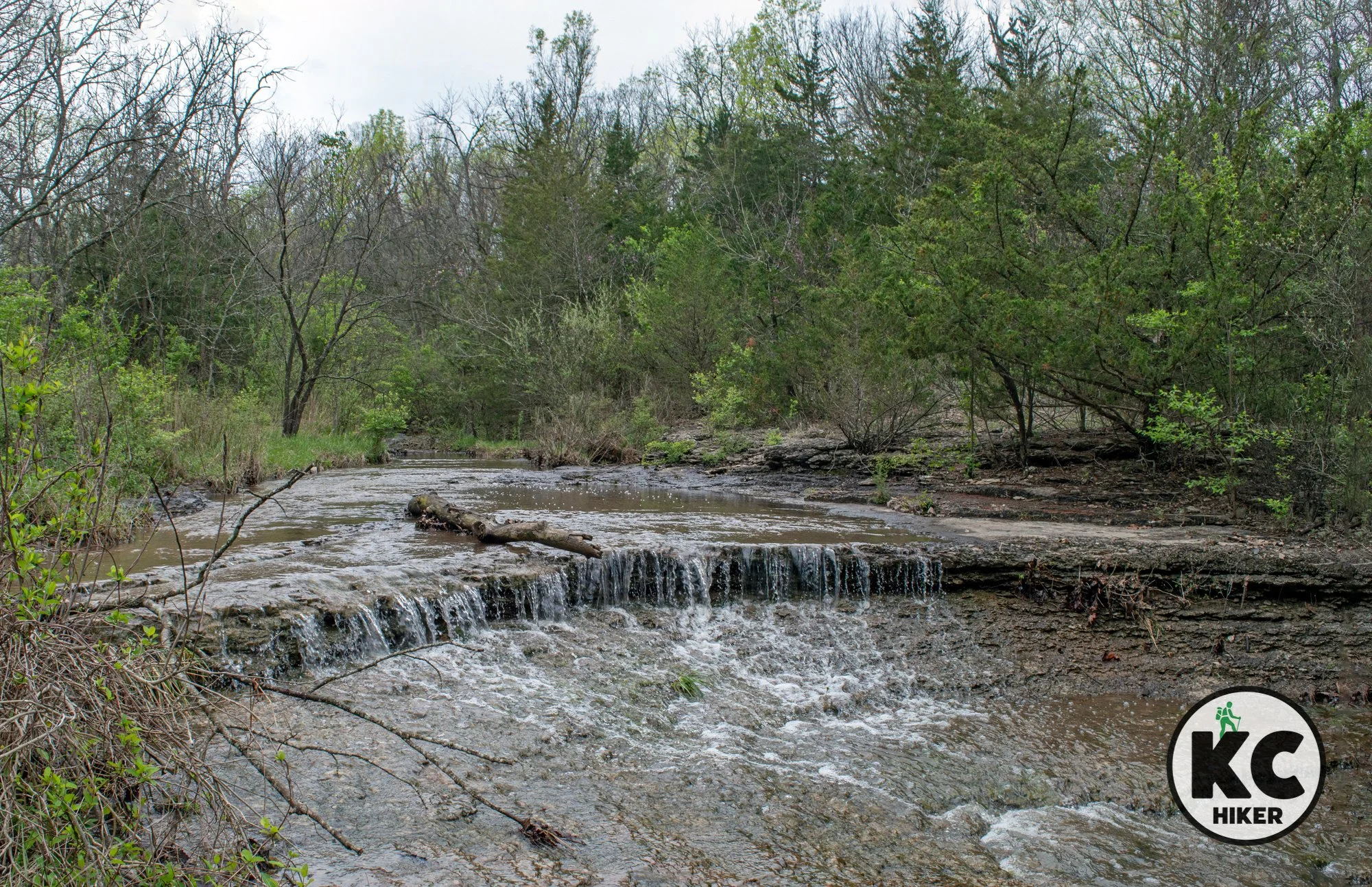
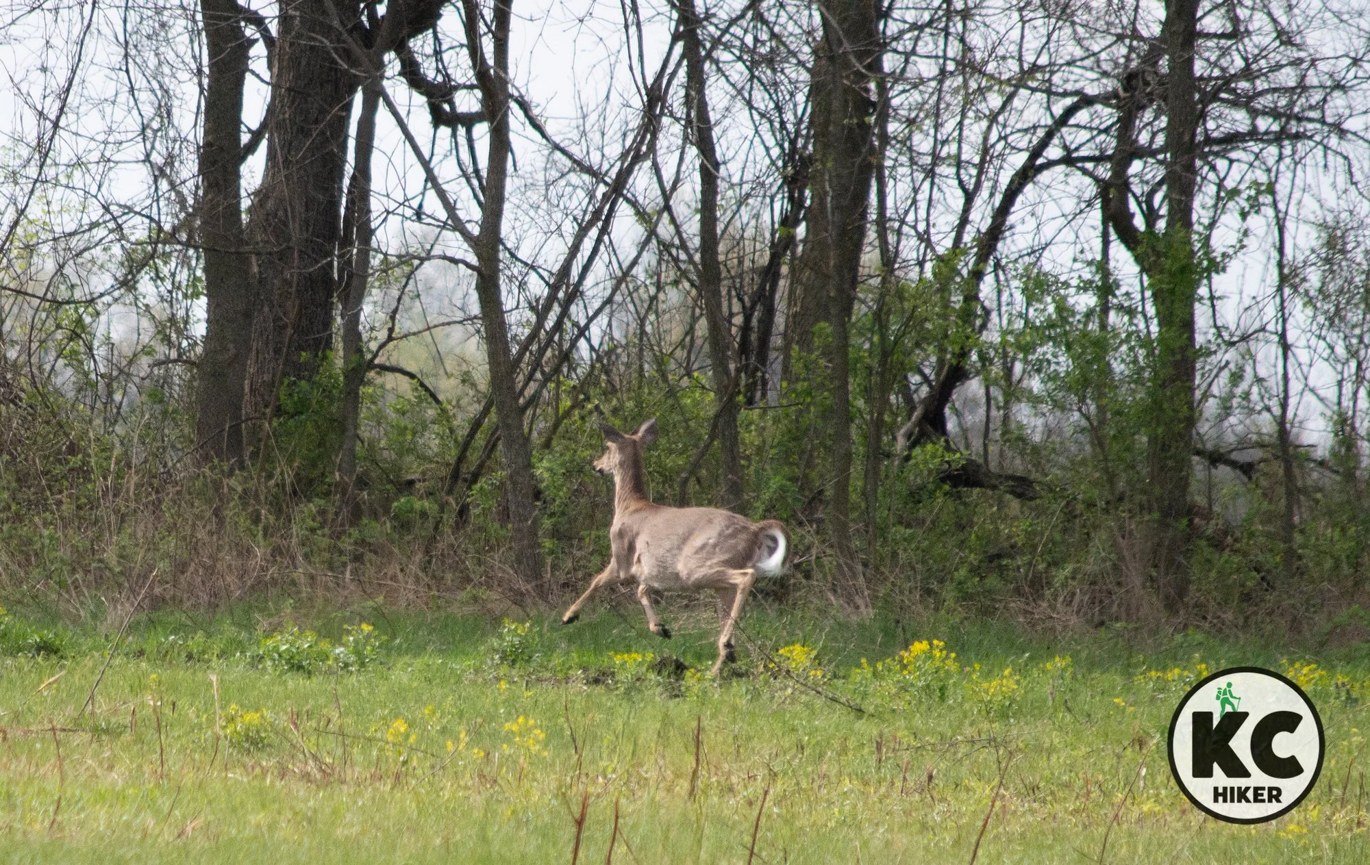
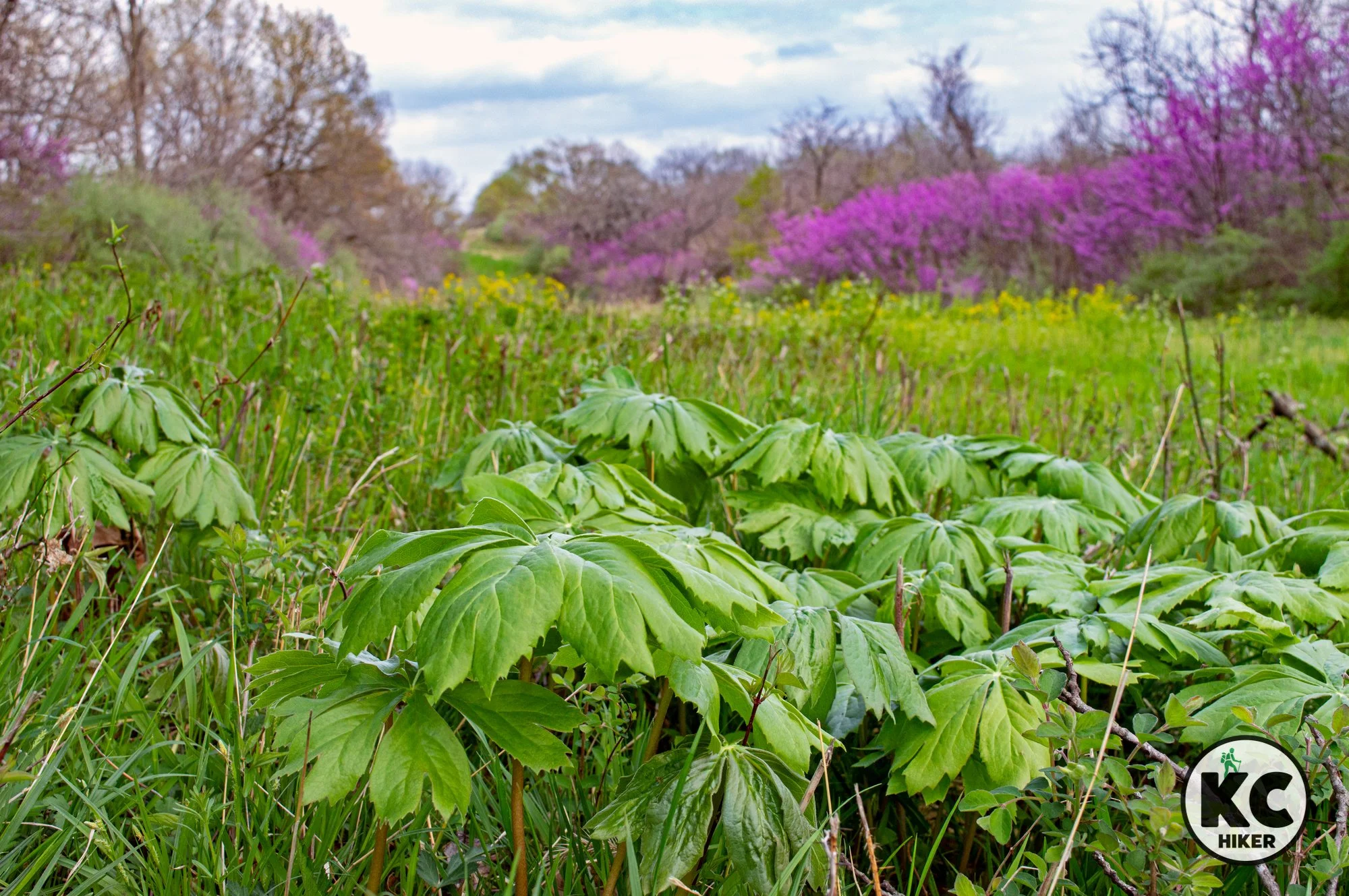
Although it passes through populated areas, this section is the most remote and “wild” region. After crossing 50 Highway, it begins a slow grade downward until it passes through the century-old Vale Tunnel. This 441-foot-long tunnel is a highlight for many. After cutting through the tunnel, the trail continues through rolling hills of southeast Jackson County, passes through Hartman Park and follows Cedar Creek for several miles. Neighborhood trails also intersect with the Rock Island Trail in this area. Hartman Park is the home to several waterfalls on Cedar Creek, as well as flush toilets. The trail ends (or begins, depending on your order) on Jefferson Street in Lee’s Summit. There is no designated parking area there, but street parking is available nearby.
Photo highlights of the Southern Pastoral Section


Cedar Creek Falls at the Hartman Park trailhead.

Explore Rocky Bluffs on the River Bluff Nature Trail
Jackson County's River Bluff Reserve Nature Trail in northern Independence, Mo., is a remote and challenging hike that is rewarded with spectacular views of ravines, giant boulders, and wildflowers.

River Bluff Reserve Nature Trail, Jackson County, Mo.
Get wild in these cliffs and ravines in northern Jackson County.
Trail River Bluff Trail.
Overview
You’ve probably never heard of the River Bluff Nature Trail. There’s a reason for that. It’s wild. It’s in the middle of nowhere. It’s not marked well. It goes straight down … and up. With that said, it’s a splendid trail with towering cliffs and limestone boulders galore. In season, wildflowers outnumber leaves and grass in an explosion of wall-to-wall color. There are small waterfalls, clear streams and canyons. Did we mention it’s very easy to get lost? If you hit at the wrong season, it’s overgrown and totally impassable. But if you hit at the right season, it’s paradise. For an optimal hike, plan your trip in fall, winter or early spring.Length 2.4 miles
Address and location 17320 E Courtney Atherton Rd, Independence, Mo., 64058
Conditions As we said in the overview, this is a poorly marked, physically challenging but scenic trail. Proceed with caution. The surface is dirt.
Kid friendly? This is a challenging trail. Children will need to be able scale steep pathways, both up and down.
How busy? This is probably one of the least visited trails in Jackson County and even in the greater Kansas City area. And that’s a pity.
Pets Yes. On a leash.
Bikes This trail would only be suitable for experienced mountain bikers.
Restrooms are not available.


Powell Gardens: Walk A Botanical Utopia Near Kansas City
Powell Gardens, near Kingsville, Mo., is a 1,000-acre site with 175 acres dedicated to gardens and cultivated plants. These can all be explored on an extensive network of paved trails. In addition, the Byron Shutz Nature Trail explores the more rustic parts of the park.
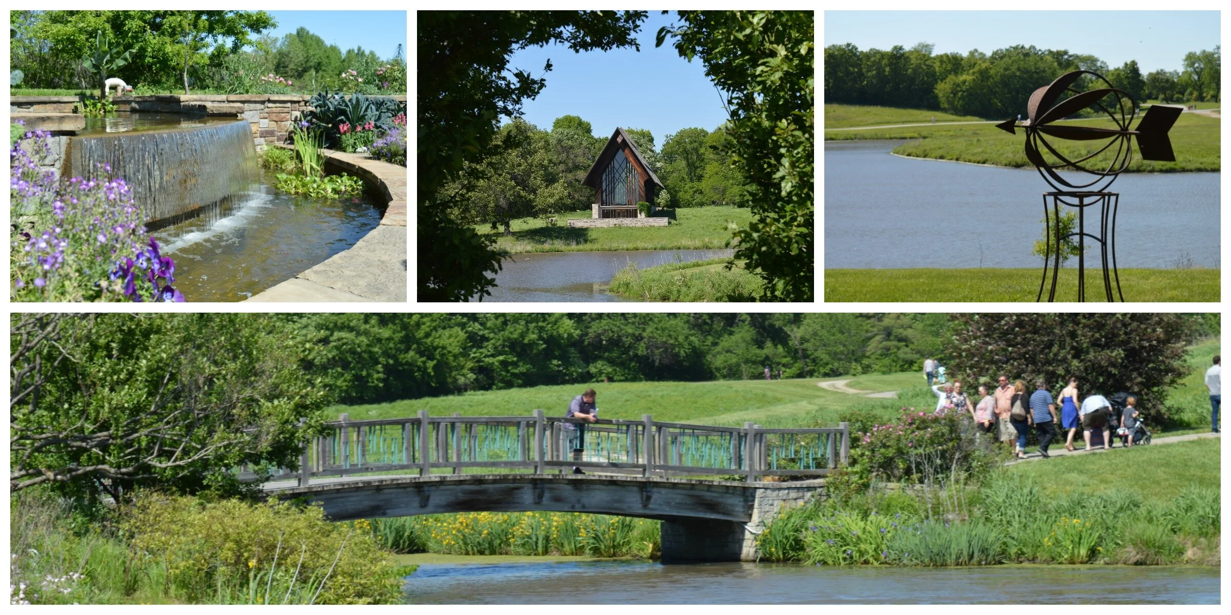
Powell Gardens, Kingsville, Mo.
Explore 175 acres of gardens and cultivated plants, plus a 3-mile nature trail.
Trail Powell Gardens
Overview
Even though it’s technically not in Jackson County (just a little over the east line), there’s no question that Powell Gardens is a natural jewel in Greater Kansas City. It’s 25 minutes east of Lee’s Summit on U.S. 50, but worth the drive. The 1,000-acre site has 175 acres dedicated to gardens and cultivated plants. These can all be explored on an extensive network of paved trails. In addition, the Byron Shutz Nature Trail explores the more rustic parts of the park. Please note: Powell Gardens is a private organization, sets its own hours and charges an admission fee.
Length The Byron Shutz Nature Trail is a 3.25-mile loop. But you can get a good walk in simply exploring the gardens.
Address and location 1609 US-50, Kingsville, MO 64061
Conditions The gardens section of Powell Gardens is highly accessible and mostly paved. The Byron Shultz Nature Trail, which is separate from the gardens “offers slight inclines and some rocky terrain, but is easily traversed by hikers with moderate experience. Novice hikers should review their fitness level and the trail length before beginning a hike (description from Powell Gardens).”
Kid friendly? Powell Gardens is designed for maximum access, so strollers and children fit right in. The Byron Shultz Nature Trail, which is separate, is best for children who can walk it.
How busy? Traffic ebbs and flows and is partly based on special activities at Powell Gardens. The gardens can be busy on holidays and in peak season.
Pets Prohibited except on designated special days.
Bikes Check with Powell Gardens before planning on biking there.
Restrooms are available throughout the park, but not on the Byron Shultz Nature Trail.


Get Art Active On The Nelson-Atkins Outdoor Trail
You don’t have to enter The Nelson-Atkins Museum of Art to view interesting art. There’s an approximately half-mile trail that loops the gallery, taking visitors on a tour of the Donald J. Hall Sculpture Park. The giant shuttlecocks on the lawn of the Nelson are a Kansas City icon. But as you venture further on the trail, an array of intriguing art emerges. The gallery’s landscaping and architecture are also of interest.

Nelson-Atkins Museum Sculpture Gallery art walk trail
You don’t have to be an art lover to enjoy a walk around the gallery’s greenery and outdoor exhibits.
Trail The Nelson-Atkins Museum of Art walking trail
Overview
You don’t have to enter The Nelson-Atkins Museum of Art to view interesting art. There’s an approximately half-mile trail that loops the gallery, taking visitors on a tour of the Donald J. Hall Sculpture Park. The giant shuttlecocks on the lawn of the Nelson are a Kansas City icon. But as you venture further on the trail, an array of intriguing art emerges. The gallery’s landscaping and architecture are also of interest. If you’d like to take a longer walk, you can combine this trek by heading immediately south and walking the trail at Gorman Conservation Center, Kauffman Legacy Park or The Country Club Plaza trail.Length About one-half mile.
Address and location 4525 Oak St, Kansas City, MO 64111
Conditions This is a paved trail that switches to sidewalks. There are some stairs, so the full route is not accessible to the disabled.
Kid friendly? The trail is a visual wonder for kids. Stairs could make strollers a challenge.
How busy? The Nelson-Atkins is a nationwide attraction and it receives many visitors. On pleasant days, this area usually has plenty of foot traffic.
Pets are welcome outside the museum in the sculpture garden, but not inside the building.
Bikes Prohibited.


Hilltop Hiking at Monkey Mountain Nature Reserve
Nestled between Grain Valley and Oak Grove, Monkey Mountain is a hill that rises about 150 feet above Sni A Bar Creek. The trail up the forested hill is steep. At the top, visitors are rewarded with 360-degree views of the area (especially after leaves drop). Another highlight is the cap of limestone boulders at the top of the “mountain.”

Monkey Mountain Nature Reserve, Oak Grove, Mo., Jackson County
Although it’s short on monkeys and mountains, the hilltop terrain and limestone boulders make for an engaging hike.
Trail Monkey Nature Reserve
Overview
Don’t go to Monkey Mountain expecting either monkeys or mountains. But if you go expecting a beautiful hilltop experience in Eastern Jackson County, you’ll be pleased. Nestled between Grain Valley and Oak Grove, Monkey Mountain is a hill that rises about 150 feet above Sni A Bar Creek. The trail up the forested hill is steep. At the top, visitors are rewarded with 360-degree views of the area (especially after leaves drop). Another highlight is the cap of limestone boulders at the top of the “mountain.” Erosion has separated the giant rocks, allowing hikers to walk between them, on them or scramble to climb them. The top of Monkey Mountain is a pastoral area with groves of forest. The area is huge: 855 acres, with most of it wooded. If you wander, you’ll find horse trails through the forest and other unofficial pathways. Plan on visiting when leaves are off and before the heat of summer. If the season is right, you can spend a delightful afternoon exploring the rolling hills of Eastern Jackson County. The All Trails app can help you find good places to walk and avoid getting lost. According to Peak Visor, Monkey Mountain is the most prominent elevation in Jackson County, Mo. It’s not the high point, but the hill that rises the highest from bottom to top.
Length The AllTrails app details several miles of trails through the park. Whether you can find them or not is another question. Plan on wandering and enjoying the area, and if you can follow a trail – it’s a bonus. You’re most likely to have success finding the back country trails when leaves are off.
Address and location 34908 E R.D. Mize Rd, Oak Grove, MO 64075
Conditions When you can find the trail, such as at the trail head in the parking lot, it’s made of dirt and is extremely steep. Beyond that there are no established trails. There are, however, the apparent remnants of a forested loop.
Kid friendly? There’s plenty to explore for kids who can make it to the boulders at the top of the hill. They might need an assist form mom or dad.
How busy? This park receives light to moderate traffic.
Pets Yes, on a leash.
Bikes Non-motorized bicycles are permitted.
Restrooms are not available.


Get Foot “Loose” At This Scenic Urban Park in KC
Loose Park has been a Kansas City recreation destination for nearly a century. A renowned rose garden, Civil War history, inspired architecture and a one-mile loop make this a premiere urban walk.
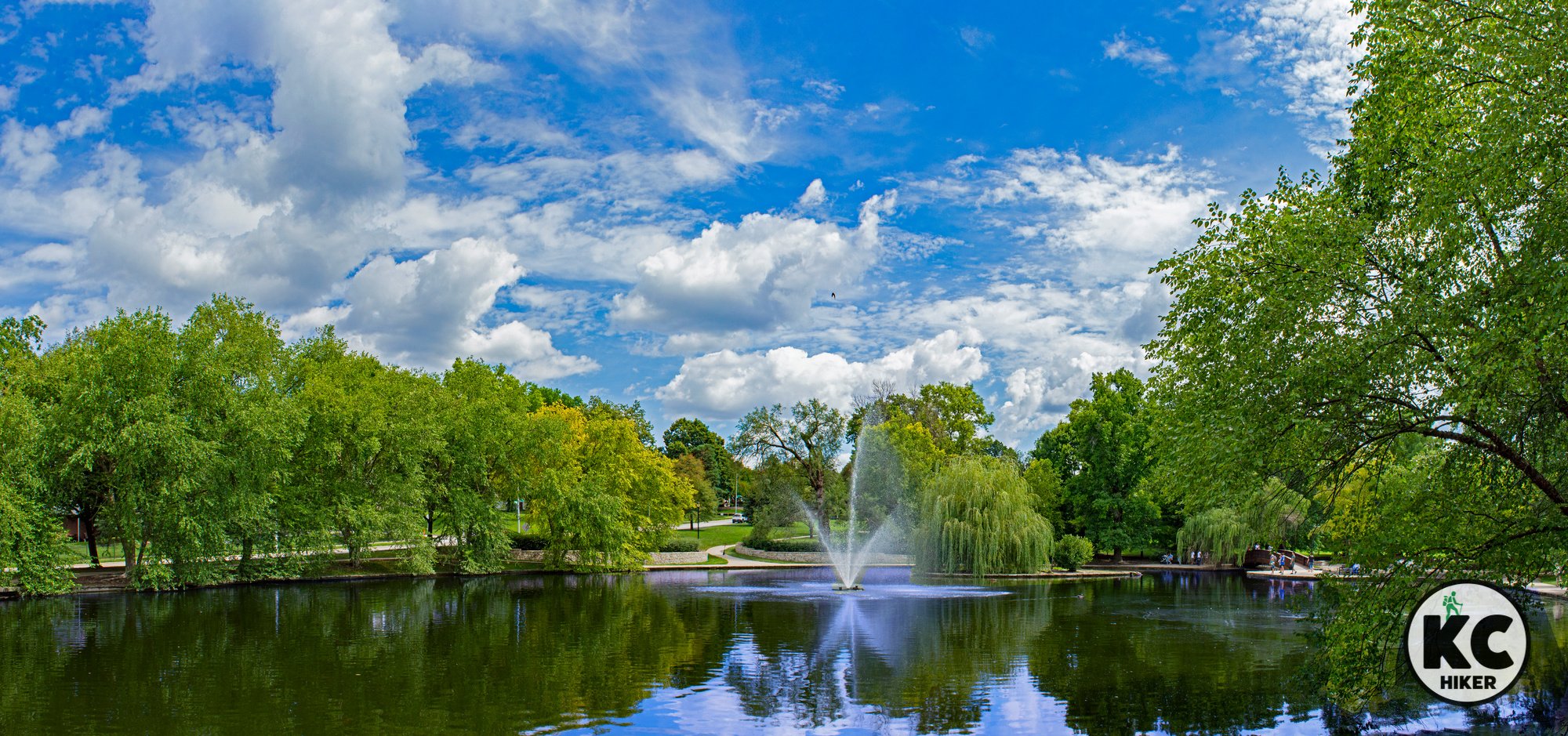
Loose Park, Kansas City, Mo.
A leisurely loop takes visitors through the heart of Kansas City at century-old Loose Park.
Trail Loose Park walking trail
Overview
Loose Park has been a Kansas City recreation destination for nearly a century. With its wide appeal, you can see why. A premiere attraction is its rose garden, with about 4,000 blooming flowers in season. Loose Lake is home to ducks and other waterfowl, a story-tall fountain and arched bridges. A mile-long trail loops the park and provides views of the greenery and historic homes along its perimeter. In addition, history buffs will enjoy the markers explaining the Civil War significance of the area. It’s near the Country Club Plaza, allowing you to easily explore both destinations.Length 1 mile loop.
Address and location 5200 Wornall, Kansas City, Mo., 64112
Conditions This is a paved and easy trail.
Kid friendly? Loose Park is an excellent environment for children and includes a large playground area. Parents will want to be mindful of traffic on the trail. In addition, water safety is necessary for children at Loose Lake.
How busy? This trail and park experience heavy traffic.
Pets Yes, on a leash. Read the regulations here.
Bikes Non-motorized bicycles are permitted.
Restrooms are generally available but may close in the off season.


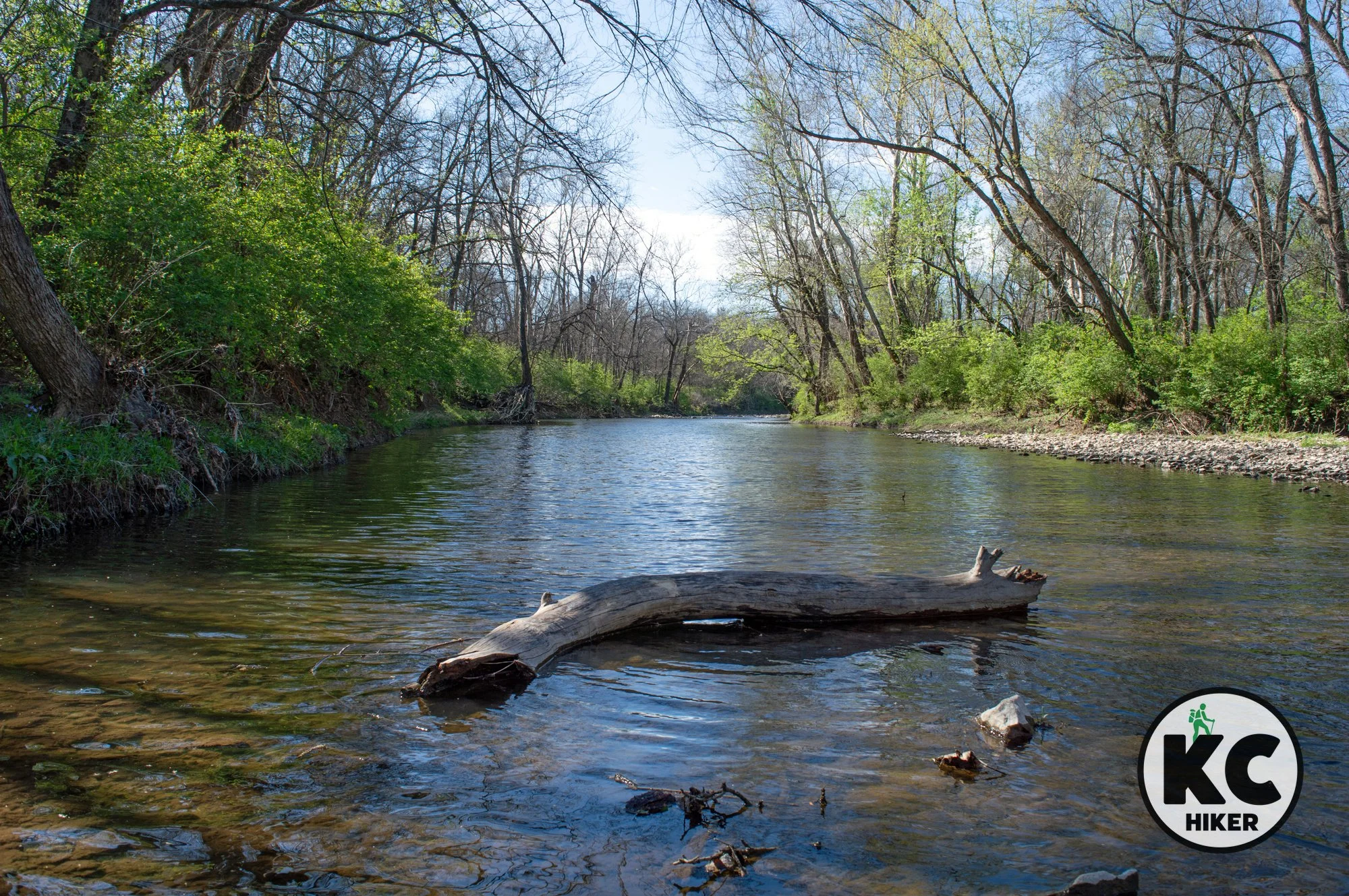
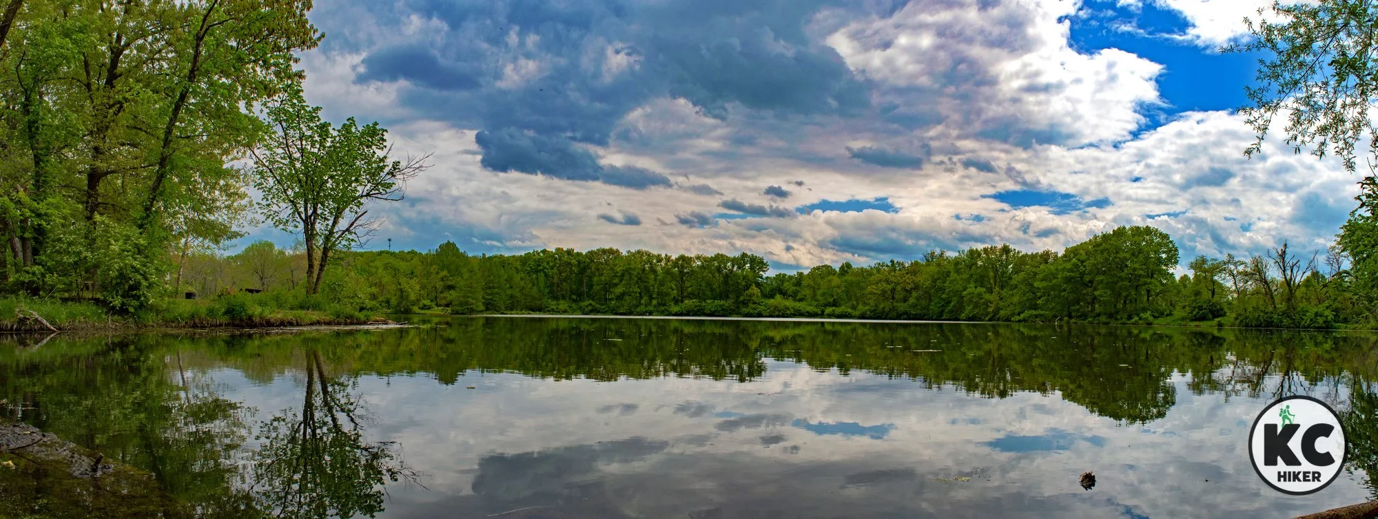
Longview Lake Trail: Waterside Splendor in Jackson County
This 6.5-mile trail follows the shoreline of Longview Lake through a mostly pastoral environment in South Kansas City. A lesser-traveled section south of Scherer Road follows the Little Blue River and explores forested terrain.

Longview Lake Trail, Kansas City, Mo.
Follow a peaceful path along the lakeshore, taking in skiers and sunsets.
Trail Longview Lake Trail
Overview
This one-way 6.5-mile trail begins at Shelter 14 near the Longview marina and ends at O’Donnell Park in Grandview. The trail provides scenic views of Longview Lake, passes under Scherer Parkway and then climbs bluffs above the Little Blue River. It can be accessed at several trail heads. In addition, there is an automated bike rental station near Shelter 14 at the main trailhead. The marina is also a point of interest with its abundance of ducks, geese and carp.The trail south of Scherer Parkway differs from the lakeside character of the rest of the trail. Generally less traveled, it follows the river from that road to O’Donnell Park.
Length 6.5 miles, one way
Address and location Longview Lake Main Trail Head, 9898 Longview Road, Kansas City, MO 64134. If you want to begin at the south entrance, park at O’Donnell Park, 13500 Kurzwell Road, Grandview, MO 64030.
Conditions The trail is made of crushed gravel and has minimal elevation changes. The southern end of the trail (south of Scherer Parkway) is more environmentally diverse, with elevation changes, woodlands and access to the Little Blue River. The majority of the trail is unshaded, so be mindful of sun and heat.
Kid friendly? This trail is excellent for strollers or children on small bikes. Parents should be mindful of bike traffic.
How busy? This trail experiences moderate to heavy traffic.
Pets Yes, on a leash. Read the regulations here.
Bikes Non-motorized bicycles are permitted. You can also rent a bike a Shelter No. 14.
Restrooms are available at the Marina and may be available seasonally at picnic shelters along the trail.


Little Blue Trace Trail: 15 Miles of Pastoral Beauty
The Little Blue Trace follows the Little Blue River from Lee’s Summit Road all the way north to 24 Highway in Independence. The one-way journey is 15.6 miles. It’s a pleasant walk (or ride) on crushed gravel and pavement that weaves in and out of suburbs and pastoral areas. The trail varies from intensely urban (walking under I-70) to farmland. With numerous trail heads, you can walk as far or as little as you like.

Little Blue Trace Trail, Independence, Mo., Jackson County
Jackson County’s premiere trail follows the river for 15 miles.
Trail Little Little Blue Trace
Overview
The Little Blue Trace follows the Little Blue River from Lee’s Summit Road all the way north to 24 Highway in Independence. The one-way journey is 15.6 miles. It’s a pleasant walk (or ride) on crushed gravel and pavement that weaves in and out of suburbs and pastoral areas. The trail varies from intensely urban (walking under I-70) to farmland. With numerous trail heads, you can walk as far or as little as you like.Length 15.6 miles
Address and location You can access the trail from:
Phelps Road/Lee's Summit Road intersection. There is a parking area and mobile restroom.
19019 E 48th St, Independence, MO 64055. The trail runs behind Natural Grocers in Independence.
4000 S. Little Blue Parkway. Enter behind the shopping center
Conditions The trail has a crushed rock surface with minimal elevation changes. There is a general absence of shade, so be mindful of sun and heat.
Kid friendly? This trail is excellent for strollers or children on small bikes.
How busy? This trail experiences moderate to heavy traffic, with urban areas being busier than rural areas.
Pets Yes. On a leash. Read the regulations here.
Bikes Non-motorized bicycles are permitted.
Restrooms Portable toilets may be available at some trailheads.


Little Blue Valley Park: Serenity rules where engines once roared
This trail follows the Little Blue River past a busy sports park and then into quiet river bottomland and prairie. Little Blue Valley Park and trail is in far east Kansas City between Raytown and Lee’s Summit. The largest section of the trail is the reclaimed race track/concert venue that was once Kansas City International Raceway. Since the track closed in 2011, nature has reclaimed most of it.

Little Blue Valley Park, Kansas City, Mo.
Take a riverside walk amid pastoral beauty.
Trail Little Blue Valley Park
Overview
This trail follows the Little Blue River past a busy sports park and then into quiet river bottomland and prairie. The 95-acre Little Blue Valley Park and trail is in far east Kansas City between Raytown and Lee’s Summit. The largest section of the trail is the reclaimed race track/concert venue that was once Kansas City International Raceway. Since the track closed in 2011, nature has reclaimed most of the old drag strip. Highlights include wildflowers in season and a scenic bridge across the Little Blue River.Length 3 miles
Address and location You can access the trail from 50 Highway at 13498 E 87th Street, Kansas City, 64139 or from Noland Road at 8259 S Noland Road, Kansas City 64138.
Conditions This is a paved and flat trail that is easy to navigate. Because most of it is unshaded, be mindful of sun and heat.
Kid friendly? This trail is great for pushing strollers or children on small bicycles.
How busy? This trail experiences light to moderate traffic.
Pets Yes, on a leash. Read more.
Bikes Non-motorized bicycles are permitted.


The history walk: Penn Valley Park and Liberty Memorial
Looking for a vigorous hike that’s loaded with history and stunning urban scenery? This is it! The National WWI Museum and Memorial, more commonly known as Liberty Memorial, is part of the 130-acre Penn Valley Park. Two miles of looping and interconnecting trails extend throughout this scenic area, providing unparalleled views of the Downtown Kansas City skyline, Union Station, Crown Center and beyond. The park itself is historic, built in 1904. Over the years, it has served as a tourist camp and a U.S. Army residential area for returning soldiers.

Penn Valley Park and Liberty Memorial Trail, Kansas City, Mo.
Get a rigorous walk and spectacular city views in this urban trail setting.
Trail Penn Valley Park and Liberty Memorial
Overview
Looking for a vigorous hike that’s loaded with history and stunning urban scenery? This is it! The National WWI Museum and Memorial, more commonly known as Liberty Memorial, is part of the 130-acre Penn Valley Park. Two miles of looping and interconnecting trails extend throughout this scenic area, providing unparalleled views of the Downtown Kansas City skyline, Union Station, Crown Center and beyond. The park itself is historic, built in 1904. Over the years, it has served as a tourist camp and a U.S. Army residential area for returning soldiers.In addition to the memorial, other highlights include:
The Hiker statue, memorializing veterans of the Spanish-American War, the Philippine Insurrection and the China Relief Expedition
Liberty Memorial Tower: Take an elevator to the top of the 217-foot tall tower for spectacular views. There is an admission fee and the tower is only open during museum hours. Learn more here.
Length 2 miles of trails.
Address and location The trail can be accessed in several locations, including:
National WWI Museum and Memorial, 2 Memorial Dr, Kansas City, Mo., 64108
Firefighter Fountain, W. 31st St & Pennsylvania Ave, Kansas City, MO 64108
Conditions Paved trails wind throughout the park. There is an absence of shade, so be mindful of sun and heat.
Kid friendly? Paved trails are ideal for pushing strollers; easy for children but be mindful of street crossings (there are a few, depending on your route).
How busy? These trails are moderately trafficked. The exception is when Liberty Memorial is the site of an outdoor event.
Pets Yes, on a leash (unless otherwise designated).
Bikes Non-motorized bicycles are permitted.
Restrooms There is a portable toilet at the picnic shelter at W. 28th St. and Kessler Road.


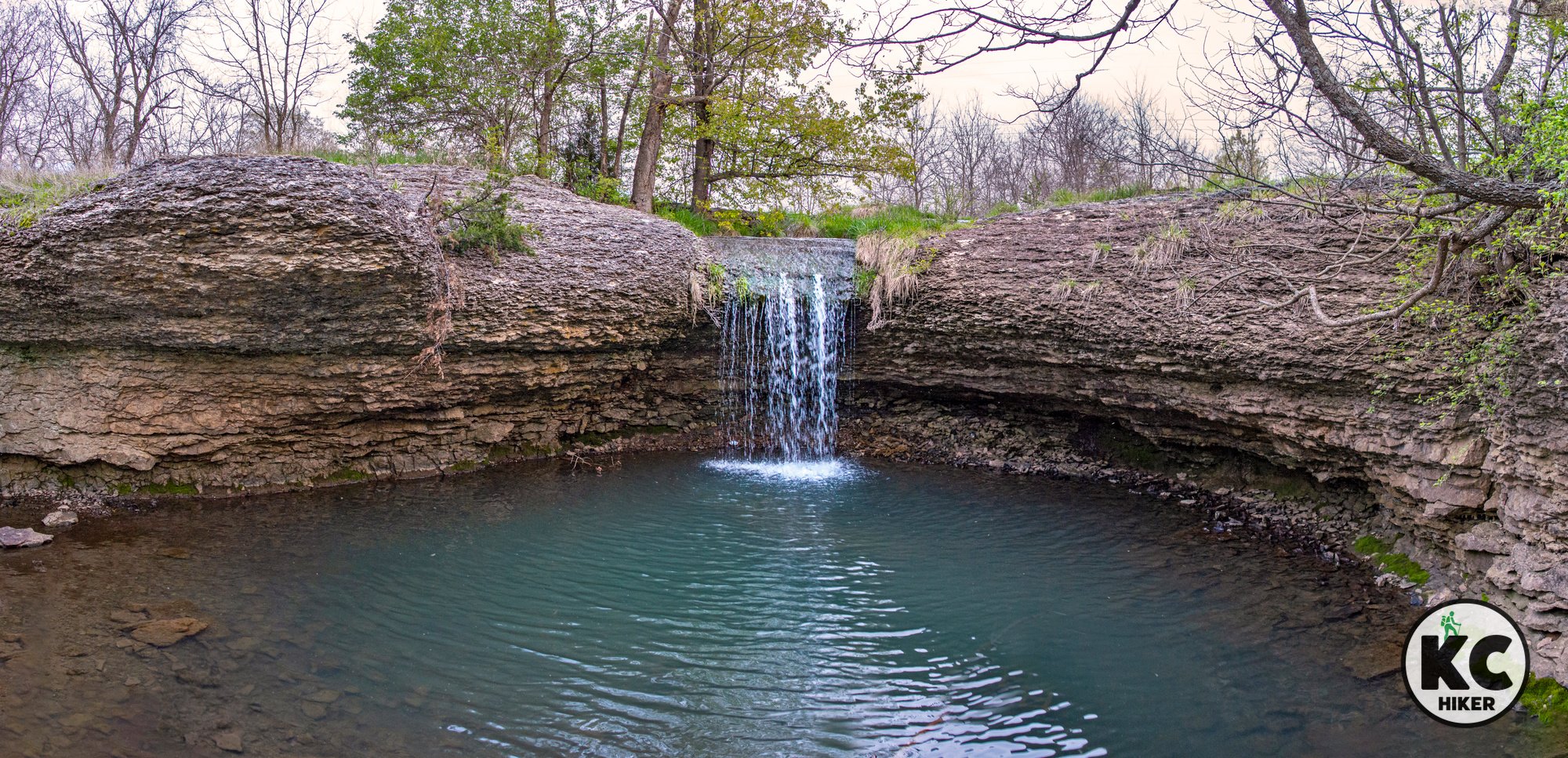
A Legacy of Nature: 700-acre Legacy Park
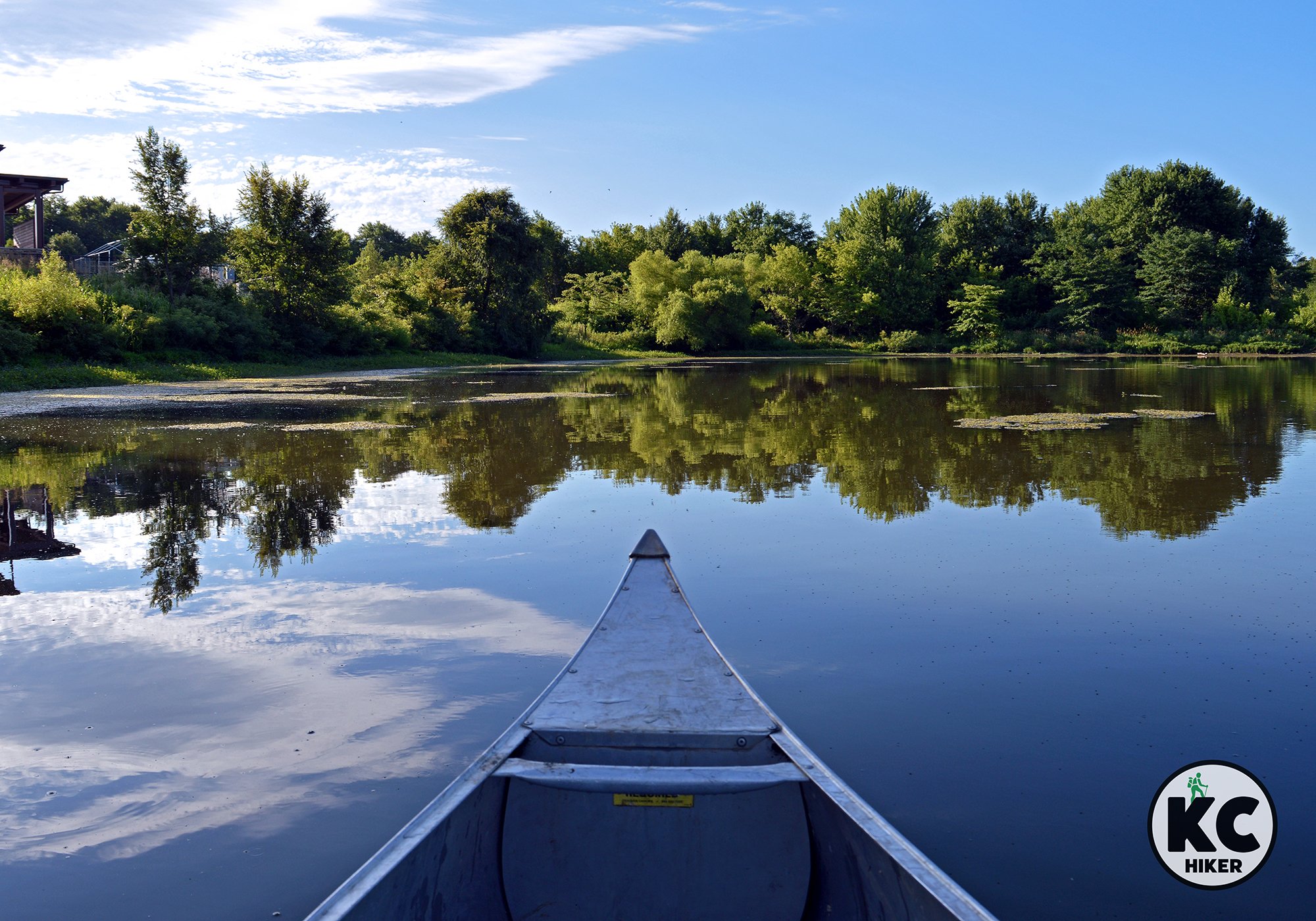
Legacy Park, in Lee’s Summit, Mo., features 700 acres dedicated to sports and recreational uses. It features more than 10 miles of trails, with about seven miles being paved. In addition to the paved routes, a dirt-track mountain bike trail explores woodlands and the park’s pastoral beauty. Legacy also features the 22-acre Legacy Lake and small streams cutting across the prairie. One feeds a spectacular waterfall on the 1014 Loop. Other outdoor activities are centered on lake, which offers fishing, canoe and stand-up paddle board rentals.
Legacy Park Trail System, Lee’s Summit, Mo.
Take in the sunset, wander quiet forest groves and be wowed by a spectacular waterfall at this Lee’s Summit preserve.
Trail Legacy Park Trail System
Overview
Legacy Park, in Lee’s Summit, Mo., features 700 acres dedicated to sports and recreational uses. It features more than 10 miles of trails, with about seven miles being paved. In addition to the paved routes, a dirt-track mountain bike trail explores woodlands and the park’s pastoral beauty. A mowed path allows you to walk a loop around the 22-acre Legacy Lake. On the north side of the park, a highlight is a spectacular waterfall on the 1014 Loop (it can run low in the dry season). Other outdoor activities are centered on lake, which offers canoe, kayak and stand-up paddle board rentals as well as fishing.Length 11 miles of paved, dirt and grass trails.
Address and location The Legacy Park Community Center is located at 901 Bluestem, Lee's Summit, MO 64086. Trails can be accessed from other locations as well. See the map below for more detailed information.
Conditions Most of Legacy Park’s trails are paved. The only exception is the dirt-track 1014 loop, which is oriented toward mountain biking (walkers are welcome). Trails are well marked and maintained.
Kid friendly? The paved trails are excellent for pushing strollers and for children’s bikes. The dirt-track 1014 Loop is impassable for strollers and is considered a beginners-level mountain bike course. Plan on kids walking.
How busy? Legacy trails are moderate-heavily trafficked.
Pets Yes, on a leash (unless otherwise designated).
Bikes Non-motorized bicycles are permitted.
Restrooms are available at the Lovell Community Center during business hours. Other restrooms are located near sports fields and picnic areas.


Hike Above Blue Springs Lake on the Lake Vista Trail
The Lake Vista Trail is one of the best-maintained, easy-to-follow trails in the Jackson County park system. The trail encircles the wooded, rolling terrain surrounding Blue Springs Lake and passes limestone cliffs and outcroppings. Another highlight is a massive, arched footbridge that passes over a creek. There are six trail heads, making it easy to plan the distance you desire. To complete the full loop, you must walk a sidewalk and bridge over Blue Springs Lake on Woods Chapel Road.

Lake Vista Trail, Blue Springs Lake, Lee’s Summit, Mo.
Trek the rocky, wooded path around the lake and get closeups of nature.
Trail Lake Vista Trail
Overview
The Lake Vista Trail is one of the best-maintained, easy-to-follow trails in the Jackson County park system. The trail encircles the wooded, rolling terrain surrounding Blue Springs Lake and passes limestone cliffs and outcroppings. Another highlight is a massive, arched footbridge that passes over a creek. There are six trail heads, making it easy to plan the distance you desire. To complete the full loop, you must walk a sidewalk and bridge over Blue Springs Lake on Woods Chapel Road.Length 5 miles
Address and location There are six trail heads, with the two most recognizable being Jacomo Spillway parking on Ligget Road and the Ligget Road parking area near the intersection with East Park Road. See the map below for all options.
Conditions This is a crushed gravel trail with minor-to-moderate elevation changes. It’s well marked and easy to follow.
Kid friendly? Pushing a stroller is certainly doable but the gravel surface will mean a bumpy ride.
How busy? This is a moderate-to-heavily-trafficked trail.
Pets Yes, on a leash (unless otherwise designated).
Bikes Non-motorized bicycles are permitted.
Restrooms are not available.


Nature in an Urban Setting: Blue Springs’ Lake Remembrance Trail
The Lake Remembrance Trail is part of Gregory O. Grounds Park in Blue Springs, Mo. It follows the shoreline of the lake and weaves between forested and open areas. There is a 2.14-mile loop and a 0.46-mile extension on the north side of the lake. The trail is an excellent place to view waterfowl, birds of prey and amphibians.

Lake Remembrance Trail, Blue Springs, Mo.
Walk the forested lake shore and observe wildlife, aquatic plants and wildflowers.
Trail Lake Remembrance Trail
Overview
The Lake Remembrance Trail is part of Gregory O. Grounds Park in Blue Springs, Mo. It follows the shoreline of the lake and weaves between forested and open areas. There is a 2.14-mile loop and a 0.46-mile extension on the north side of the lake. The trail is an excellent place to view waterfowl, birds of prey and amphibians.Length 2.6-miles of trails, including the main loop and side trails.
Address and location You can access the trail at:
29112-29498 NE Jefferson St, Blue Springs, Mo., 64029
Blue Springs Dog Park, NE 20 St, Blue Springs, Mo., 64029
Parking lot near the intersection of NE Duncan Road and NE Sparta Drive, Blue Springs, Mo., 64029
Conditions This is a paved trail, well marked and maintained.
Kid friendly? The trail is perfect for pushing strollers and children’s bikes. Parents need to be mindful of passing cyclists.
How busy? This is a heavily-trafficked trail.
Pets Yes, on a leash (unless otherwise designated).
Bikes Non-motorized bicycles are permitted.
Restrooms There is a pit toilet on the park’s east side.


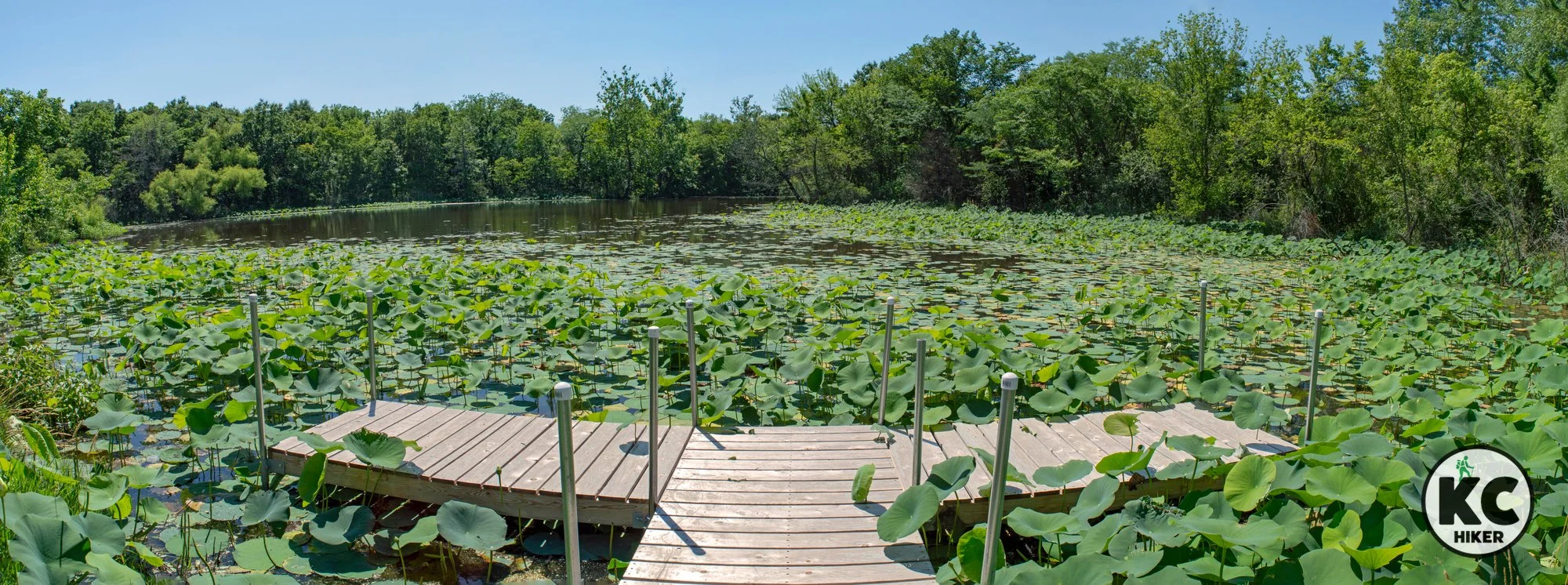
James A. Reed Wildlife Area: A Haven For Nature Lovers
With 12 lakes and abundant wildlife, James A. Reed Conservation Area is a delight for nature lovers. Its 3,000 acres area is dotted with lakes, forest groves and rows of crops. Shawnee Trace Natural Trail follows East Branch Big Creek and rises above gentle bluffs. But beyond the trail, James A. Reed is ripe for the wanderer. In addition to the designated nature trail, there are miles of multi-use trails throughout the park.
James A. Reed Wildlife Area, Lee’s Summit, Mo.
Wander 3,000 acres of lakes, streams and pastoral beauty.
Trail James A. Reed Wildlife area
James A. Reed Wildlife Area preserves 3,000 acres of pastoral beauty in the midst of a rapidly developing area in Lee’s Summit. With 12 lakes and abundant wildlife, this refuge is a delight for nature lovers. The park is dotted with ponds, forest groves and rows of crops. Shawnee Trace Natural Trail follows East Branch Big Creek and rises above gentle bluffs (see “conditions” information below). James A. Reed is ripe for the wanderer. In addition to the designated nature trail, there are miles of mowed multi-use trails throughout the park. These are the heart of the nature refuge, bringing you close to ducks, great blue heron, deer and abundant wildflowers.
Length 2.4-mile Shawnee Trace Trail; in addition there are miles of multi-use trails.
Address 12405 S,E, Ranson Road, Lee's Summit, MO 64082
Conditions The Shawnee Trail is a natural surface trail with few elevation changes, except for a brief rise over some rock outcroppings. The trail is poorly marked and minimally maintained. In summer, it’s nearly impassable due to spider webs, overgrowth and poison ivy. Get a map (see below), bring a compass and water and head out when the bugs and poison ivy dissipate. There is beauty to be found here, for sure, but you won’t really know your way around until your second or third trip. An alternative is to follow the many miles of multi-use trails that traverse the park (see the map below). Multi-use means that part of the trail is open to horses. The multi-use trails are generally mowed paths through fields and forest.
Kid and stroller friendly? Kids must be prepared to walk for at least an hour on the nature trail. The park is not conducive to strollers.
Conservation area
Unlike other parks, conservation areas permit hunting. Be aware of hunting seasons.
Pets Prohibited except hunting dogs during hunting season.
Bikes Prohibited on the hiking trail; allowed on roads and multi-use trails.
How busy? This is a light-to-moderately trafficked area.
Pets Yes, on a leash (unless otherwise designated).
Bikes Prohibited except on roadways.
Restrooms There is a restroom at the regional office building and there are pit toilets in several locations throughout the refuge.


Get in the Zen Zone on the Carl Chinnery Nature Trail at Unity Village
The Carl Chinnery Trail, near Lee’s Summit, runs through gently rolling hills, timber and pastoral beauty. Part of the trail follows Little Cedar Creek, which occasionally breaks into cascades and small waterfalls. This stream provides many opportunities for children to splash and play (but don’t drink it!). Limestone outcroppings and boulders are a continual presence. It’s a prime location to spot deer, birds and waterfowl.

Carl Chinnery Nature Trail at Unity Village, Mo.
Discover a cache of natural beauty near suburban Lee’s Summit.
Trail Carl Chinnery Nature Trail at Unity Village
Overview
This loop trail, near Lee’s Summit, runs through gently rolling hills, timber and pastoral beauty. Part of the trail follows Little Cedar Creek, which occasionally breaks into cascades and small waterfalls. Limestone outcroppings and boulders are a continual presence. It’s a prime location to spot deer, birds and waterfowl.Other highlights include:
“Hobo Rock,” a place where wanderers carved inscriptions in stone.
A “natural bridge” apparently known to pioneers. Legend has it that outlaw Jesse James and his gang hid out there.
Unity Lake – a serene reservoir surrounded by forest.
Although it may be tempting to explore off-trail, Unity asks that all guests stay on the path. Lakes are for viewing, not swimming or other activities.
Length 2.4-mile loop
Address and location 1901 NW Blue Pkwy, Unity Village, MO 64065
The trail head is immediately east of the Unity office complex and is marked with a large sign. Park in the parking lot adjacent to the trail head.
Conditions Crushed gravel, easy to moderate
Kid friendly? This is a gravel trail that, theoretically, could accommodate a “four-wheel drive” stroller. But it will be a bumpy ride. The trail is ideal for children who can walk it, although they may tire if you attempt the full 2-mile loop.
How busy? This is a light-to-moderately trafficked trail.
Pets Yes, on a leash (unless otherwise designated).
Bikes Prohibited.
Restrooms are not available on the trail.


Burr Oak Woods: 1,000 acres of woods and wilds
Burr Oak Woods is a must-visit destination for nature buffs in Kansas City. Located in Blue Springs, the park features a nature center, limestone boulders and cliffs, clear streams and tall grass prairie. You can spend an hour or a day exploring the more than 1,000 acre refuge. If you’re short on time, we recommend the Bethany Falls Trail. But no matter which trail you pick, you can’t go wrong.

Burr Oak Woods Conservation Area, Blue Springs, Mo.
Mighty oak trees, limestone boulders and pastoral beauty are highlights of this Eastern Jackson County refuge.
Trail Burr Oak Woods Conservation Area
Overview
Burr Oak Woods is a must-visit destination for nature buffs in Kansas City. Located in Blue Springs, the park features a nature center, limestone boulders and cliffs, clear streams and tall grass prairie. You can spend an hour or a day exploring the more than 1,000 acre refuge. It’s compelling in all seasons, although mid-summer can be buggy and muggy. If you’re short on time, we recommend the Bethany Falls Trail. But no matter which trail you pick, you can’t go wrong. The visitors center is a destination for school children from around the metro area and features hands-on displays. In addition, Burr Oak Woods is the site of numerous educational classes – both indoors and out – sponsored by the Missouri Department of Conservation. Although the park is open daily, visitors’ center hours may vary.Most people miss several hundred acres of this refuge north of Pink Hill Road. That area can be accessed from the parking lot on Strode Road and can be explored via mowed (but unmarked) trails. This section includes glade areas, restored tallgrass prairie, wooded groves and steep ravines. The prairie areas are dominated by big bluestem grass, which can reach seven feet in height. Mixed in are a potpourri of multi-colored wildflowers.
Length There is a total of six miles of hiking on six different trails. However, you can walk many more miles if you venture onto what are called “area access trails.” These are open to the public but may not be as well marked or maintained as the designated trails. They can be viewed on the trail map below.
Address and location
1401 N.W. Park Road, Blue Springs, MO 64015
Conditions Trails range from paved to gravel and natural surface and from easy to moderate.
Kid friendly? Children will enjoy the nature center and the paved trail can easily accommodate strollers. The gravel trails are for children who are up for a rigorous hike.
How busy? This is a popular destination and can be busy on peak days and seasons.
Pets Prohibited. You can read the rules here.
Bikes Prohibited on trails.


Pass Gardens and Groves on the Country Club Plaza Trail
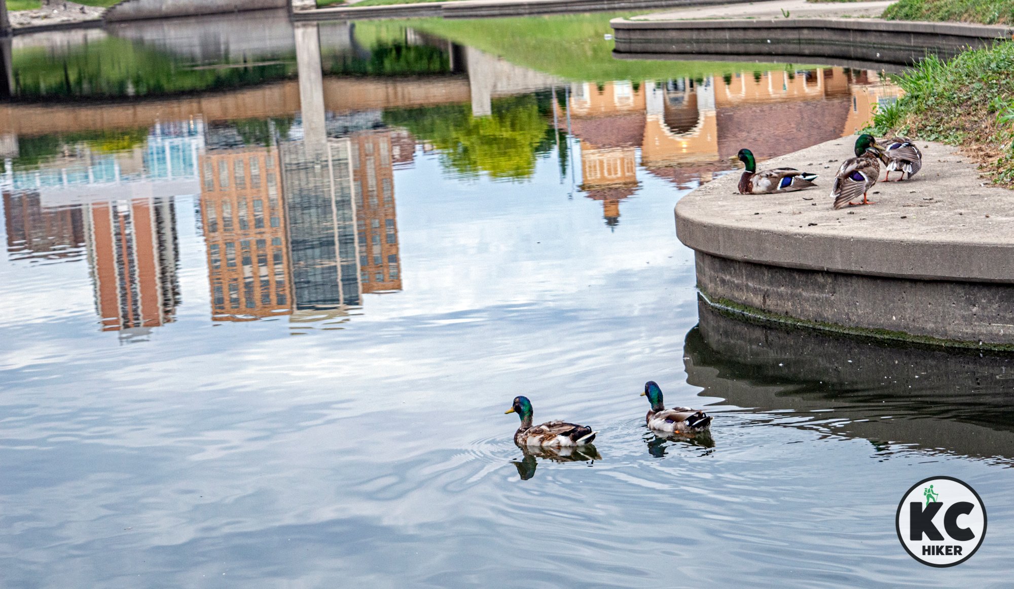
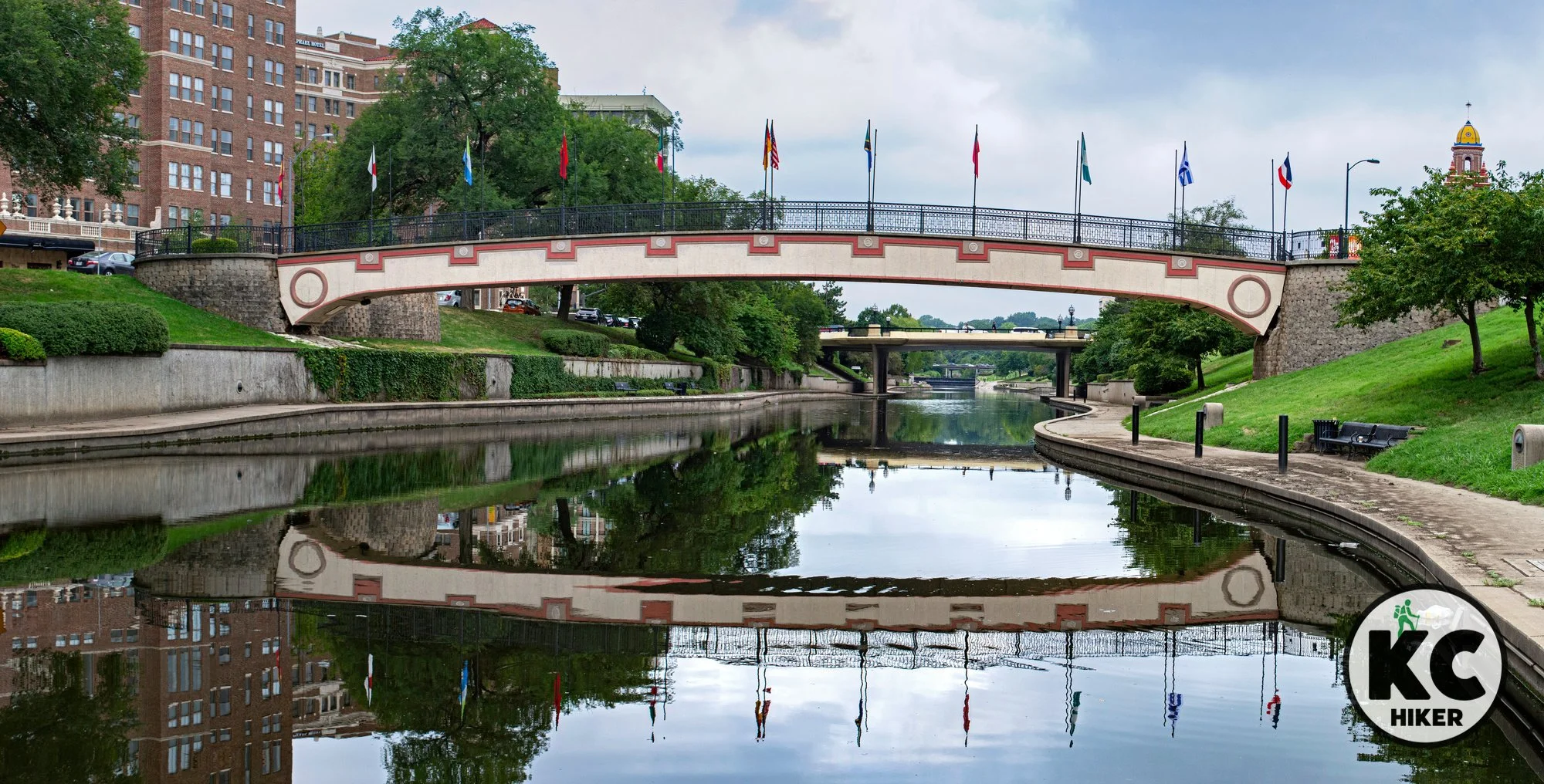
Begin at Kauffman Legacy Park and walk east alongside Brush Creek until you reach the Country Club Plaza. You can walk both sides of the creek, viewing Plaza architecture, the Sister Cities Bridge, Frank Theiss Park, The Nelson Museum and waterfowl. You can also include this walk with the loops around Kauffman Legacy Park, the Gorman Conservation Discovery Center and The Nelson Museum. If you do that, you’ll trek about four miles.

Walk along Brush Creek on The Country Club Plaza in Kansas City, Mo.
Take an architectural journey through one of Kansas City’s most popular districts.
Trail Plaza Walking Trail
Overview
This urban hike is a visual delight. Park at the Anita B. Gorman Conservation Discovery Center and walk west alongside Brush Creek until you reach the Country Club Plaza. You can walk both sides of the creek, viewing Plaza architecture, the Sister Cities Bridge, Frank Theiss Park, The Nelson Museum and waterfowl. You can also include this walk with the loops around Kauffman Legacy Park, the Gorman Conservation Discovery Center and The Nelson Museum. If you do that, you’ll trek about four miles.Length 1-4 miles, depending on your route.
Address and location
You can park in any public lot and walk to the trail. Parking access immediately adjacent to the trail can be found at the Ewing and Muriel Kauffman Memorial Garden, 4800 Rockhill Rd, Kansas City, Mo., 64110.Conditions This trail is in great condition. There is little shade, so be prepared for sun and heat on warm days. Disability access may be limited.
Kid friendly? Although there’s no reason kids can’t walk along the creek, parents should be mindful of water safety.
How busy? This spot is moderately trafficked.
Pets Yes, on a leash (unless otherwise designated).
Bikes Prohibited.
Restrooms are available at Kauffman Gardens and the Anita B. Gorman Conservation Discovery Center during business hours.
Trail map: The entire route of the trail is visible on Google Maps.


Directions to Anita B. Gorman Conservation Discovery Center
Paved and Natural Surface Trails Follow the Blue River in Kansas City
The Blue River Trail system is a sprawling north-south network that provides a variety of natural and urban environments along its route. The Blue River Greenway Trail is a paved six-mile trail. The Blue River Parkway Trail is a natural-surface single-track trail that runs more than 25 miles in South Kansas City.
Discover nature alongside one of Kansas City’s most prominent rivers.
Trail Blue River Trail System
Overview
The Blue River Trail system is a sprawling north-south network of more than 30 miles of paved and natural surface trails. It's actually two different trail systems, but they parallel one another and intertwine.
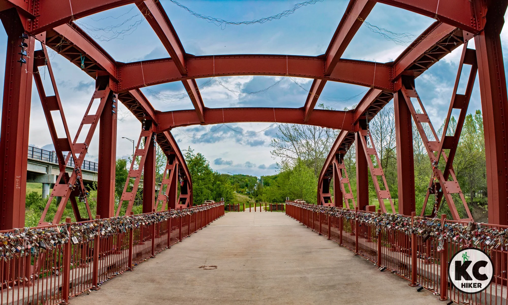
Blue River Greenway Trail
This wide, paved trail runs 6 miles, beginning at 119th St. and Blue River Parkway in South Kansas City. It continues north through Minor Park to 95th Street near the Bannister Road Federal Complex. It’s available to bikers and walkers and intersects with the paved Indian Creek Trail at its northern end. Scenery along the trail includes open areas, lowland forest, ponds and the Blue River itself.
Did you know?
The original Red Bridge, at Minor Park, is also called the Locks of Love Bridge and is adorned with thousands of padlocks. It is accessible at the Minor Park trail head.
Conditions This paved trail is well maintained with minor elevation changes.
Kid friendly? The paved trail presents excellent opportunities for strollers and children on bikes. Parents will need to be mindful of passing bikers.
How busy? The paved trail is popular and busy, particularly near Minor Park, home of picnics and sports activity.
Pets Yes, on a leash (unless otherwise designated).
Bikes Non-motorized bicycles are permitted.
Restrooms Portable restrooms are available at Minor Park.
Access
99th Street Trailhead, 9895-9847 Shepherds Drive, Kansas City, Mo., 64131
Blue River Parkway Trailhead, E. 104th St. (under I-435 bridge)
Blue River Park and Athletic Fields, 1324 E 104 St, Kansas City, Mo., 64131
Alex George Wetland Park, 10633, 10831 Blue River Rd, Kansas City, Mo., 64131
Minor Park, 11103 Holmes Rd, Kansas City, Mo., 64131
Southern Trailhead, 11900-12056 Blue River Road, Kansas City, Mo., 64146
Blue River Parkway Single-Track Trail
Running approximately parallel to the paved trail is an intricate system of single-path natural surface trails that are 26 miles in length. These trails run on the east and west sides of the Blue River. The system is maintained by the Urban Trail Company and is rustic and rugged. This trail can close during wet weather, so visit the Urban Trail website to check the status.
Conditions The trail is well marked but is challenging in terms of elevation changes and footing. In warmer months, trails can narrow due to overgrowth. In summer, low-lying areas can prove humid and attract mosquitos and gnats.
Kid friendly? The dirt track trail is narrow and not built for strollers. Parents will need to be mindful of passing bike traffic.
How busy? The dirt track trail is popular with mountain bikers and traffic levels depend on the section and season.
Pets Yes, on a leash (unless otherwise designated).
Bikes Non-motorized bicycles are permitted.
Restrooms Portable restrooms are available at Minor Park.
Did you know?
The southernmost access for the natural surface bike trail is on E. 139th St., between Holmes and Prospect, in South Kansas City. This is a quiet walk that parallels the river before looping back to the trailhead. Plan on street parking.


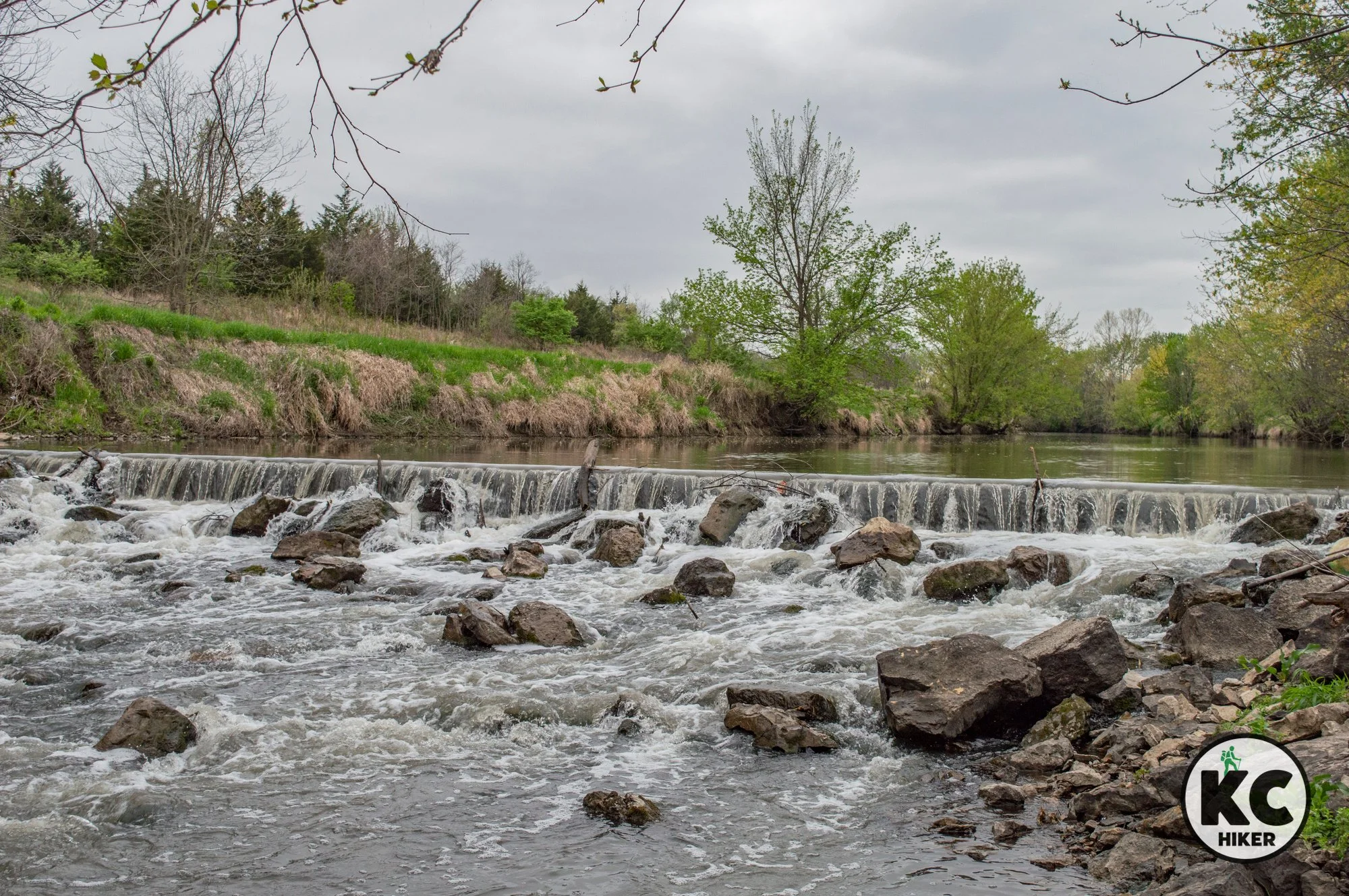
Experience wildlife and a waterfall at Bridger Conservation Area
The Jim Bridger Urban Conservation area is a delight and hidden gem near the border of Lee’s Summit and Blue Springs, Mo. A mowed and dirt trail takes you through crop rows, pastureland, woods and bottomland forest. Wildflowers and wildlife – especially birds – are plentiful. This area is designated as a Great Missouri Birding Trail.

The Jim Bridger Urban Conservation Area straddles Lee’s Summit and Blue Springs, Mo.
Discover birds by the thousands, falling water, explosive sunsets and quiet.
Trail Bridger Urban Conservation Area
Overview
The Jim Bridger Urban Conservation area is a diverse nature refuge near the border of Lee’s Summit and Blue Springs, Mo. A mowed and dirt trail takes you past a shelf waterfall and through prairie, woods and bottomland forest. Wildflowers and wildlife – especially birds – are plentiful. This area is designated as a Great Missouri Birding Trail. In the middle of the park, the trail descends into a valley walled by limestone outcroppings and glades. The conservation area itself is only 320 acres but borders Jackson County’s Kemper Outdoor Education Center, which features the one-mile, natural surface Habitat Trail (included in our map below). Although the Kemper park (home to a summer camp) is closed through most of winter, you can still walk the trail during posted hours. Beyond trails, some of Bridger’s best-kept secrets are found off the trail. Wander the prairie and follow the stream. Who knows what nature may reveal?Conditions This trail is unmarked. With that said, is generally clear where the trail runs. It consists of a mowed path through fields and tallgrass. There is also a scenic dirt path that follows a stream and leads to wet weather waterfalls. It’s marked with a small sign that is easily missed. If you are walking west to east, the path is immediately to your left after your cross a small stream at the bottom of an incline (download our map below for details). Elevation changes are moderate; the trail is entirely natural surface and so requires firm footing.
Kid and stroller friendly? Only hearty kids will be able to tackle the trail. Children who do will experience many possibilities for outdoor fun – especially with the creek and waterfalls.
Address
There are east and west trailheads to Bridger Conservation Area. The west trailhead is 500 feet south of Kemper Outdoor Education Center, which is located at 8201 S. Jasper Bell Road, Blue Springs, MO 64015. The east entrance is located about one-quarter mile west of the fire station, which is located on S.W. Wyatt Road, Blue Springs, MO 64014.Pets Yes, on a leash
Bikes Prohibited
Restrooms are not available.

Catch River and City Views on the Berkley Riverfront Trail
The Berkley Riverfront Trail is a paved trail offering scenic views of the river and the Kansas City skyline. A highlight is the observation deck on the Town of Kansas Bridge (which is not really a bridge), giving a multi-story view of the river and points north, east and west. You’ll also pass under the Heart of America motorist and railroad bridges, which span the Missouri River.

Berkley Riverfront Park and trail parallel the Missouri River from the River Market District to Casino KC.
Follow the Missouri River from the River Market to Casino KC.
Trail Berkley Riverfront Park and Trail
Overview
The Berkley Riverfront Trail offers access points at the River Market, Berkley Park and Casino KC (formerly Isle of Capri Casino). A paved trail offers scenic views of the river and the Kansas City skyline. A highlight is the observation deck on the Town of Kansas Bridge (which is not really a bridge), giving a multi-story view of the river and points north, east and west. You’ll also pass under the Heart of America motorist and railroad bridges, which span the Missouri River. As the population of the area has exploded via apartment complexes, the trail has become extremely popular and busy.
Extras No trip on this trail is complete without a visit to the River Market area, which includes the City Market. From the Town of Kansas Bridge, you can take a stairway or elevator several stories down to the river/trail head.
Length 1.3 miles, one way.
Address and location You can park at the River Market or at Berkley Park. Parking is becoming increasingly challenging, so it may be optimal to park offsite and ride the Kansas City Streetcar to the River Market trailhead.
Conditions This is a paved a level trail, accessible by anyone.
Kid friendly? This trail is ideal for strollers and biking children. Parents should be attentive to passing cyclists.
How busy? This is a heavily trafficked trail.
Pets Yes, on a leash (unless otherwise designated).
Bikes Non-motorized bicycles are permitted.


