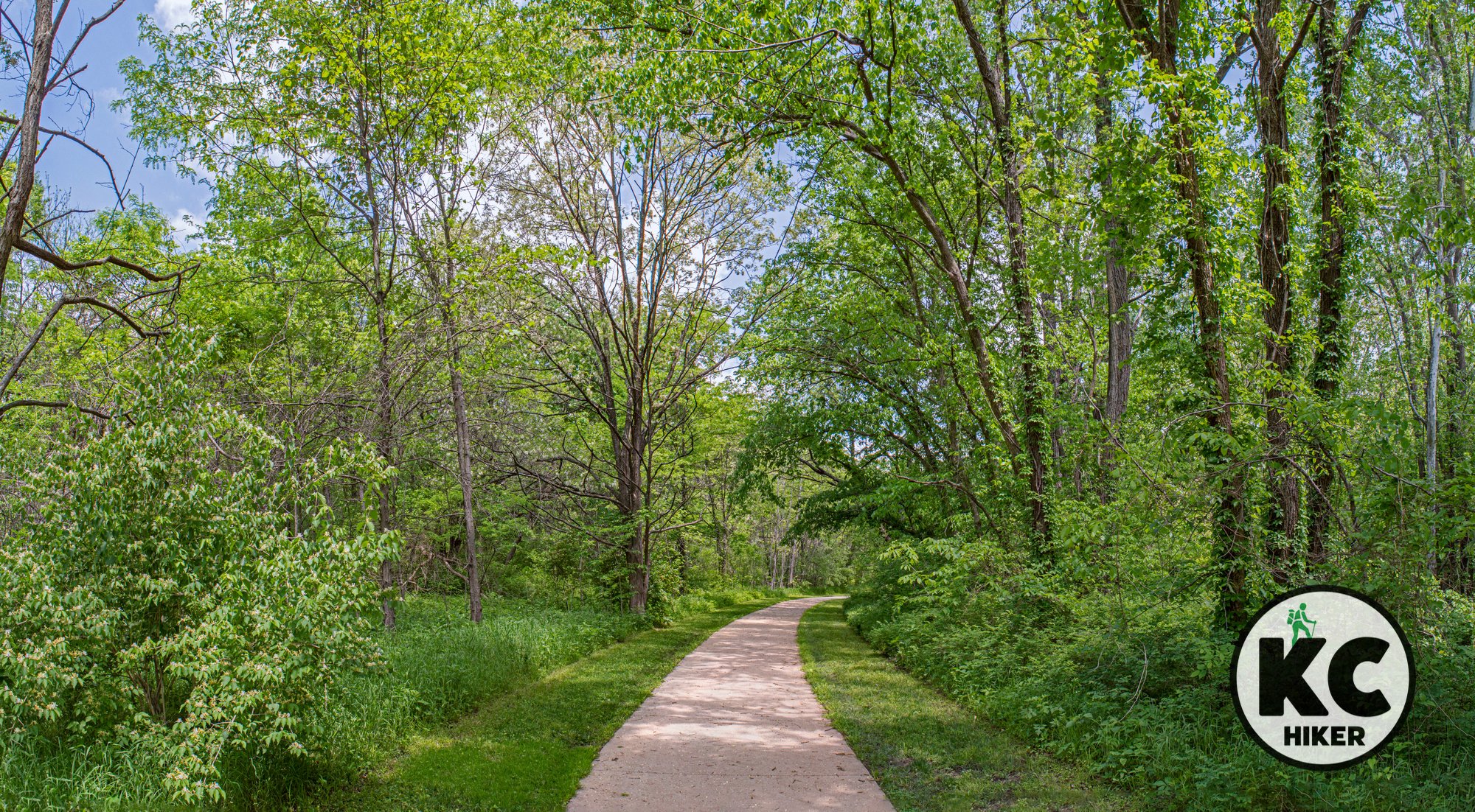
Explore 15 miles of trails at KC North’s McHenry Park
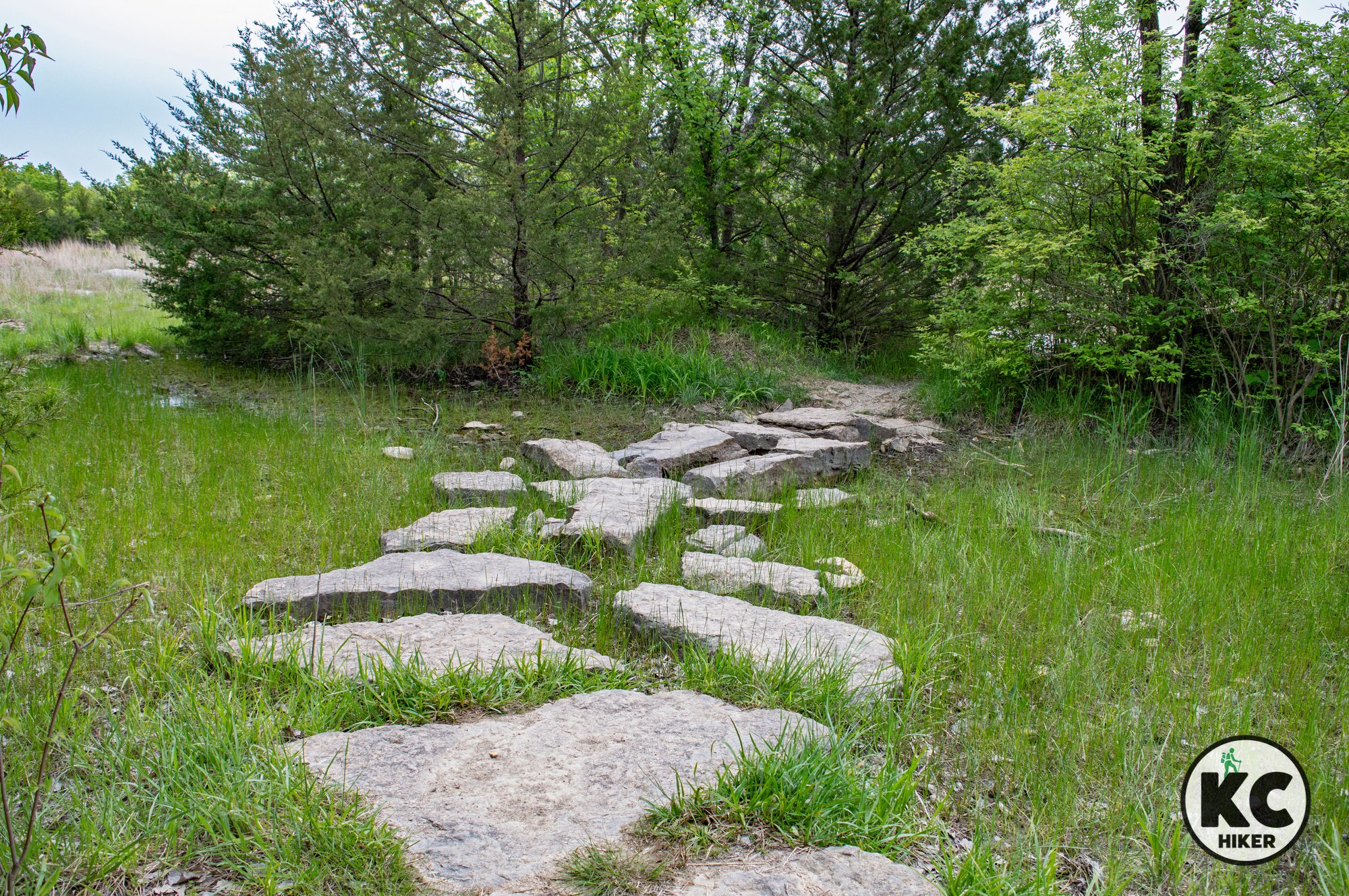
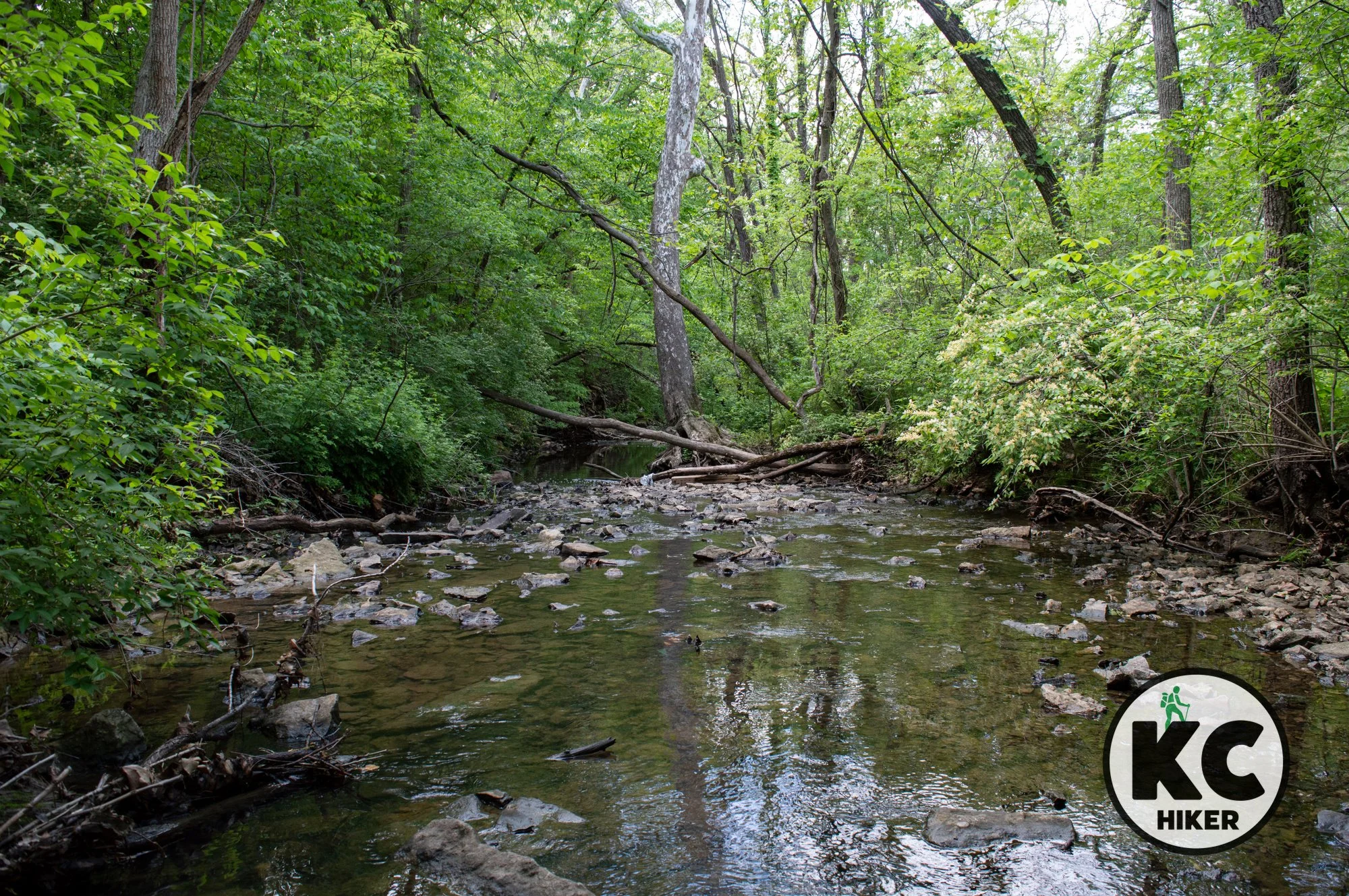
At Kansas City North’s McHenry Park, 15 miles of trails wind through a former quarry and farmland in the shadow of KCI Airport. Except for the sounds of occasional aircraft, the area has a remote vibe. As hikers burrow deep into this 800-acre park, they’ll find themselves enveloped in dense forest, broken by occasional prairies. A series of well-marked interconnected loops allow you to customize your own hike.

Forested hills, marshland and meadows comprise this more than 2,000-acre reserve.
Trail Mark L. McHenry Park trails
Overview
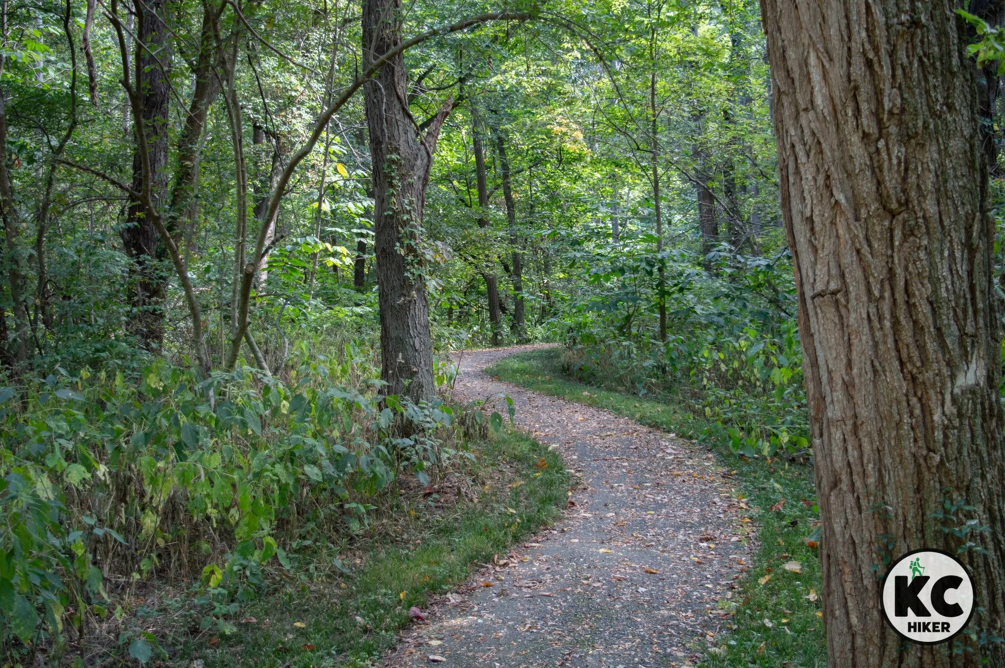
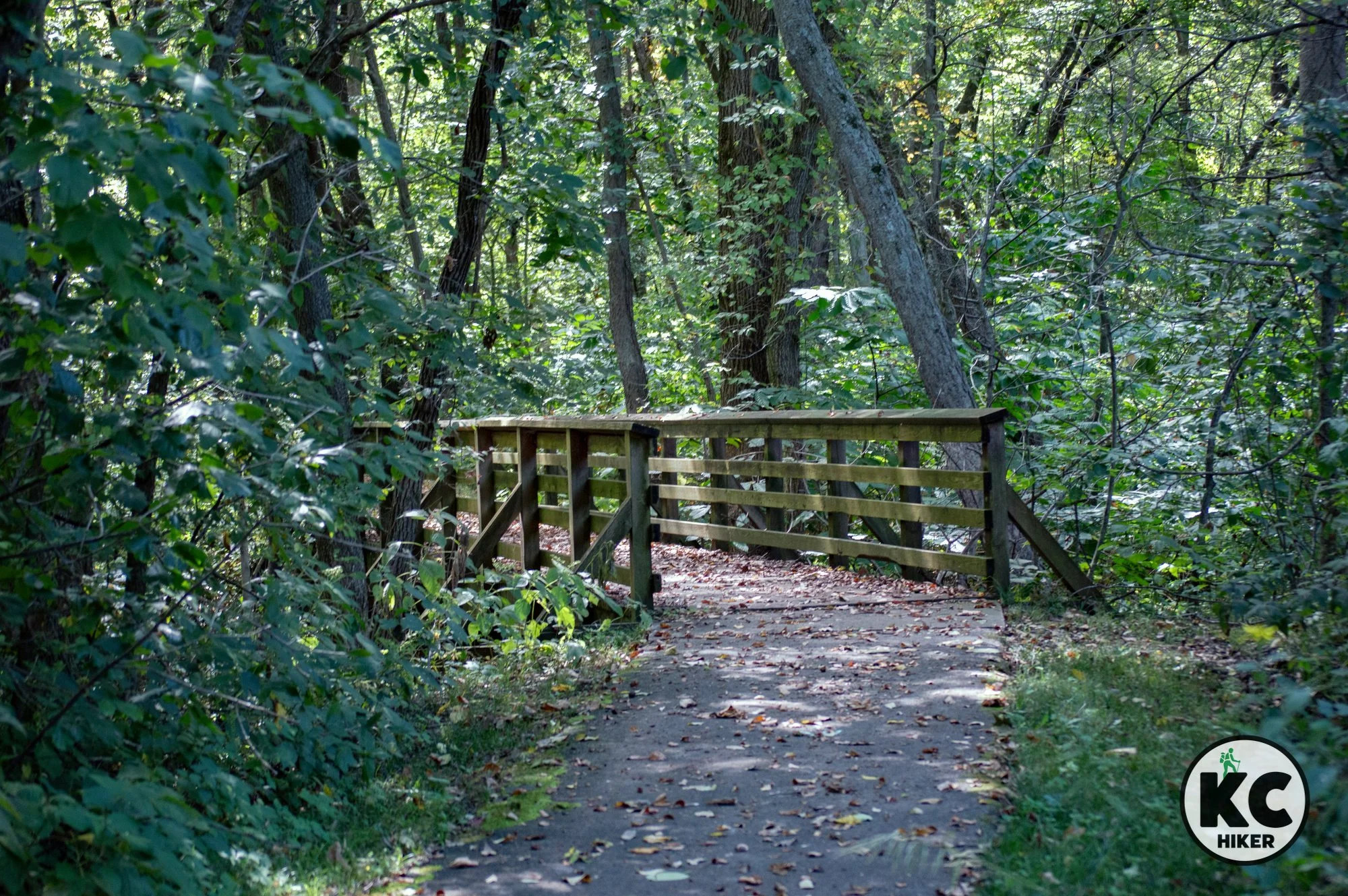
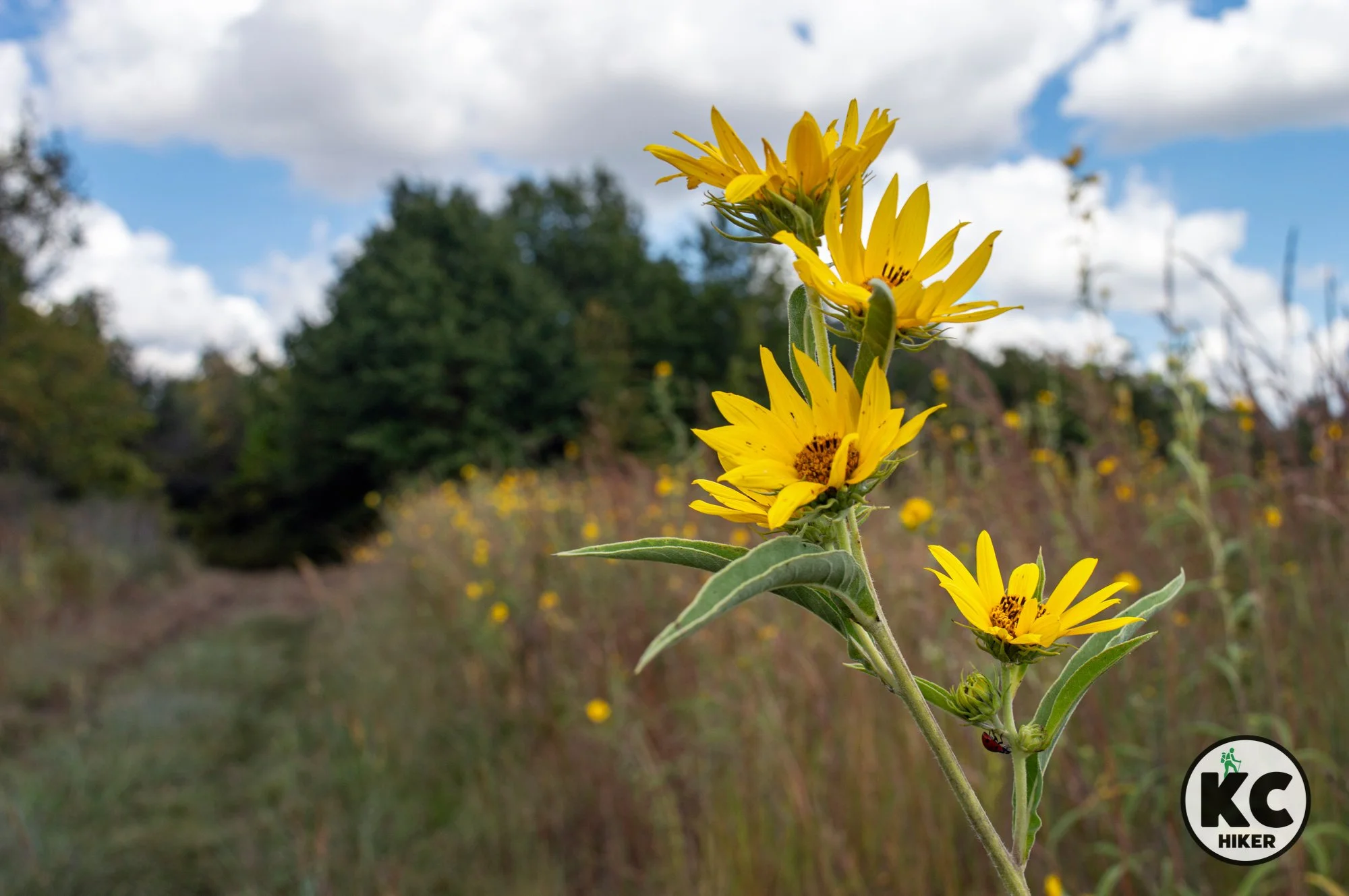
Mark L. McHenry Park, previously known as Tiffany Springs Park, provides more than 800 acres of recreational space near KCI Airport. Although the west side of the park is a team sports area, the majority of McHenry is forested and undeveloped. This is an area reclaimed from agricultural and industrial use. Remnants of quarries can be seen and have been repurposed as ponds. Apart from the sound of planes overhead, this park is a quiet respite in the busy suburbs of Kansas City’s Northland. It’s characterized by forest interrupted by occasional meadows, dissected by Hayes Creek and Brush Creek. Hikers, bikers and equestrians will all find available trails.
Length
There are four trails totaling about 15 miles. These interconnecting loops allow you to customize how far you want to walk and easily change course. The trails are: Brush Creek Loop, Ridge Ride Trail, Hampton Lane Trail and Matt Quary Trail.
Address
Trailheads are accessed from the parking lot at the intersection of N. Childress Avenue and N.W. Old Tiffany Springs Road, Kansas City, Mo. 64153. If the gate to the parking lot is locked, you can park on the roadside. Trailheads can easily be missed: They’re located at the confluence of N. Childress and Old Tiffany Springs Road, as shown below. (There are additional trailheads accessible in the parking lot.)

Conditions Hike and bike trails are well-marked and cleared. The equestrian trails are not maintained to the same standard, but are still accessible for hikers. Elevation changes are minor to moderate.
Kid friendly? These are relatively easy trails but would be prohibitive for strollers.
How busy? These trails are lightly to moderately trafficked.
Pets Yes, on a leash (unless otherwise designated).
Bikes are allowed on designated trails, which are indicated by posted signs.
Restrooms There are no restrooms near the trailhead. Restrooms are open seasonally at the Mark McHenry Park sports complex.


Explore native hardwood forest at Bluffwoods Conservation Area
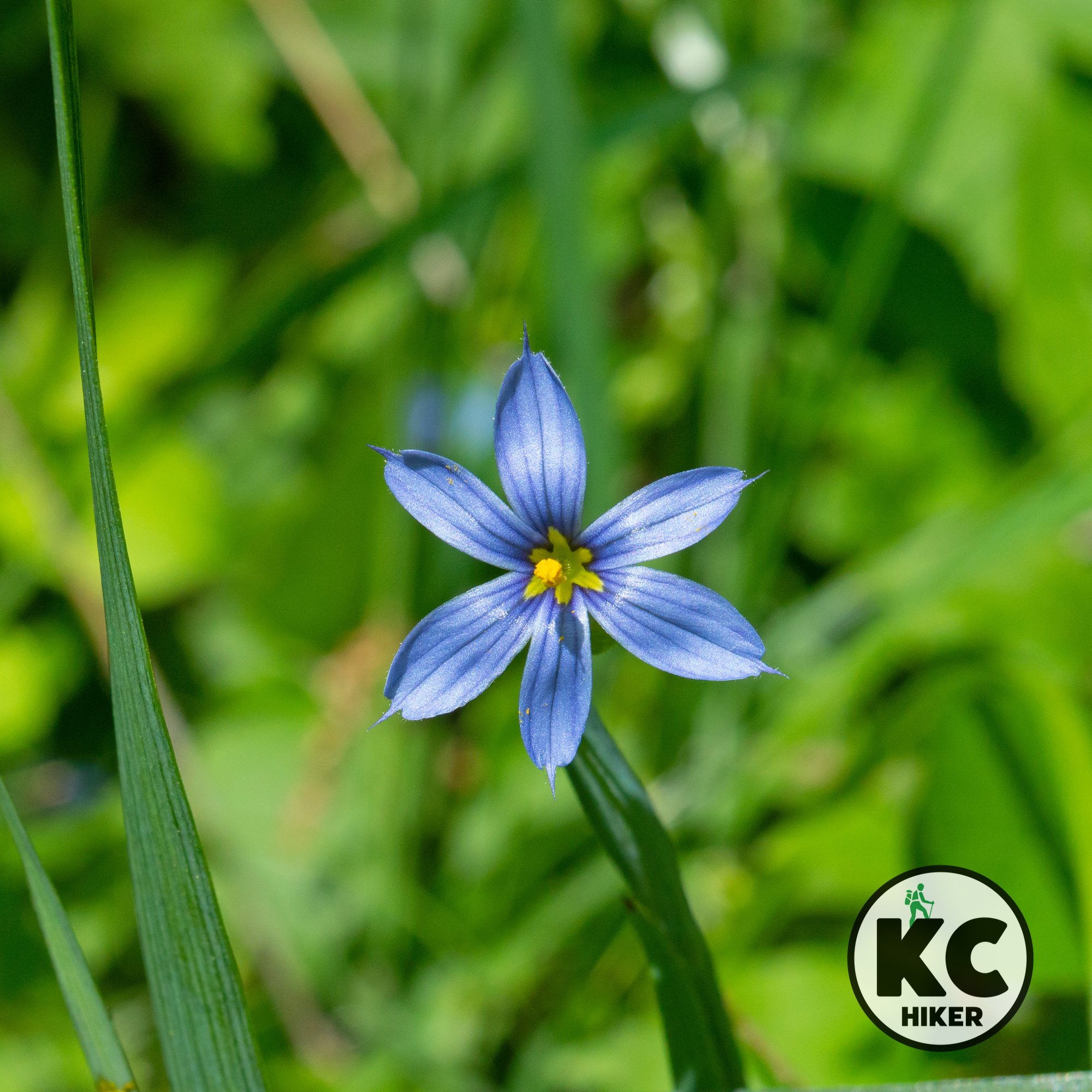
Bluffwoods Conservation Area comprises more than 2,000 acres of Loess Hills rising above the Missouri River Valley. This heavily wooded area includes some of the last remaining oak-hickory forest in northwest Missouri. Wildflowers and wildlife can also be discovered in this remote area, which is between St. Joseph and Weston, Mo.
Forested hills, marshland and meadows comprise this more than 2,000-acre reserve.
Trail Bluffwoods Conservation Area
Overview
Bluffwoods Conservation Area is actually not in Platte County, but we list it here because it’s only 15 minutes across the county line in Buchanan County. Bluffwoods comprises more than 2,000 acres of loess hills rising above the Missouri River Valley. This heavily wooded area includes some of the last remaining oak-hickory forest in northwest Missouri. Wildflowers and wildlife can also be discovered in this remote area, which is between St. Joseph and Weston, Mo. In addition to forest, the area includes marshes, retired crop and pasturelands and a few natural prairies. Bluffs rise 250 feet above the river, which lies about a half mile to the west. Bird watchers will find this area interesting as it is designated by an Important Bird Area by the Audubon Society.
Length
The paved Forest Nature Trail is a series of loops totaling 1.2 miles. The Maple Falls and Lone Pine trails connect and total about 3 miles (all trails are not equal, so see the “conditions” section below). In addition, there are several miles of mowed service roads open to hikers.
Address
There are two major trailheads along (with multiple other access points). There’s weak cell service here, so if you use a map app to find Bluffwoods Conservation Area, there’s no telling which end of the refuge you’ll end up at. To help you get where you want to go, use these directions:
The Forest Nature Trail is located at 3393-4111 SW Bethel Rd, St Joseph, MO 64504. This is the paved trail.
The Maple Falls and Lone Pine Trailhead is located at the intersection of Henman Road and County Road 60 SW, next to Kerlin Cemetery. These are unpaved trails.
Conditions
The Forest Nature Trail is paved, easy and in excellent condition.
The Maple Falls Trail (Loop A) and Lone Pine Trail (Loop B) are natural surface trails with several hundred feed of elevation gain. They could be characterized as moderate in difficulty. Note: They are slippery when wet. Trekking polls are recommended. While Loop A is generally easy to follow, Loop B disappears into the forest, leaving you to bushwhack your way back to the trailhead. For this reason, Loop B is not recommended by KC Hiker.
The park also includes service roads, which can be walked. Download the map below to view all trails and service roads.
Kid friendly? The paved trail is easy with only minor elevation changes. The area’s other trails are natural surface and/or mowed. Topography can be steep.
How busy? The paved trail receives moderate traffic in peak season. The natural surface trails are less frequented..
Pets Yes, on a leash (unless otherwise designated).
Bikes Non-motorized bicycles are permitted on designated service roads [more here].
Restrooms There are primitive restrooms at both trailheads.


Hike rolling plains and marshlands at Kendzora Conservation Area
Kendzora Conservation Area is an outpost of northern Missouri beauty. The natural surface, grassy loop around the area is comprised of rolling hills with glimpses of distant horizons. The 35-acre Kendzora Lake and adjacent 120 acres of marshland provide a prime habitat for waterfowl and migratory birds.
Kendzora Conservation Area, Platte County, Mo.
Nearly 900 acres are divided between upland prairie, forest groves and bottomland marshes.
Trail Anthony and Beatrice Kendzora Conservation Area
Overview
Kendzora Conservation Area is an outpost of northern Missouri beauty. The natural surface, grassy loop around the area is comprised of rolling hills with glimpses of distant horizons. The 35-acre Kendzora Lake and adjacent 120 acres of marshland provide a prime habitat for waterfowl and migratory birds. The area has been designated as part of the Great Missouri Birding Trail system. In addition to wildlife, wildflowers explode throughout the preserve. The Platte River runs through the western reaches of the refuge.
Length The Kendzora Loop, on the northern side of the area, is a 3.8-mile mowed service road. In addition, there is an “unofficial” 2-mile trail that follows levies through the bottomland area on the reserve’s south side.
Address and location Missouri Conservation areas can lead to confusion when input into map apps. That’s because there are rarely offices or singular entrances. The trailhead for the Kendzora Loop is located on the north side of Union Mill Road near Edgerton, Mo. The official address is Kendzora Conservation Area, Edgerton, MO 64444. However, that may not get you to the trailhead. To arrive there, use the department’s trail map and navigate accordingly.
Conditions The Kendzora Loop is mowed, hilly terrain. There are few markers but it’s generally easy to navigate. The Great Birding Trail is less developed.
Kid friendly? These trails are for only the hardiest of children.
How busy? These are low-traffic trails; use caution during peak hunting seasons.
Pets Yes, on a leash (unless otherwise designated).
Bikes are not permitted.
Restrooms None


Explore wild river wetlands on two Northland trails
Trails at Little Bean Marsh Conservation Area and Lewis and Clark State Park navigate oxbow lakes, bottomland forest and marshlands near the Missouri River. About two miles of level trails open this area for exploration to hikers.

Missouri’s Lewis and Clark State Park
Trails at Little Bean Marsh Conservation Area and Lewis and Clark State Park navigate oxbow lakes, bottomland forest and marshlands near the Missouri River.
Trail Little Bean Marsh Conservation Area and Lewis and Clark State Park.
Overview
Little Bean Marsh Conservation Area and Lewis and Clark State Park are two distinct entities, but they are only five miles apart. The marsh is in northern Platte County while the park is in southern Buchanan County. Both allow exploration of remnants of the formerly wild bottomlands of the Missouri River. Since neither has long trails, they can easily be combined on one outing, allowing a fuller exploration of this unique habitat. Both areas are centered on oxbow lakes, which are formed when the river changes course but leaves behind a body of water. Bean Lake is intermittently full, depending on precipitation. However, Gosling Lake, in Lewis and Clark State Park, is 365 acres in size and is a fishing attraction (but check before you go because it can run dry). Both areas are connected to the history of the Lewis and Clark expedition in 1804. This biome can be characterized as dense forest, interspersed by marshes. It’s a magnet for wildlife and wildflowers, including native species of iris in season. The area is best avoided in hot weather because dense vegetation and low elevation make it quite humid. In addition to the lowlands, loess hills immediately west of both parks are an underappreciated scenic area that can be explored via rural roads in the area.
Length The Lewis and Clark Gosling Lake Trail is 1.3 miles. The Little Bean Marsh Trail is about 1 mile in length.
Address and location
Little Bean Marsh Conservation Area is 4 miles north of Iatan, Mo., on Highway 273. A Google Map is below. Don’t turn east off the highway until you reach Westside Drive.
Lewis and Clark State Park is 801 Lakecrest Blvd., Rushville, MO 64484.
Conditions Both trails are flat. The Little Bean Marsh Trail is paved, but rough in a few places. The Gosling Lake Trail at Lewis and Clark State Park is gravel.
Kid friendly? These are low-traffic trails with no hills. The paved Bean Marsh trail can accommodate strollers. The gravel trail at Lewis and Clark State Park is not stroller-friendly.
How busy? This are low-traffic trails.
Pets Yes, on a leash (unless otherwise designated).
Bikes Non-motorized bicycles are permitted at Lewis and Clark State Park but not Little Bean Marsh.
Restrooms There are no restrooms at Little Bean Marsh; Lewis and Clark State Park offers public restrooms.

Gosling Lake sits in a former channel of the Missouri River at Lewis and Clark State Park.

Lewis and Clark State Park is in the bottomlands at the foot of loess hills.
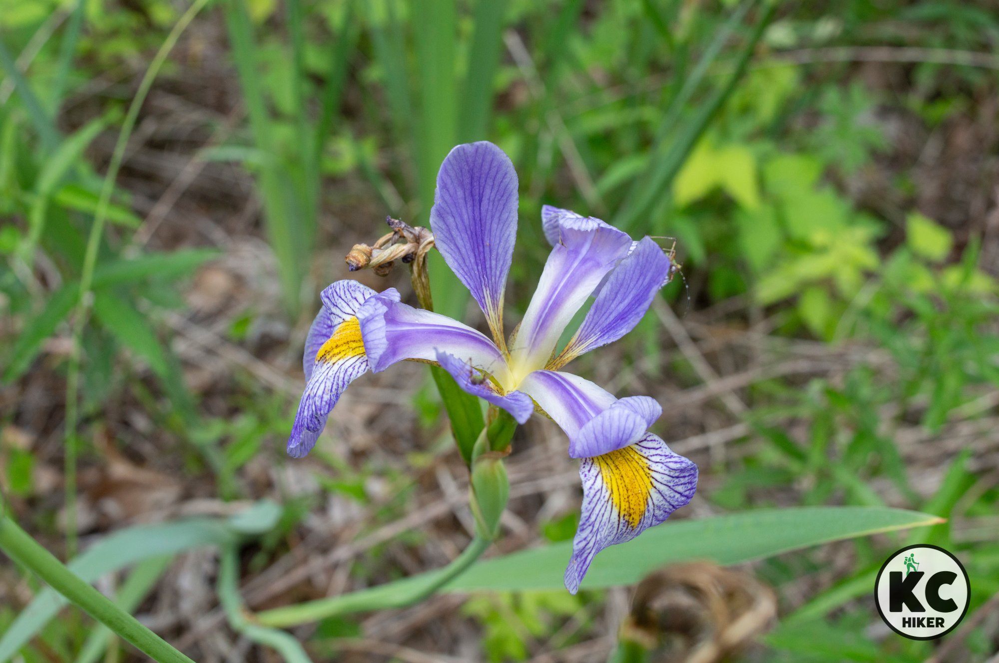
Little Bean Marsh Conservation Area preserves some of the native bottomland forest habitat noted by explorers Lewis and Clark. This includes wild iris.

A trail through Little Bean Marsh Conservation Area explores the thick bottomland forest habitat near the Missouri River.

Interurban and Linear Trails in Platte County
Take an urban walk through Riverside, past the Briarcliff Waterfall, and view Kansas City’s skyline in Kansas City’s Northland. The Interurban and Linear trails traverse a scenic section of urban Platte County. It’s busy but still beautiful.

Briarcliff Waterfall in Riverside, Mo., Platte County.
Take an urban walk through Riverside, past the Briarcliff Waterfall, and view Kansas City’s skyline.
Trail Interurban & Linear Trails
Overview
The Interurban and Linear trails traverse a scenic section of urban Platte County. It’s busy but still beautiful. The trailhead is in a park-like setting in Riverside. From there, the trail cuts through a neighborhood before switching to a sidewalk along N.W. Platte Road (see our map). You could turn around at the end, but what’s the fun in that? We have mapped a loop that takes you through Charles A. Garney Park, then through a neighborhood on a bluff before returning you to the trailhead.
Length About 2 miles
Address and location The trailhead is an extra-large cul-de-sac where you can park on the street. Take Vivian Road, then turn south on N.W. St. Joe Boulevard to reach the trailhead parking.
Conditions This is a paved trail, for the most part. More than half of it doubles as a sidewalk. There are very few markers, so you’re best using the map on this page or navigating with a map app. Most of the route is moderately hilly, with one steep hill (on a sidewalk).
Kid friendly? The paved trail is a hilly walk on a hard surface. There is busy motorist traffic along the route, so children will need to be shepherded away from streetsides. Kids will enjoy the lake, waterfall and fountains along the route, but parents should be mindful of water safety.
How busy? This is a moderately-trafficked trail in a somewhat congested area.
Pets Yes, on a leash (unless otherwise designated).
Bikes Non-motorized bicycles are permitted.
Restrooms There are no official restrooms associated with this trail, but it passes through retail areas that offer public accessiblity.

Charles A. Garney Park

Briarcliff Waterfall, Riverside, Mo.

Charles A. Garney Park

Briarcliff Waterfall Park
Map to Riverside trailhead and street parking
Amity Woods Nature Park: A quiet refuge in KC’s Northland
Amity Woods Nature Park, in Platte County, Mo., is home to a 1-mile out-and-back trail that also includes a few side loops. A clear stream meanders through this quiet, heavily forested park. A parking lot provides access at the trailhead. The stream and rocky outcroppings are accessible from the trail.

Amity Woods Nature Park, Platte County, Mo.
This one-mile out-and-back trail is cloaked in forest and intersects a rocky stream.
Trail Amity Woods Nature Park and Trail
Overview
Amity Woods Nature Park, in Platte County, Mo., is home to a 1-mile out-and-back trail that also includes a few side loops. A clear stream meanders through this quiet, heavily forested park. A parking lot provides access at the trailhead. The stream and rocky outcroppings are accessible from the trail.
Length 1 mile out-and-back (for a total of 2 miles)
Address and location
MO-152 & North Amity Avenue, Kansas City, Mo., 64153
Conditions This is a paved trail with few dirt/wood chip side trails.
Kid friendly? The paved trail is excellent for strollers and children on small bikes. Kids will enjoy playing in the creek.
How busy? This is a moderately-trafficked trail.
Pets Yes, on a leash (unless otherwise designated).
Bikes Non-motorized bicycles are permitted.
Restrooms None


Nature in the Northland: Prairie Creek Greenway
In the “far north” of the Kansas City area, near Platte City and KCI Airport, is the little known Prairie Creek Greenway Trail. Part wild and part backyard, this paved trail follows its namesake stream through wooded and pastoral areas. A highlight is Prairie Creek Falls (nothing like Niagara, but impressive for Kansas Citians). You can begin at the north our south trailhead.

Prairie Creek Greenway Trail
Seven pedestrian bridges and a waterfall are highlights of this 6-mile trail near Platte City, Mo.
Trail Prairie Creek Greenway Trail
Overview
In the “far north” of the Kansas City area, near Platte City and KCI Airport, is Prairie Creek Greenway Trail. Part wild and part backyard, this paved trail follows its namesake stream through wooded and pastoral areas. A highlight is Prairie Creek Falls (nothing like Niagara, but impressive for Kansas Citians). In summer and spring, this trail is flanked by legions of wildflowers. You can begin at the north or south trailhead. Topography is gently rolling to level, with a steep upward grade near the northern trailhead. The trail is mostly exposed to the sun, with a few shaded groves.
Length 6.75 miles total, including neighborhood offramps.
Address and location There are several access points, but the main trailheads with parking are at:
Sycamore Drive, Platte City, Mo. 64079 This is in a residential area, but has a designated parking area (see map below).
North Highway (N Highway), Platte City, Mo. 64079 There is a designated parking area (see map below).
Conditions This is a paved trail with few elevation changes. Be prepared for extensive unshaded areas.
Kid friendly? The trail is excellent for strollers and children on small bikes. Parents should be mindful of passing bikers.
How busy? This is a moderately-trafficked trail.
Pets Yes, on a leash (unless otherwise designated).
Bikes Non-motorized bicycles are permitted.
Restrooms Don’t count on it, but there is usually a portable toilet at the southern trailhead off of N Highway.


North Trailhead, Prairie Creek Greenway Trail
South Trailhead, Prairie Creek Greenway Trail

Experience falls and forest on the Northland’s Line Creek Trail
The Line Creek Trail is a paved, easily accessible trail winding through a busy section of suburban Platte County. It begins just north of Barry Road in Kansas City and continues south to Homestead Park in Riverside. This streamway trail weaves in and out wooded areas and across footbridges, paralleling Line Creek for its entire length.

Line Creek Trail, Platte County, Mo.
Enjoy 8 miles of wooded paths and streams in the midst of a busy Northland area.
Trail Line Creek Trail
Overview
The Line Creek Trail is a paved, easily accessible trail winding through a busy section of suburban Platte County. It begins just north of Barry Road in Kansas City and continues south to Homestead Park in Riverside. This streamway trail weaves in and out wooded areas and across footbridges, paralleling Line Creek for its entire length. There are two large waterfalls and several smaller falls. This extensive greenway has attracted wildlife, waterfowl and numerous songbirds., so be on the lookout for discoveries. The Line Creek Trail is one of the premiere hiking destinations in the Kansas City area.Double Waterfall The quickest access to this waterfall and cascades is to enter at the Community Center trailhead (see below), then head south about one-half mile.
Triple Waterfall Begin at the Community Center trailhead (see below) and walk about one mile north to reach the falls.
Length 8.25 miles each way.
Address and location Trail heads are at:
Renner Brenner Park, 2901 NW Vivion Road, Riverside, Mo., 64150
Homestead Park, 4803 NW Homestead Road, Riverside, Mo., 64150
Kansas City Northern Miniature Railroad, 6060 NW Waukomis Drive, Kansas City, Mo., 64151
Line Creek Community Center, 5940 N.W. Waukomis Drive, Kansas City, Mo., 64151
Conditions This trail is paved and easy to access. There are minor-moderate elevation changes.
Kid friendly? The trail is excellent for strollers and children on small bikes. Parents should be mindful of passing bikers.
How busy? This is a moderate-to-high traffic trail.
Pets Yes, on a leash (unless otherwise designated).
Bikes Non-motorized bicycles are permitted.
Restrooms Although there are some restrooms in the vicinity of the trail, it quickly becomes remote, with facilities out of reach.


Tower above the Missouri River at Weston Bend State Park
Weston Bend State Park and the adjacent bluffs trail are among the most scenic in the Kansas City area. The 1,100-acre park is centered on the 250-foot bluffs that tower over the Missouri River. Guests can explore the ridges, valleys and rocky terrain to their hearts’ content. The park also contains lowland trails that explore the bottomland forest along the shore of the Missouri River.

Weston Bend State Park and Weston Bluffs Trail, Weston, Mo., Platte County
Epic trails follow the voyage of Lewis and Clark and explore the bluffs and bottomland of this historic area.
Trail Weston Bend State Park trails and Weston Bluffs Trail
Overview
Weston Bend State Park and the adjacent bluffs trail are among the most scenic walking paths in the Kansas City area. The 1,100-acre park is centered on the 250-foot bluffs that tower over the Missouri River. Guests can explore the ridges, valleys and rocky terrain to their hearts’ content. The park also contains lowland trails that explore the bottomland forest along the shore of the Missouri River. The “bend” in Weston Bend refers to a change in the river’s direction. The high vantage points and river access provide excellent opportunities to view eagles, waterfowl and other birds of prey. The area is also rich in history, with Lewis and Clark passing here in 1804.There are six trails inside the park, featuring a total of 8 miles on a combination of paved and natural surface walkways.
The Weston Bluffs Trail begins east of the park, passes through it and ends in downtown Weston, Mo. It’s a 3.25-mile gravel trail that follows close to the shore of the river but is high enough to offer scenic views. You can make a full day experience by walking the Weston Bluffs Trail, exploring the park, shopping and eating in downtown Weston, then walking back. The town was established in 1837 and is home to many historic houses and buildings. The downtown area hosts eclectic shops and restaurants.
Length The Weston Bluffs Trail is 3.25 miles one way; Weston Bend State Park includes 8 miles of trails.
Address and location
The Weston Bluffs Trail parking is at the intersection of Highway 45 and Beverly Drive in Weston/Platte County, Mo. (see the maps below)
Weston Bend State Park is located at 16600 MO-45, Weston, Mo., 64098
Conditions The Weston Bluffs Trail is gravel and experiences only moderate elevation changes. Weston Bend State Park has a variety of trail surfaces, from paved to dirt. Difficulty levels range from high to easy.
Kid friendly? Parents can push a stroller along the Weston Bluffs Trail and the paved trail in the state park. Some park trails follow ridges and include sheer drops, so parental oversight needs to be exercised.
How busy? This trail can be heavily trafficked during peak days, hours and seasons.
Pets Yes, on a leash (unless otherwise designated).
Bikes Non-motorized bicycles are permitted on the Weston Bluffs Trail and the designated bicycle trail in the state park.
Restrooms There are public restrooms in Weston Bend State Park; however, they are not easily accessed from the Weston Bluffs Trail. Restroom access can also be found in the town of Weston.


State Park location
Weston Bluffs Trail Parking Lot

Follow the water on the Missouri Riverfront Trail
The Missouri Riverfront Trail extends 4.8 miles from E.H. Young Park in Riverside to its western trail head at English Landing Park in Parkville. E.H. Young Park provides scenic river views and ample parking to begin your journey west. Follow the sidewalks past Argosy Casino and join the trail as it passes under U.S. 69. From there, it follows the top of the Missouri River levy, providing views of the river, bottomland forest and pastoral beauty. It eventually descends the levy to parallel the river until it connects to English Landing Park.

Missouri Riverfront Trail, Riverside, Mo., Platte County
Hike or bike alongside the Missouri River from Parkville to Riverside, Mo.
Hike atop the levy from Riverside to Parkville
Trail Missouri Riverfront Trail
Overview
The Missouri Riverfront Trail extends 4.8 miles from E.H. Young Park in Riverside to its western trail head at English Landing Park in Parkville. E.H. Young Park provides scenic river views and ample parking to begin your journey west. Follow the sidewalks past Argosy Casino and join the trail as it passes under U.S. 69. From there, it follows the top of the Missouri River levy, providing views of the river, bottomland forest and pastoral beauty. It eventually descends the levy to parallel the river, connecting to English Landing Park.Length 4.8 miles, one way.
Address and location The trail begins in Riverside, Mo., and can be accessed at:
E.H. Young Park, 1001 Argosy Pkwy, Riverside, Mo., 64150
The traffic circle at the intersection of Horizons Parkway and Argosy Casino Parkway, Riverside, Mo.
Trail head parking at the intersection of Highway 9 and NW River Park Drive, Riverside, Mo., 64150
English Landing Park (east end), 8701 McAfee St, Parkville, Mo., 64152
Conditions This trail begins as concrete, switches to gravel and then changes to asphalt. There is little shade, so keep the heat in mind and stay hydrated. If you want to stick to a short, paved trail with facilities, you can confine your walking to E.H. Young Park or visit English Landing, which includes several miles of loops.
Kid friendly? E.H. Young Park is the eastern trail head and provides a playground and safe areas to view the Missouri River. The Riverfront Trail is lengthy and is mostly confined to a gravel surface on top of the levy, so it’s not optimal for small children and strollers. However, kids who want to hike or bike can thrive on the trail. There are extensive play areas on the west side at English Landing.
How busy? This trail is long and ventures into remote areas so traffic is minimal on most of the trail. However, English Landing, which is the trail’s western terminus, is highly trafficked.
Pets Yes, on a leash (unless otherwise designated).
Bikes Non-motorized bicycles are permitted.
The are restrooms at the east trailhead (E.H. Young Park) and west trailhead (English Landing Park).


Map to E.H. Young Park trailhead, Riverside, Mo.

English Landing Park and Platte Landing Park
English Landing Park and Platte Landing Park are arguably the most picturesque riverfront area in Greater Kansas City. The parks are adjacent to each other. An easy, crushed gravel path follows the Missouri River and loops the perimeter of both parks, which are adjacent to historic downtown Parkville. There is ample shade and there are play areas for children at English Landing. In addition, this trail connects with the 6-mile Missouri Riverfront Trail, allowing you to create a hike or bike trip of more than 15 miles.

English Landing and Platte Landing parks and riverfront trails, Parkville, Mo., Platte County
Take in the Mighty Missouri in Parkville.
Trail English Landing Park & Platte Landing Park
Overview
English Landing Park and Platte Landing Park are arguably the most picturesque riverfront area in Greater Kansas City. The parks are adjacent to each other. An easy, crushed gravel path follows the Missouri River and loops the perimeter of both parks, which are adjacent to historic downtown Parkville. There is ample shade and there are play areas for children at English Landing. In addition, this trail connects with the 6-mile Missouri Riverfront Trail, allowing you to create a hike or bike trip of more than 15 miles.Extras Downtown Parkville, and nearby Park University, are charming and worth a visit.
Length There are five miles of total trails. Platte County Parks has designed a 5K and 10K running path and the map is featured below.
Address and location 8701 McAfee St, Parkville, Mo., 64152
Conditions This trail is beautifully maintained and suitable for all purposes.
Kid friendly? The park has numerous play opportunities for children. Parents should be mindful of bicycle traffic and teach children to have a healthy respect for the Missouri River (don’t fall in).
How busy? This is a popular park and can be heavily trafficked during peak days and hours.
Pets Yes, on a leash (unless otherwise designated).
Bikes Non-motorized bicycles are permitted.
Restrooms Public restrooms are available


Parkville Nature Sanctuary: A jewel in KC’s Northland
Parkville Nature Sanctuary and White Alloe Creek Conservation Area are one of the Kansas City area’s most scenic natural areas. Well-marked dirt trails lead past streams, waterfalls, limestone outcroppings and wooded bluffs in Platte County, Mo. Experience about four miles of trails in this wooded refuge in the area’s Northland.

Parkville Nature Sanctuary and White Alloe Creek Conservation Area, Parkville, Mo., Platte County
Wooded bluffs, rocky ledges and clear streams are preserved in the sanctuary and White Alloe Creek Conservation Area.
Trail Parkville Nature Sanctuary and White Alloe Creek Conservation Area
Overview
Driving through downtown Parkville, many motorists aren’t aware that a nature sanctuary is only moments away. Beyond the bustling suburbs, about 180 acres are preserved in amid hills, woods and rushing streams. Parkville Nature Sanctuary and White Alloe Creek Conservation Area are two distinct entities, but there is no practical separation. They blend seamlessly together in one of the Kansas City area’s most scenic natural areas. Well-marked dirt trails lead past waterfalls, limestone outcroppings and wooded bluffs. The topography includes low-lying wetlands and steep, rocky hills, making for a diverse outdoor experience.Length There are about 4 miles of total trails.
Address and location 100-198 E 12 St, Parkville, Mo., 64152
Conditions This is a well-marked and maintained, dirt track trail with minor-moderate elevation changes.
Kid friendly? Pushing a stroller on this trail will be challenging but not impossible. This area is ideal for children who want to splash in streams and have a hands-on experience with nature.
How busy? This is a popular trail and can be heavily trafficked on peak days/seasons.
Pets Prohibited.
Bikes Prohibited.
Restrooms A restroom is located at the south end of the 12th Street parking lot.
Official Websites


Clear your head in the Green Hills of Platte
The Green Hills of Platte Preserve is a 48-acre island of nature in the midst of a busy Northland suburb. This heavily-forested park is dissected by wide gravel and dirt trails. When leaves have fallen, it provides views of the Missouri River Valley, which is about 150 feet below. Wildflowers are abundant in season.

Green Hills of Platte Wildlife Preserve, Parkville, Mo., Platte County
Explore 48 acres of dense forest in the midst of neighborhoods and industry at the Green Hills of Platte Wildlife Preserve.
Trail Green Hills of Platte Wildlife Preserve
Overview
The Green Hills of Platte Preserve is a 48-acre island of nature in the midst of a busy Northland suburb. This heavily-forested park is dissected by wide gravel and dirt trails. When leaves have fallen, it provides views of the Missouri River Valley, which is about 150 feet below. Wildflowers are abundant in season. It’s a great place for a break and clearing your mind.Length 1 mile.
Address and location 4730 N Green Hills Rd, Parkville, Mo., 64152
Conditions This is an easy-to-follow gravel and mulch trail. However, it has a steep elevation gain of about 70 feet.
Kid friendly? Children will enjoy playing and exploring in this park, but pushing a stroller would prove a challenge.
How busy? This park is low to moderately trafficked.
Pets Yes, on a leash.
Bikes Non-motorized bicycles are permitted.
Restrooms None