Find Respite at Lake Remote Park and Nature Area
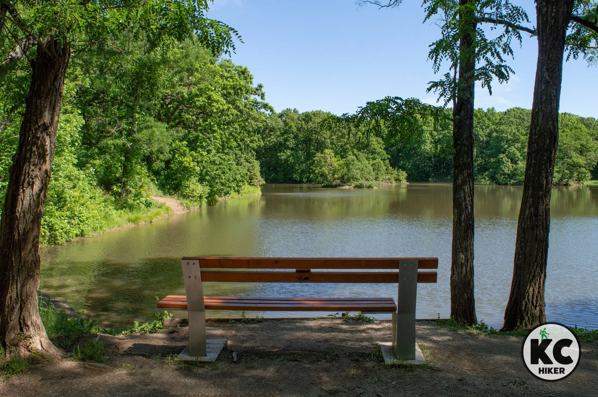
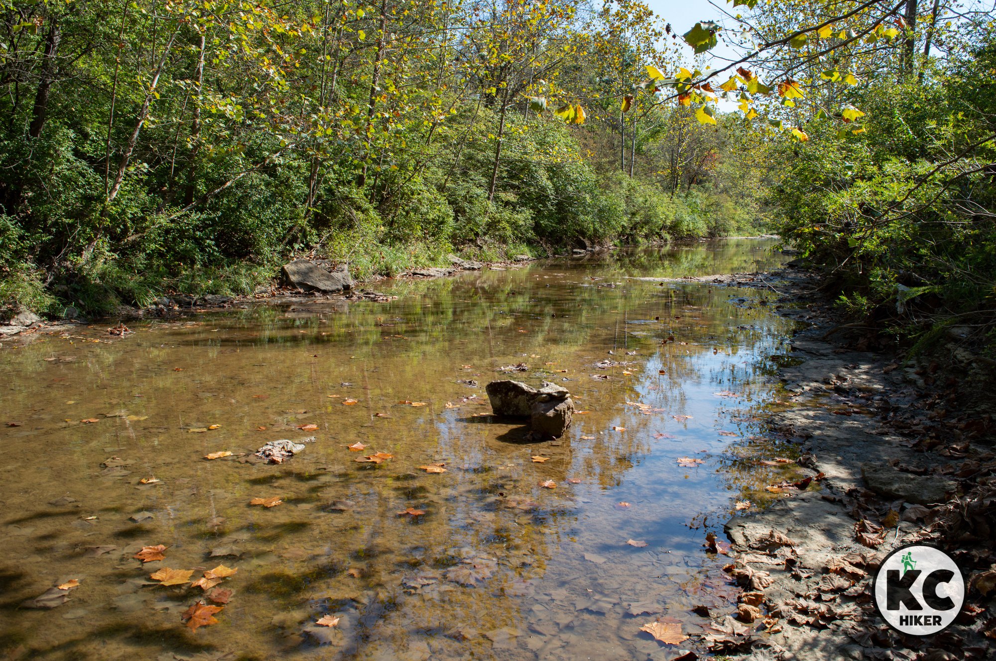
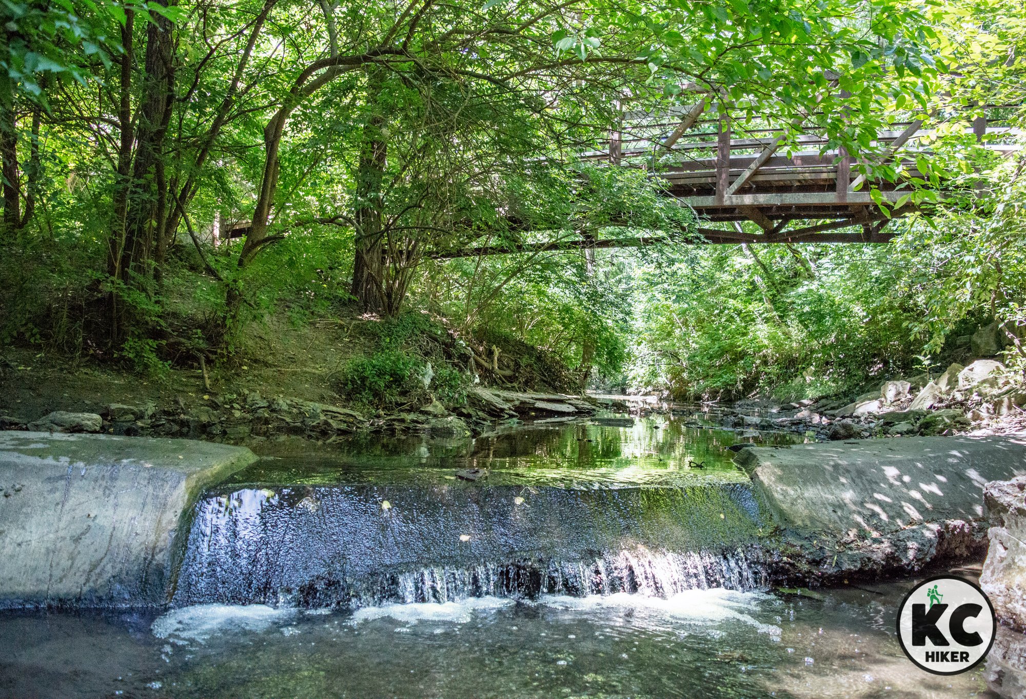
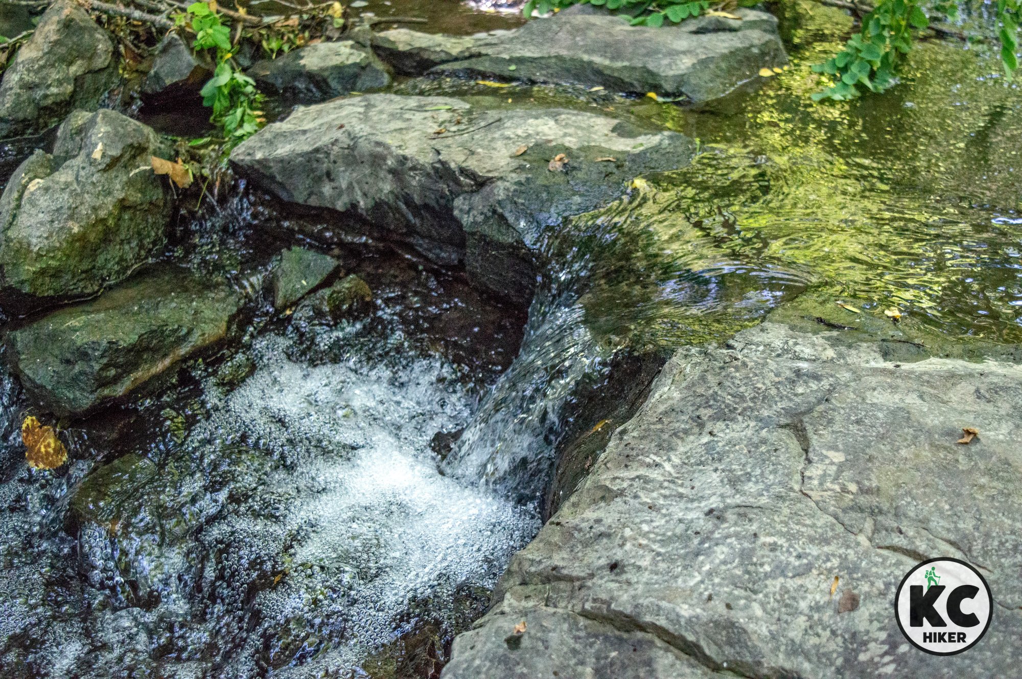
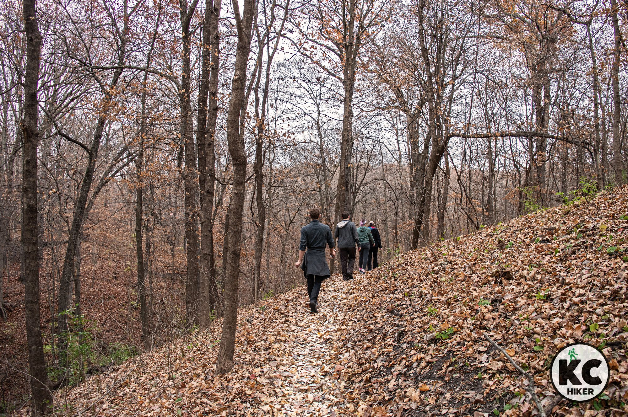
Lake Remote Park and Nature Area is located below the Smithville Lake dam and is out of sight of the reservoir. Several miles of looping trails explore a quiet wooded enclave that surrounds Lake Remote. There is a mix of gravel, grass and natural surface trails. The park is characterized by gently rolling, forested terrain typical of northwest Missouri. It’s a quiet retreat that can encompass a few minutes or several hours.

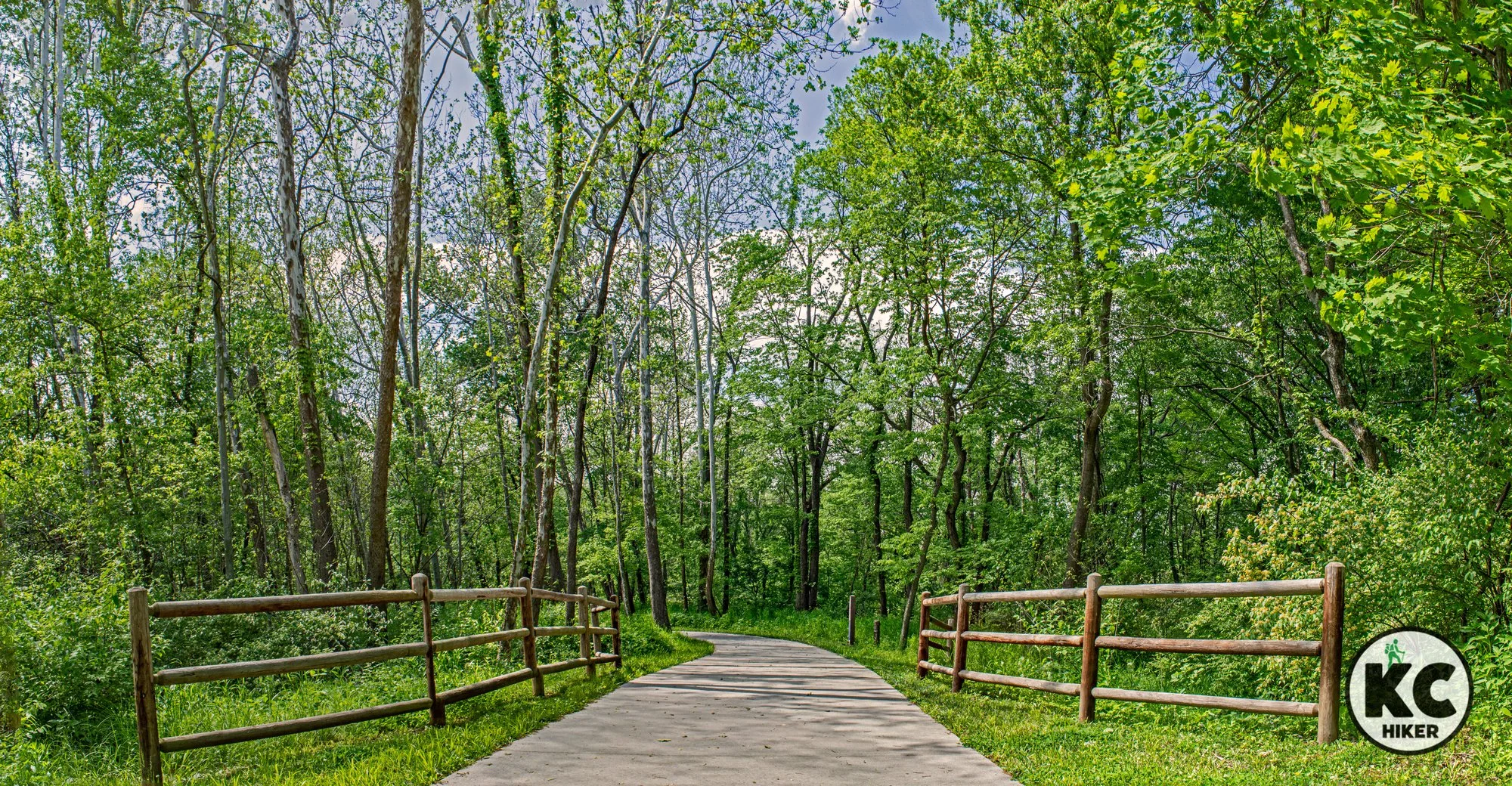
Lake Remote Park and Nature Area at Smithville Lake
This multi-use trail exists apart from the trails that surround Smithville Lake Reservoir. It explores a wooded enclave below the dam.
Trail Lake Remote Park and Nature Area at Smithville Lake.
Overview Smithville Lake is renowned for more than 50 miles of trails for walking, biking and horseback riding. All of these trails explore the area along the lakeshore or in its immediate proximity. But there’s one exception: Lake Remote Park and Nature Area is located below the dam and out of sight of the reservoir. Several miles of looping trails explore a quiet wooded enclave that surrounds Lake Remote. There is a mix of gravel, grass and natural surface trails. The park is characterized by gently rolling, forested terrain typical of northwest Missouri. It’s a quiet retreat that can encompass a few minutes or several hours.
Conditions These trails are generally well marked but can be extremely slippery and muddy. The park is characterized by minor-moderate elevation changes.
Kid friendly? Parents need to be mindful of water safety around Lake Remote. These trails would be difficult for a stroller.
How busy? This trail is moderately-lightly trafficked.
Pets Yes, unless stated otherwise.
Bikes Yes
Restrooms are available south of the trailhead at the Smith’s Fork playground. However, accessibility may be seasonal.


This Northland refuge preserves old-growth forest in Greater KC
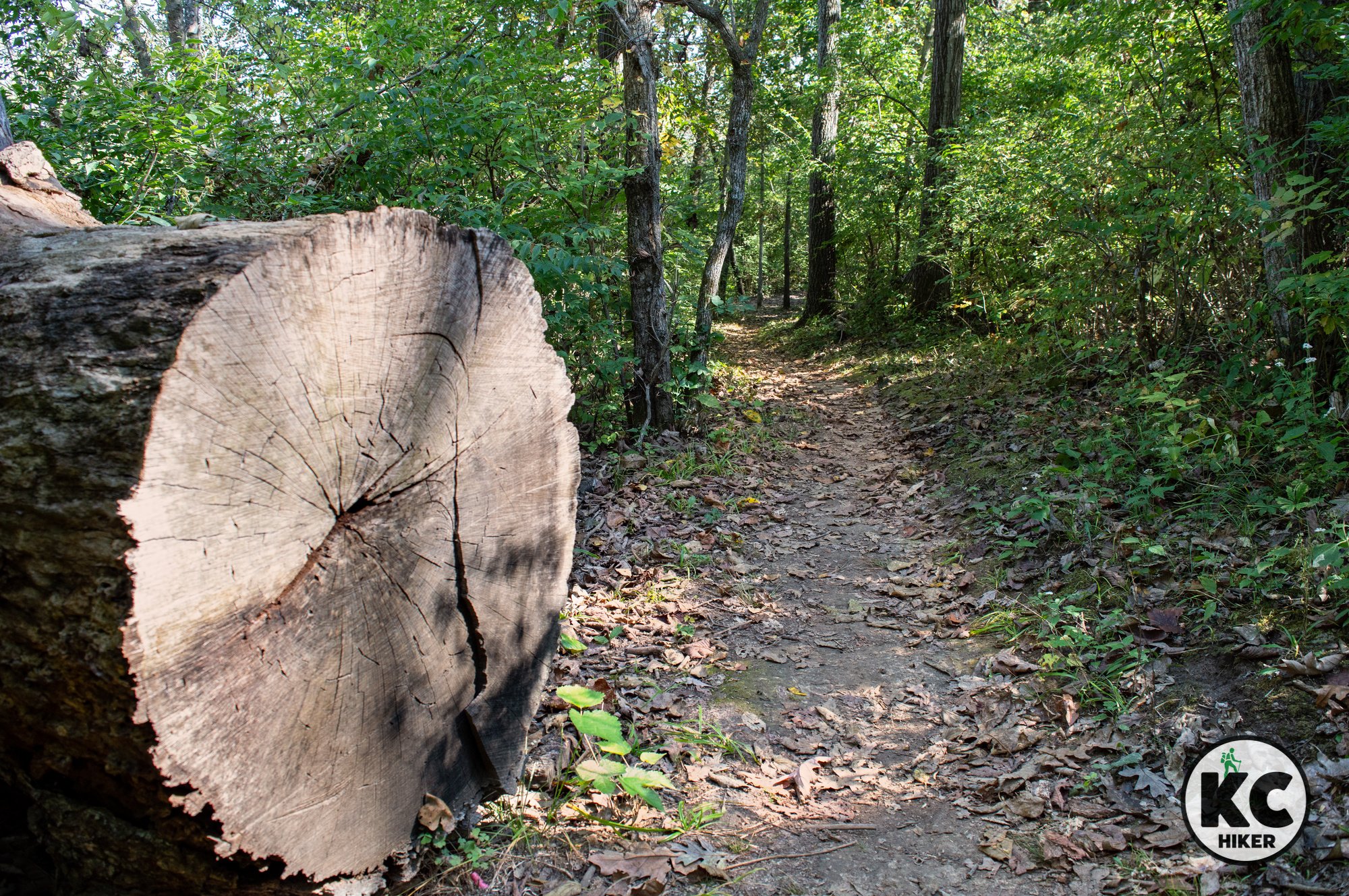
Trice-Dedman Memorial Wildlife Area, in Clinton County, preserves one of the few remaining stands of old growth forest in northwest Missouri. A one-mile, natural surface loop explores this unique environment.

Trice-Dedman Memorial Woods in Clinton County, Mo.
This 60-acre tract, owned by The Nature Conservancy, is a last stand of original woodland in northwest Missouri.
Trail Oak Leaf Trail at Trice-Dedman Memorial Woods
Overview
In Kansas City, and much of the Midwest, we’re grateful for even a few acres of woods. It’s where kids play in the creek and we might spot a deer or hear the “hoot” of an owl.Beyond these patches, it’s hard to find extended forested areas in the Kansas City metro. Much of it has met the fate of the bulldozer and, before that, the plow or the farmer clearing land for grazing.
The wooded areas that exist are often a new generation of trees that has sprung up upon vacant fields or abandoned industrial areas. These “start from scratch” forests are often dominated by oaks, cedars and cottonwoods and lack the biodiversity of the original environment. They’re often called “scrub forest.”
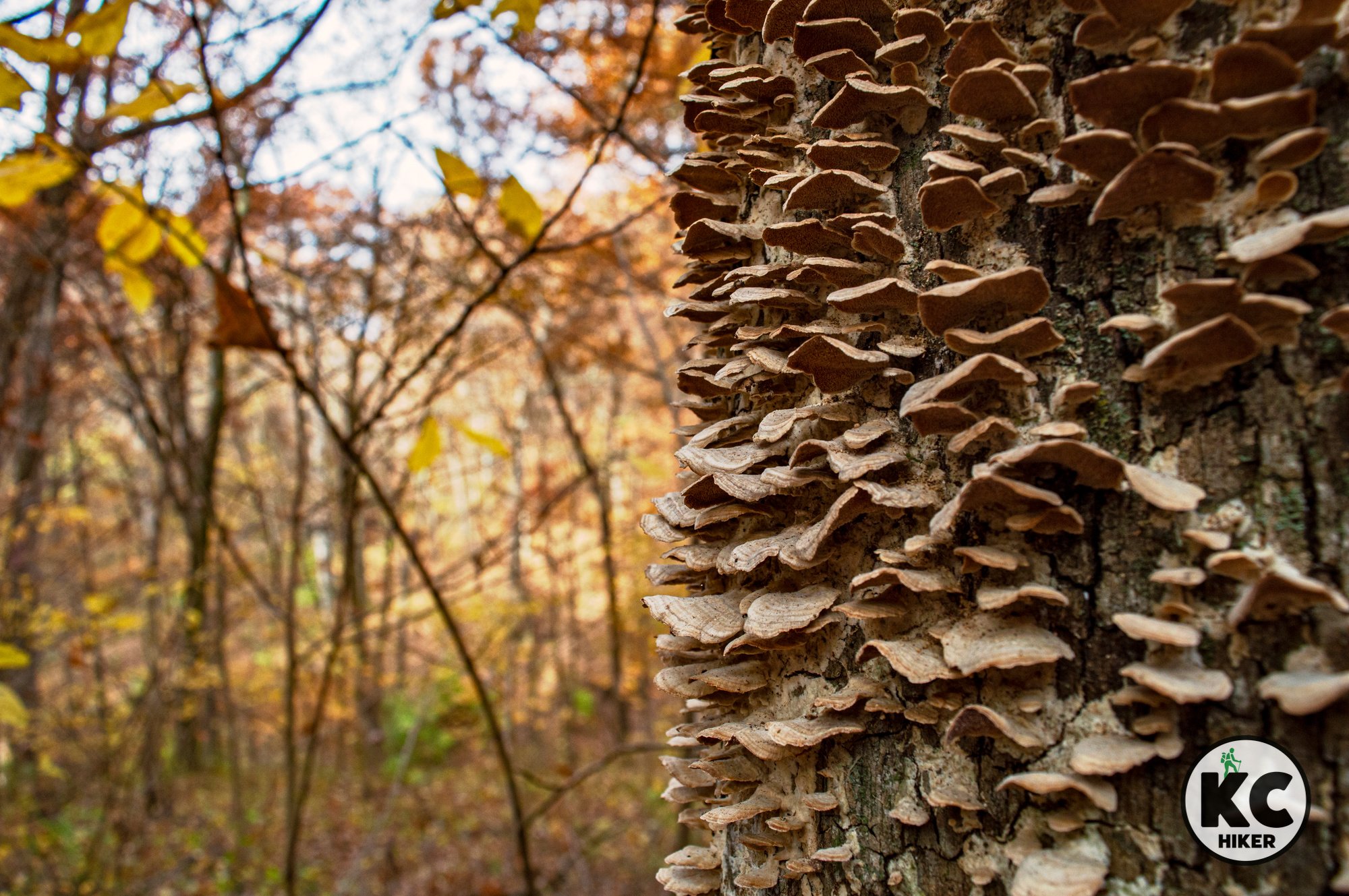
But in a little corner of Kansas City’s north, a pocket of old growth forest remains. About 60 acres comprise Trice-Dedman Memorial Woods in Clinton County (north of Kearney, Mo.). Some of the trees here range from 160-180 years old. As you walk through this grove, there is indeed something different. There’s an absence of invasive species (no honeysuckle!), space between trees and room for the sunlight to penetrate to the forest floor. This property is owned by The Nature Conservancy and is a partnership between it, Missouri Parks and the Department of Natural Resources.
The Nature Conservancy has identified 200 native species in the area, which is known for its spring wildflowers. It’s also a premiere place to spot birds and other wildlife.
An early resident named Tomas Dockery wrote about what northwestern Missouri – including this area – was like in 1855: "For the timbered portions of the county, there was absolutely no brush. The trees were very massive and the ground underneath was covered with prairie grass. The massive trees, the prairie flowers and grass all combined to make this a truly beautiful and inviting country."
At Trice-Dedman Memorial Woods, it’s inviting you.
Length 1 mile loop.
Address and location Trice-Dedman Memorial Woods, 392 MO-116, Lathrop, Mo., 64465. Google Maps shows the trailhead as being on the south side of MO-116 – this is an error. The trailhead is on the north side. There is no parking lot, but there is a wide shoulder with enough room for about three vehicles. Look for this gate:

Conditions This natural surface trail is well marked and easy. There are some minor elevation changes. It can be slippery when wet.
Kid friendly? This is a short (one mile) trail with few safety concerns.
How busy? This trail is lightly trafficked.
Pets Yes, unless stated otherwise.
Bikes No.


Jackass Bend: Funny name, serious wildlands
Lewis and Clark rowed past this lowland forest reserve in 1804. Today it welcomes hardy visitors to explore its woods, clearings and Missouri River shoreline. Jackass Bend National Wildlife Refuge offers 861 acres of wildlands to explore. It’s part of the 20,000-acre Big Muddy National Wildlife Refuge.

Jackass Bend National Wildlife Refuge, Ray County, Mo.
Lewis and Clark rowed past this lowland forest reserve in 1804. Today it welcomes hardy visitors to explore its woods, clearings and Missouri River shoreline.
Trail Jackass Bend National Wildlife Refuge
Overview
Jackass Bend National Wildlife Refuge offers 861 acres of wildlands to explore. It’s part of the 20,000-acre Big Muddy National Wildlife Refuge, headquartered near Boonville, Mo. If you are looking for trails, or even service roads, you’ll be disappointed. If you are looking for quiet and a mostly undisturbed experience of riparian (bottomland) forest, you’ll be delighted.This section of the refuge came to be when the Flood of 1993 destroyed thousands of square miles of agricultural land along the Missouri River. When the floods receded, devastation appeared. But what was destructive for agriculture was a boon for nature. Left to itself, the bottomland has rapidly returned to its native state of Sycamores, Cottonwoods, Hickory and Maple trees. Ground cover is thick, including reeds, tall grasses and vines. With effort, you can reach the Missouri River and walk the rocky shoreline. There are also two oxbow lakes within the refuge, but their size is dependent on rainfall.
There are no maps, so you’ll need a navigation aid, whether it’s an old-fashioned compass or a phone app. Avoid tick season and aim for visiting this area after the first frost and before no-see-ums return in the spring. For the adventurous, you can boat or kayak to the refuge. (For those into details: It’s only two miles east of Clay County, so although it’s in Ray County, we’ll call it close enough to include in this listing.)
USA Today published a fascinating profile of the Big Muddy National Wildlife Refuge here.
Length No trails exist, but the entire area is free to explore.
Address and location Access Jackass Bend National Wildlife Refuge by taking Highway 210 to S. Union Road in Ray County (8446 S Union Rd, Orrick, Mo., 64077). Union, a gravel road, is a bit rough, but a four-wheel drive is not required. Here is a map showing the intersection that leads to the trailhead (go south one mile).
Conditions This area is only for those up for a challenge. There are minimal elevation changes (an occasional levy to walk up and down), but it’s 100% bushwhacking. There are no maps so you must be comfortable and capable of navigating with either a compass or map app. Wear long pants to protect yourself from scratching vines and bushes.
Kid friendly? This is only for the hardiest of kids.
How busy? You’re unlikely to see anyone. However, the area is subject to Missouri hunting seasons, so be aware of hunters and dress appropriately.
Pets Yes, unless stated otherwise.
Restrooms are not available.


Escape the Daily Grind on Big Shoal Greenway Trail
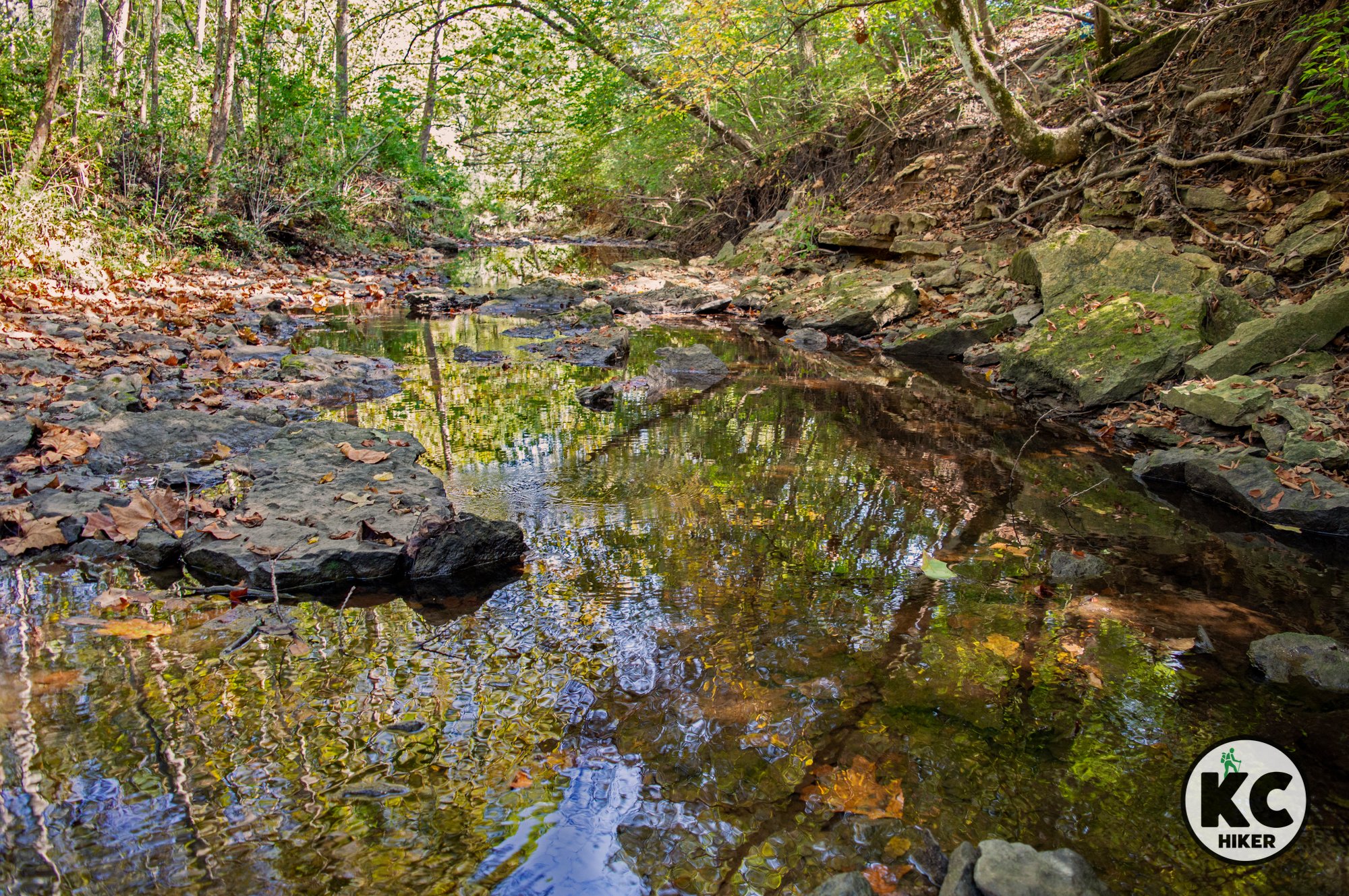
Big Shoal Creek Greenway zigs and zags for two miles under forest canopy in suburban Clay County. The paved trail is never far from a neighborhood, but the towering trees sometimes make the surrounding suburbs undetectable. Big Shoal Creek can be accessed at several points along the path. Along the stream (which can range from a trickle to flash flooding), cliffs and rocky pools are exposed. Big Shoal Creek Greenway is a respite from the bustling suburbs of Kansas City’s Northland.

Follow the path of Big Shoal Creek under giant sycamores and forest canopy in suburban Clay County.
Trail Shoal Creek Greenway Trail
Overview
Big Shoal Creek Greenway zigs and zags for two miles under forest canopy in suburban Clay County. The paved trail is never far from a neighborhood, but the towering trees sometimes make the surrounding suburbs undetectable. Big Shoal Creek can be accessed at several points along the path. Along the stream (which can range from a trickle to flash flooding), cliffs and rocky pools are exposed. Big Shoal Creek Greenway is a respite from the bustling suburbs of Kansas City’s Northland.
Length 2 miles out and back (for a total of four miles).
Address and location The main trailhead includes a parking lot and is located at 3324 N.E. 55th St., Kansas City, Mo., 64119. The trail can also be accessed at 5400 Chouteau Trafficway, but you’ll have to park in the commercial area because there is no dedicated trail parking. On the east side it can be accessed via N. Brighton Avenue, but there is no parking.
Conditions This trail is paved, easy to navigate and has minimal elevation changes.
Kid friendly? This is well-suited to bikes, strollers and walking children.
How busy? This trail is moderately trafficked.
Pets Yes, unless stated otherwise.
Bikes Yes.
Restrooms are not available along the trail.


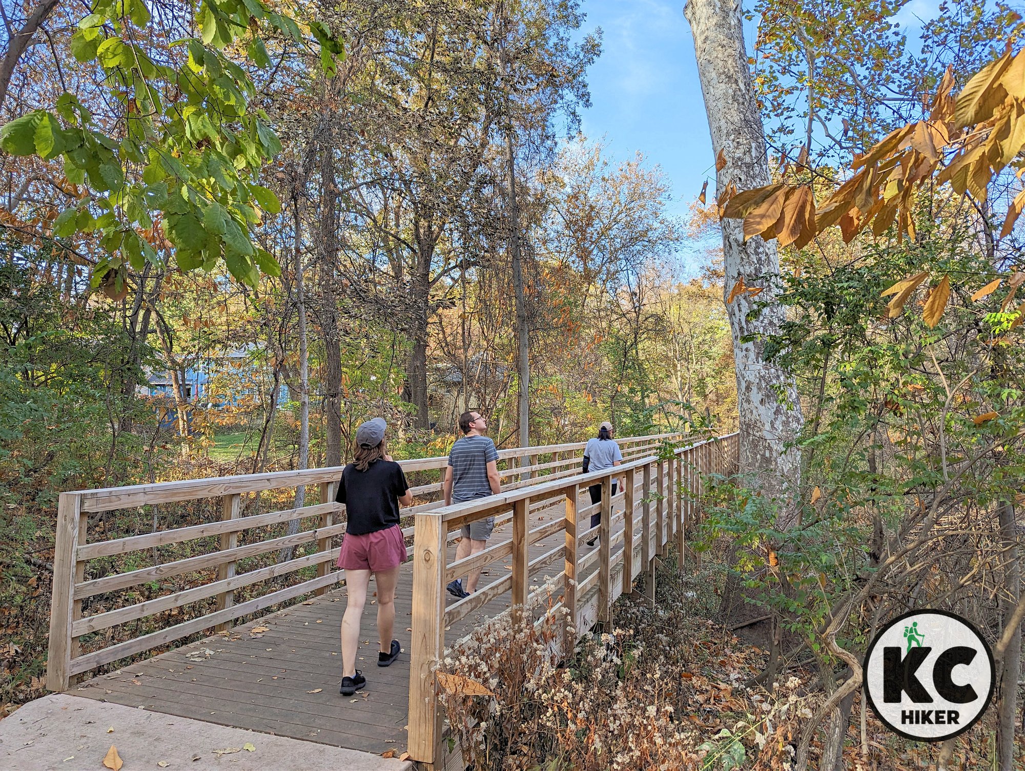
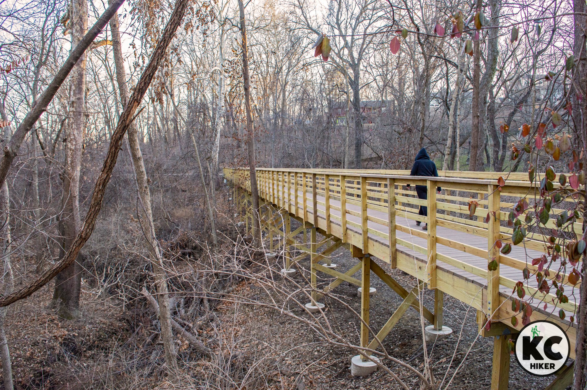
Boardwalks of Bliss: Briarcliff Greenway Trail
Briarcliff Greenway Trail isn’t lengthy – about one mile each way. But what it lacks in length it makes up for in uniqueness. This paved trail slices through a hilly and wooded area in Kansas City’s Northland. Its standout feature is the presence of multiple bridge boardwalks spanning the area’s many ravines and tributaries.

Multiple boardwalks span ravines in this forested Northland enclave.
Trail Briarcliff Greenway Trail
Overview
Briarcliff Greenway Trail isn’t lengthy – about one mile each way. But what it lacks in length it makes up for in uniqueness. This paved trail slices through a hilly and wooded area in Kansas City’s Northland. Its standout feature is the presence of multiple bridge boardwalks spanning the area’s many ravines and tributaries. The wooded area is nestled between neighborhoods that recede from view when leaves are in full bloom. Parking can be challenging, so please see the details below.A discussion of this trail would not be complete without mentioning its neighborhood: Briarcliff Hills. Briarcliff Road, which parallels the trail, is home to an eclectic neighborhood that rises 200 feet above the Missouri River and city below.
Bonus: There’s a Frank Lloyd Wright home, the Bott House, which can be seen from the road (it’s a private residence so please respect that). Any trip to the trail should include a drive or walk through this scenic enclave.
Length 2 miles (one mile out, one mile back).
Address and location There are no dedicated parking areas. The southern trailhead, on 37th Street, is a particularly bad (even dangerous because of low visibility and no shoulders) place to park. Because of this, we recommend:
Briarcliff Elementary School The trail can be accessed on the east and south sides of the school as you exit the parking lot. 4100 N. Briarcliff Road, Kansas City, Mo., 64116.
From 41st Terrace You can also park at the dead end of 41st Terrace.
Conditions This is a paved trail interspersed with wooden overpasses. There are a few optional exits, but it’s generally easy to follow.
Kid friendly? This trail is short and paved, well-suited to children.
How busy? This trail is moderately trafficked.
Pets Yes, unless stated otherwise.
Bikes Yes.
Restrooms are not available.


Map to Briarcliff Elementary School Trailheads

Shoal Creek Trail: A history-packed Northland walk
Shoal Creek Trail, in Clay County, runs north-south through Hodge Park. This paved trail is appropriate for everyone, gently weaving through the wooded landscape with minimal elevation changes. A bonus (including bonus mileage) is the 80-acre Shoal Creek Living History Museum.
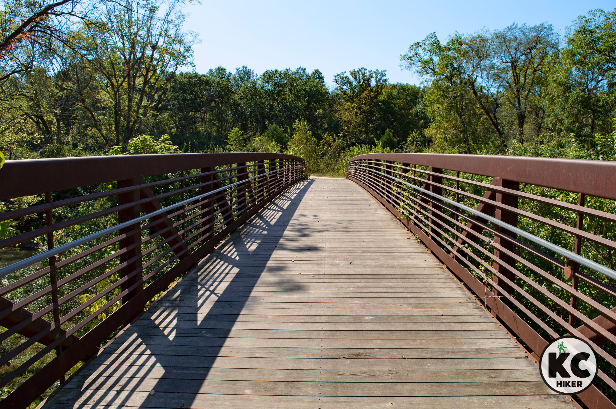
Shoal Creek Trail is a paved path traversing Hodge Park for about 1 mile, each way (two miles total).
Begin at Shoal Creek Living History Museum, then set out on a relaxing two-mile paved walk.
Trail Shoal Creek Trail
Overview
The paved Shoal Creek Trail runs north-south through 1,000-acre Hodge Park. It generally follows the course of the stream, which is rocky and crystalline. It’s a trail for everyone, gently weaving through the wooded landscape with minimal elevation changes.A bonus (including bonus mileage) is the 80-acre Shoal Creek Living History Museum. The “museum” (actually a park) re-creates an 1800s frontier Missouri village with 21 buildings and has a reserve that’s home to buffalo. The museum and the south trail head share the same parking lot at Hodge Park. The Shoal Creek Living History map and guide can be downloaded here (large file).
If you’re looking for more of a challenge, a 7-mile mountain bike trail also winds through the park.
Length 2 miles (one mile out, one mile back).
Address and location
South trailhead 7000 N.E. Barry Road, Kansas City, Mo., 64157. Begin at the Shoal Creek Living History Museum.
North trailhead 98 N.E. Reinking Road, Kansas City, Mo., 64157. Drive south to the end of the parking lot, then walk over the bridge.
Conditions This is a wide, paved trail perfect for any type of outdoor recreation. The Living History walking path is gravel. Elevation changes are moderate.
Kid friendly? This trail is stroller friendly. There are passing cyclists, so parents should be mindful of bike traffic.
How busy? This trail is moderately trafficked.
Pets Yes, unless stated otherwise.
Bikes Yes.
Restrooms are seasonally available.
Shoal Creek Trail Map
The solid green line, beginning near Hodge Park Rugby field, is the paved Shoal Creek Trail. The dotted lines are the Hodge Park mountain bike trail system.


Directions to the north trailhead of Shoal Creek Trail, Kansas City, Mo.

Explore Northland woods on 7 miles of trails at Hodge Park
A single-track trail winds through 1,000-acre Hodge Park, near Liberty. This area is characterized by gently rolling woodlands and quiet streams. Although the trail offers seven miles of loops and switchbacks, you can chart a course for however short or long you like.
Hodge Park mountain bike/hiking trail system in Kansas City North, Clay County.
A single-track trail winds through 1,000-acre Hodge Park, near Liberty.
Trail Hodge Park Trail System
Overview
There’s a lot going on at this massive Northland park, which is Kansas City’s second largest. That includes a golf course and sports fields, but in the background is a seven mile trail system that’s an escape from the urban hubbub. This area is characterized by gently rolling woodlands and quiet streams. Although the trail offers seven miles of loops and switchbacks, you can chart a course for however short or long you like. Hikers can begin at the southern end or the northern. The south trailhead is located at the Shoal Creek Living History Museum, an 1800s Midwestern village (with bison) created for education and recreation. The northern trailhead begins near sports fields. Unless you’re interested in seeing the village, the north trail head is easier to locate and the area is more scenic.
Nearby
In the same park you can hike a paved two-mile out-and-back that traverses the park north and south. Learn more about the Shoal Creek Trail here.
Length 7 miles.
Address and location
South trail head 7000 NE Barry Rd, Kansas City, Mo., 64157. Begin at the Shoal Creek Living History Museum.
North trail head 98 NE Reinking Rd, Kansas City, Mo., 64157. Drive south to the end of the parking lot, then walk over the bridge. From there, you can continue on a paved trail (Shoal Creek Trail) or the single-track Hodge Park trails.
Conditions These are well-marked, single track, natural surface trails. Be sure to get a map or use a trails app because it’s easy to get disoriented amid numerous loops. Elevation changes are minimal.
Kid friendly? This is an easy trail, with minimal elevation changes. Children will need to walk or be carried. Mountain bikers share this trail with walkers, so parents will need to be mindful of passing cyclists.
How busy? This trail is moderately trafficked.
Pets Yes, unless stated otherwise.
Bikes Yes.
Restrooms are open seasonally.


Find Solace at Martha Lafite Thompson Nature Sanctuary
Martha Lafite Thompson Nature Sanctuary is a gently rolling park in Clay County, Mo., that’s home to about 100 acres of restored prairie and lowland forest. Cutting through its center is Rush Creek, a broad stream that usually flows year round. A multitude of trails, both paved and natural surface, allow guests to explore the limits of the property.

Martha Lafite Thompson Nature Sanctuary, Liberty, Mo., Clay County
Martha Lafite Thompson Nature Sanctuary and Rush Creek Conservation Area provide a 100-acre preserve in the Northland.
Trail Martha Lafite Thompson Nature Sanctuary and Rush Creek Conservation Area
Overview
Martha Lafite Thompson Nature Sanctuary is a gently rolling park in Clay County, Mo., that’s home to about 100 acres of restored prairie and lowland forest. Cutting through its center is Rush Creek, a broad stream that usually flows year round. A multitude of trails, both paved and natural surface, allow guests to explore the limits of the property. The Martha Lafite Thompson Nature Sanctuary and Rush Creek Conservation Area are a public-private partnership. The sanctuary, which is about half of the 100 acres, is run by a nonprofit foundation. The conservation area belongs to the state of Missouri but is managed by the foundation. It’s generally opened from 8 a.m.-5 p.m., but be sure to check hours before you go. There is a visitors’ center, but hours are limited.
Length There are 12 trails – none of them long – that explore the park’s diverse environments. It’s an opportune location to introduce children to nature.
Address and location 407 N La Frenz Road, Liberty, Mo., 64068
Conditions Trails are both paved and natural-surface. Elevation changes are minor to moderate. Most trails are well-marked and easy to follow. Some of the natural surface trails and the park’s infrastructure are showing their age and are in decline. Some natural surface trails (at least on our visit) can be overgrown. However, the paved surface trails are clear and easy to navigate.
Kid friendly? The paved trails, of which there are several, are perfect for pushing a stroller and walking. Trails are relatively short and there are benches stationed throughout the park. Children will enjoy splashing in Rush Creek, but parents should be mindful of water safety.
How busy? This trail is moderately trafficked.
Pets Prohibited.
Bikes Prohibited.
Restrooms are available in the visitors center when it is open.


This Liberty trail cuts a verdant strip through the Northland
Westboro-Canterbury Greenway passes through wooded and open areas between quiet neighborhood streets. The north-south section of the trail follows a clear stream and includes several bridge overpasses. Additional features include picnic areas and playgrounds. The stream can be scenic, including small waterfalls. The wooded areas provide ample shade.

Westboro-Canterbury Greenway Trail, Liberty, Mo., in Clay County
Westboro-Canterbury Greenway winds and weaves through wooded subdivision and follows a clear stream.
Trail Westboro-Canterbury Greenway
Overview
Westboro-Canterbury Greenway passes through wooded and open areas between quiet neighborhood streets. The north-south section of the trail follows a clear stream and includes several bridge overpasses. Additional features include picnic areas and playgrounds. The stream can be scenic, including small waterfalls. The wooded areas provide ample shade.
Length 2 miles, one-way. If you walk all of the trail extensions it totals 3.1 miles.
Address and location There are several access points, with the main one at 1030 S. Withers Road, Liberty, Mo., 64068. That trail head features a parking lot. The trail can also be accessed at:
Buckingham Drive and South Wales Street (street parking)
Dunwich Drive and Downing Street (street parking)
Liberty Drive and Kingston Court (street parking)
1400 Canterbury Lane, Liberty, Mo., 64068 (street parking only).
Conditions This is a paved trail that’s easy to follow. Elevation changes are minimal. The area is low-lying, so standing water (or even flash flooding) can be an issue during heavy rain. Low-lying, wet areas also tend to foster mosquitos.
Kid friendly? This trail is perfect for pushing a stroller, riding a bike or strolling.
How busy? This trail is moderately trafficked.
Pets Yes, on a leash (unless otherwise designated).
Bikes Yes.
Restrooms are available at Westboro Canterbury Park during park hours.


Get Northland Natural: Stocksdale Park and Walnut Woods Conservation Area
In Liberty, Mo., Walnut Woods Conservation Area and Stocksdale Park combine to provide six miles of weaving, wooded natural surface trails. It’s a collective effort of the city of Liberty, the Missouri Department of Conservation and the Urban Trail Co., which built and maintains the trail (please follow its guidance regarding trail closures). This is a unique, natural environment where the woods are so dense that it’s difficult to see beyond the row of trees in front of you.

Stocksdale Park and Walnut Woods Conservation Area, Liberty, Mo., in Clay County
Explore dense forest on slightly rolling terrain in Clay County, Mo.
Trail Walnut Woods Conservation Area and Stocksdale Park Hiking/Biking Trails
Overview
In Liberty, Mo., Walnut Woods Conservation Area and Stocksdale Park combine to provide six miles of weaving, wooded natural surface trails. It’s a collective effort of the city of Liberty, the Missouri Department of Conservation and the Urban Trail Co., which built and maintains the trail (please follow its guidance regarding trail closures). This is a unique, natural environment where the woods are so dense that it’s difficult to see beyond the row of trees in front of you.
Length 6 miles
Address and location 901 S. La Frenz Rd, Liberty, Mo., 64068. Enter the trail system through Stocksdale Park. After parking, walk east to the trail head. The beginning of the trail shares space with a disc golf area.
Conditions These trails are hard-packed dirt, created for mountain bikers but also open for walkers and runners. These single-track trails are well marked and maintained. However, the trail system itself is complex, so you’ll need a map and compass or trail app to stay apprised of where you are. If it has recently rained or snowed, check the Urban Trail Co. website to make sure the trail is open.
Kid friendly? This is a narrow, single-track trail, so children will need to be able to walk themselves. There is plenty of nature at their fingertips. Parents will need to be mindful of passing cyclists.
How busy? This trail is moderately trafficked.
Pets Yes, on a leash (unless otherwise designated).
Bikes Yes.
Restrooms are available at Stocksdale Park.
Official Websites:


Walk This Multi-Park Trail Through Excelsior Springs
The Downtown Excelsior Springs Trail System is made up of three trails: Fishing River Linear Park Trail, Isley Park Woods Trail and Siloam Mountain Trail. These trails wind through the city and five parks: Paul Craig Park, Fishing River Linear Park, Isley Park Woods, East Valley Park and Siloam Mountain Park. The trails gave you a diverse experience combining Main Street USA, a riverside walk and a steep, forested ascent (or descent) of Siloam Mountain.

Excelsior Springs Siloam Mountain Trail and downtown trail loop, Clay County, Mo.
Visit this iconic town, walk the Fishing River and scale Siloam Mountain.
Trail The Downtown Excelsior Springs Trail System, including Siloam Mountain Trail.
Overview
Excelsior Springs is best known for its iconic The Elms Hotel and Spa, which dates to 1912. However, this northern Clay County town of 10,000 has other attractions. Our interest is in The Downtown Excelsior Springs Trail System. This walk is made up of three trails: Fishing River Linear Park Trail, Isley Park Woods Trail and Siloam Mountain Trail. These trails wind through the city and five parks: Paul Craig Park, Fishing River Linear Park, Isley Park Woods, East Valley Park and Siloam Mountain Park. The trails gave you a diverse experience combining Main Street USA, a riverside walk and a steep, forested ascent (or descent) of Siloam Mountain. Arguably, Siloam Mountain is the highlight, rising about 150 feet above the Fishing River at its base. Is it a mountain? We’ll leave that for the cartographers and geologists to hash out. Is it scenic? Definitely.
Length The combined length of the Downtown Excelsior Springs Trail System is about 2 miles.
Address and location You can enter the trail at any point along its route (see the map below), but the city recommends Jim E. Piburn Field, 112 S. Thompson Ave, Excelsior Springs, Mo., 64024. If you want to start at the top, you can park at Siloam Mountain Park. Navigate to the intersection of Ellsworth St. and Silvers Drive, Excelsior Springs, Mo., 64024.
Other area attractions The city is near Watkins Mill State Park, an excellent hiking destination in and of itself. Excelsior Springs is also near one of Kansas City’s most scenic waterfalls, Tryst Falls. And of course there’s eclectic and historic Downtown Excelsior Springs and the famous Elms Hotel and Spa.
Conditions The trails range from concrete to dirt, to boardwalks to woodchips. They are well marked, but you’ll be more likely to stay on course if you keep a map handy.
Kid friendly? A significant amount of this trail is accommodating to strollers, but there are portions where the grade is too steep and you may have to change your plans. If you stay in the downtown area, you’ll be fine. Since this is a populated area, parents will need to be mindful of their children when crossing streets.
How busy? These parks are in the heart of Excelsior Springs, so traffic can be moderate. But since the trail is two miles long, congestion is unlikely.
Pets Yes, on a leash (unless otherwise designated).
Bikes Yes.
Restrooms are available at Siloam Mountain Park. Portable toilets may be available elsewhere along the trail.


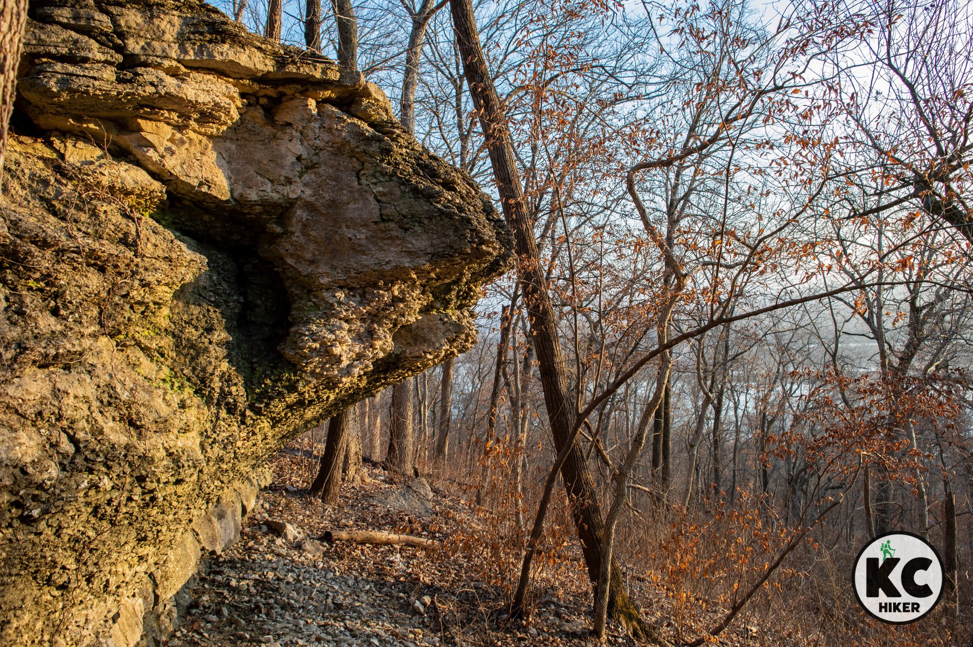
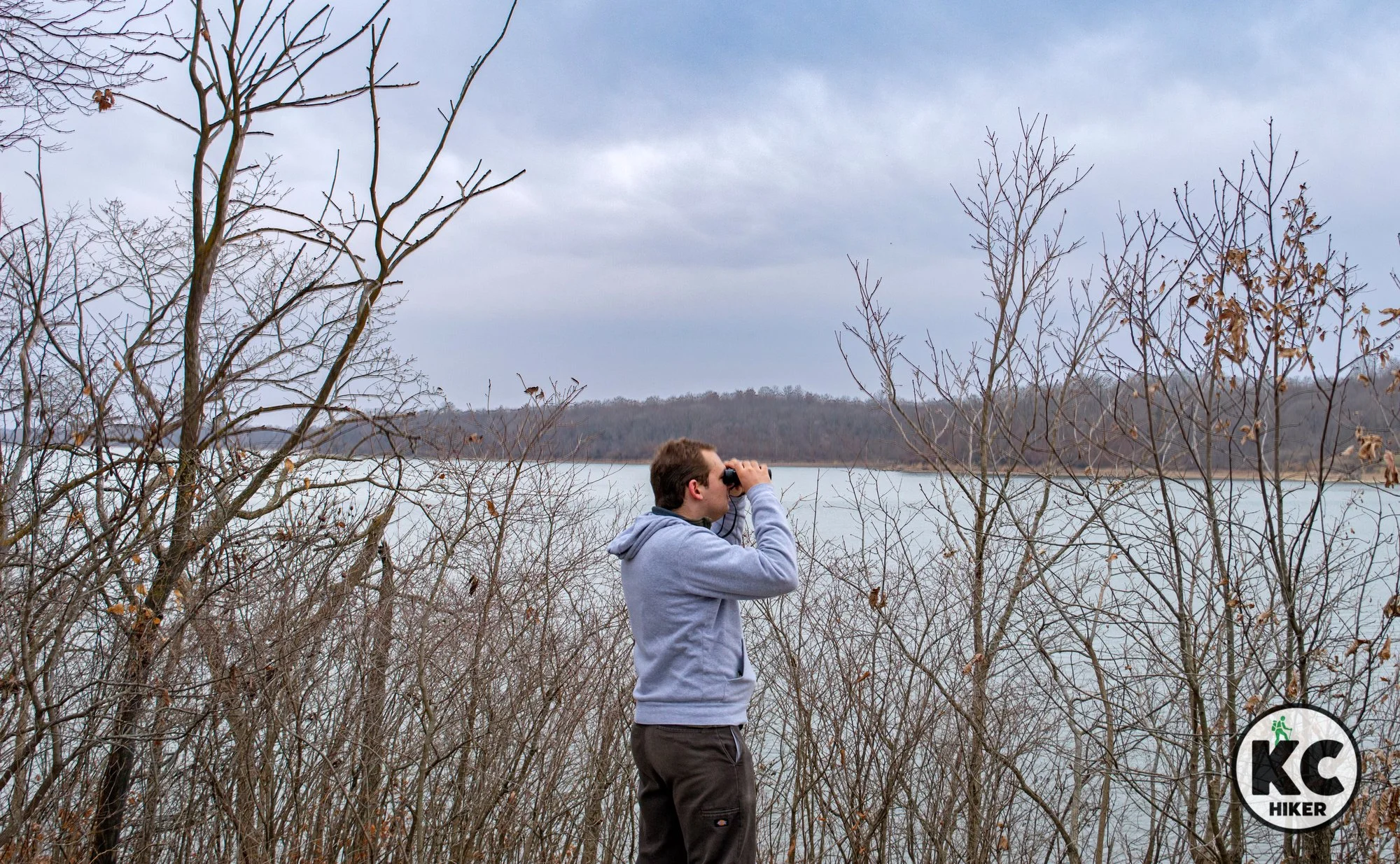
Cooley Lake Conservation Area: Rugged Bluffs and Serene Marshland
Hikers can enjoy Missouri River access, an oxbow lake and towering bluffs.

Cooley Lake Conservation Area, Clay County, Mo.
Hikers can enjoy Missouri River access, an oxbow lake and towering bluffs.
Trail Cooley Lake Conservation Area
Overview
Cooley Lake is named after a still-existing oxbow lake that broke off from the Missouri River. Part of the conservation area is north of Highway 210 and part is south. The southern portion provides about a half-mile of riverfront access. The northern side is where the trails are located. Hikers will experience diverse environments. In the lowlands you’ll find extensive marsh areas, including those surrounding Cooley Lake. Sometimes it’s more marsh than lake, but it’s a beautiful area regardless. The 1,345-acre reserve also includes some cropland. A highlight is the 200-foot bluffs that rise from the lake and overlook the Missouri River Valley. The bluffs are heavily forested and peppered with limestone outcroppings. An observation platform is located atop the bluffs. It can be reached by driving up Ridge Road. Trails are scenic but challenging to navigate. See our notes below on conditions.
Conservation area warning
It’s best to wear orange during major hunting seasons. It’s also recommended to stay on trails and avoid dawn and dusk.
Length The bottomland trail is approximately one mile out-and-back (two miles total). The ridge trail is approximately 1.5-miles out-and-back (three miles total).
Address and location The conservation area is two miles east of Missouri City on 210 Highway. The address is Cooley Lake Conservation Area, Excelsior Springs, Mo., 64024. If you need street coordinates, take 210 Highway to Boyer Road and turn north. You’ll immediately enter the area.
Conditions Trails in Missouri Conservation areas, including this one, are often sporadically maintained and difficult to follow. This is especially true during seasons of thick foliage. On paper, there are several miles of trails here. The reality is that a significant portion are overgrown from May-October. This can be frustrating, because trail signs are still posted, but often seem to lead to nowhere. Because this is a beautiful area and worth seeing, we’ve reconfigured the Missouri Department of Conservation map to illustrate navigable trails (see map below)
Ridge Trail Access this natural surface trail from Ridge Road, where there is a small, gravel parking area. Cross the street (south) and begin where a trail sign is posted. This will lead about 1.5-miles east before trail markers stop and you can return the way you came. This trail is best enjoyed from late fall to early spring.
Bottomland Trail This trail begins at a parking lot and parallels the marsh. It’s essentially a dirt road and is easy to follow. It ends abruptly in a crop field. This trail is best enjoyed from late fall to early spring.
Exploring off trail is rewarding. Climbing the rock bluffs and wandering the lowlands unearths many surprises. You’ll need sturdy footwear because the area ranges from marshy, to muddy to rocky. The bluffs are extremely steep.
Kid friendly? Small children will enjoy exploring nature but may find the trails challenging. With several small lakes, parents should also be mindful of water safety and exercise safety during popular hunting seasons. If you visit the river frontage, extra care must be given to water safety.
How busy? This conservation area is a place of solitude – except during deer and turkey season.
Pets Yes, on a leash (unless otherwise designated); hunting dogs can be off leash, but see all regulations here.
Bikes Prohibited except on roadways.
Restrooms are available at the Missouri River access part of the conservation area.


Smithville Lake is home to more than 60 miles of trails
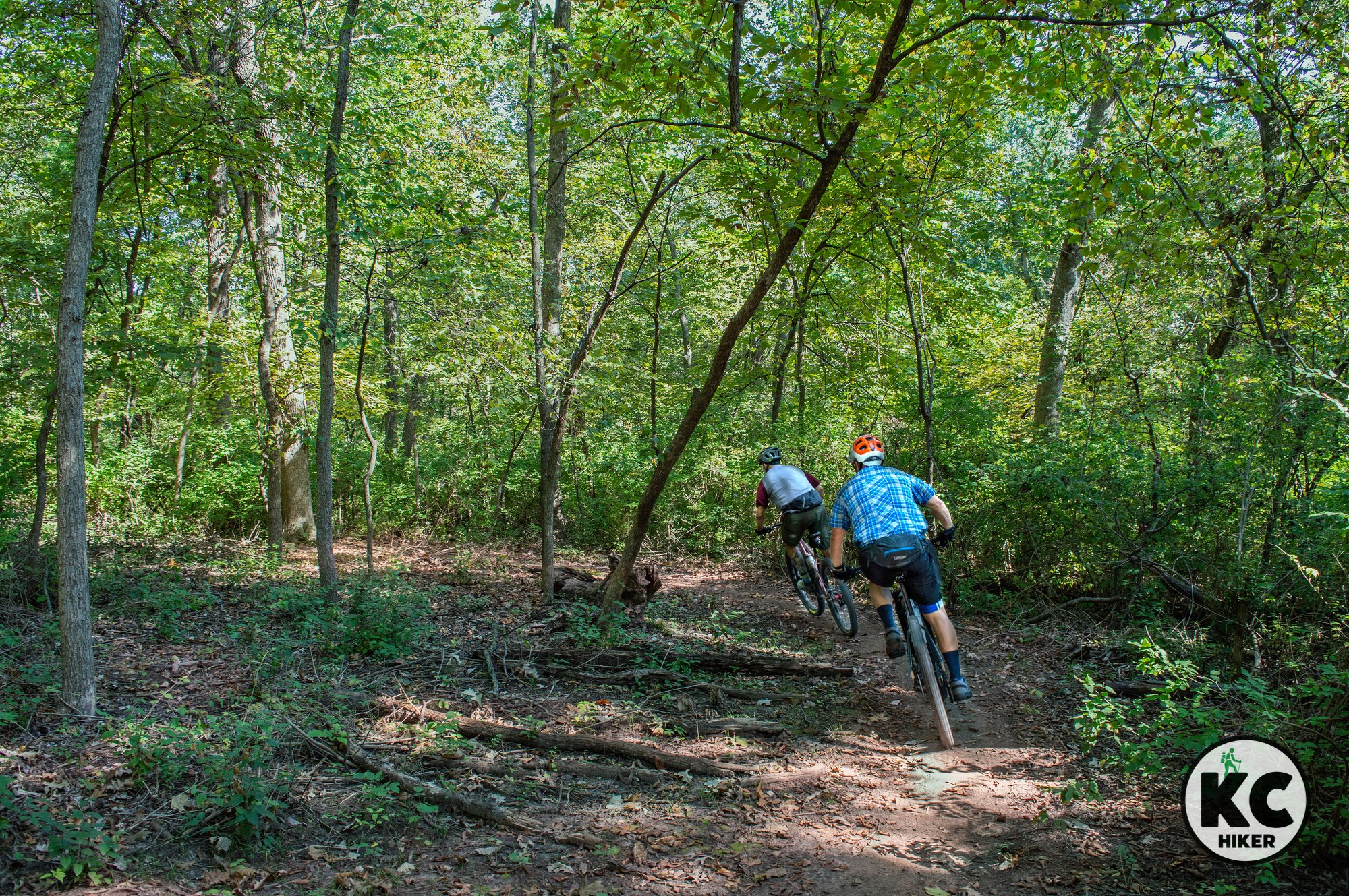
Smithville Lake, in northern Clay County, Mo., is unique in its abundance of trails. According to the U.S. Army Corps of Engineers, the area features 24 miles of 10-foot-wide asphalt walking/biking trails, 11 miles of single-track mountain biking trails, and 26 miles of equestrian trails. This means there is something for everyone from the equestrian to the stroller pusher to the hard core mountain biker. The environment around Smithville Lake is gently rolling and pastoral, with much of the shoreline covered in forest. What it lacks in spectacular scenery, it makes up for in size: The lake is 7,200 acres and has more than 175 miles of shoreline. The remoteness of Smithville Lake and its lake environment make it a hotspot for viewing eagles, birds of pray and waterfowl.
Smithville Lake is a smorgasbord of trails, with 24 miles of 10-foot-wide asphalt walking/biking trails, 11 miles of single-track mountain biking trails and 26 miles of equestrian trails.
Numerous trail options are available for walkers, bikers and equestrians.
Trail Smithville Lake Trail System, Clay County, Mo.
Overview
Smithville Lake, in northern Clay County, Mo., is unique in its abundance of trails. According to the U.S. Army Corps of Engineers, the area features 24 miles of 10-foot-wide asphalt walking/biking trails, 11 miles of single-track mountain biking trails, and 26 miles of equestrian trails. This means there is something for everyone from the equestrian to the stroller pusher to the hard core mountain biker. The environment around Smithville Lake is gently rolling and pastoral, with much of the shoreline covered in forest. What it lacks in spectacular scenery, it makes up for in size: The lake is 7,200 acres and has more than 175 miles of shoreline. The remoteness of Smithville Lake and its lake environment make it a hotspot for viewing eagles, birds of prey and waterfowl.
Length There are 61 combined miles of walking, biking and equestrian trails.
Address and location There are numerous trail heads at which to begin your journey. Smithville Lake is located in Smithville, Mo., in Clay County. Download the trail map or view the Google map below to choose a starting point.
Conditions The 24 miles of walking trails are paved with asphalt. The bike trails and horse trails are natural surfaces. The trails are expertly marked and maintained and there is ample parking at trailheads.
Kid friendly? The wide asphalt trails are excellent for accommodating children on bicycles or on strollers. Hearty kids will likely be fine on the single-track bike trails and horse trails.
How busy? The Smoke and Davey Trail is a popular destination. The lake also features hundreds of campsites and draws many “weekend warriors.” The bike and horse trails receive less traffic.
Pets Yes, on a leash (unless otherwise designated).
Bikes Allowed.
Restrooms can be found throughout the park, however, some are only open seasonally.
Trail Maps
Smithville Lake paved walking trail map [quick download] [high resolution]
Smithville Lake single-track mountain bike map (courtesy of the Urban Trail Co.)


Hidden Valley Park: An Oasis of Nature in KC’s Northland
The Hidden Valley Trail begins immediately south of Hidden Valley Park in Clay County in Kansas City, Mo. It’s an oasis of nature sandwiched between Worlds of Fun, interstate highways and office complexes. But if you wear headphones (or earplugs), you would think you were somewhere in the woods of central Missouri or the Ozarks. The trail is well marked and maintained by the Urban Trail Co. If there has been recent precipitation, check their trail status chart to make sure it’s open. Topographically, it gently weaves around the steep banks of a creek that drains a broad area. You’ll walk under 100% forest canopy on a hard-packed dirt path. This is a highly-rated, relaxing and fairly easy trail allowing you to escape urbanity in the midst of it.

Hidden Valley Park and Trail system, Kansas City, Mo.
At Hidden Valley Park, hikers and bikers can trek wild woods in the shadow of Worlds of Fun.
Trail Hidden Valley Park and Trail
Overview
The Hidden Valley Trail begins immediately south of Hidden Valley Park in Clay County in Kansas City, Mo. It’s an oasis of nature sandwiched between Worlds of Fun, interstate highways and office complexes. But if you wear headphones (or earplugs), you would think you were somewhere in the woods of central Missouri or the Ozarks. The trail is well marked and maintained by the Urban Trail Co. If there has been recent precipitation, check their trail status chart to make sure it’s open. Topographically, it gently weaves around the steep banks of a creek that drains a broad area. You’ll walk under 100% forest canopy on a hard-packed dirt path. This is a highly-rated, relaxing and fairly easy trail allowing you to escape urbanity in the midst of it.
Length 4 mile loop.
Address and location 4029 Bellaire Ave, Kansas City, Mo., 64117
Conditions This is a dirt trail but it’s effortless to navigate. There are minor elevation changes and it’s easy-to-moderate in difficulty. The trail would be a challenge for someone with a disability.
Kid friendly? Although this trail doesn’t accommodate strollers, it’s a great walk for children. Parents should be mindful of letting kids get too close to the steep banks of the stream.
How busy? This trail can be busy during peak days and hours.
Pets Yes, on a leash (unless otherwise designated).
Bikes Allowed.
Restrooms are available at Hidden Valley Park.


Maple Woods Natural Area Preserves Old-Growth Forest in KC’s Northland
This 60-acre preserve is an outpost of old-growth forest that gives a glimpse of pre-development Kansas City. Fall colors are dazzling because of the concentration of maple trees. Maple Woods is a National Natural Landmark recognized by the National Park Service. In addition, you can find Pawpaw trees, which yield the largest tree fruit native to the United States.

Maple Woods Natural Area, Gladstone, Clay County, Mo.
Talk a walk through old growth forest in Clay County
Trail Maple Woods Natural Area
Overview
This 60-acre preserve is an outpost of old-growth forest that gives a glimpse of pre-development Kansas City. Fall colors are dazzling because of the concentration of maple trees. Maple Woods is a National Natural Landmark recognized by the National Park Service. In addition, you can find Pawpaw trees, which yield the largest tree fruit native to the United States. The Missouri Department of Conservation describes the area this way: “Maple Woods is a reminder of the wildlands that once dominated this area just 200 years ago. This old-growth forest is a National Natural Landmark and contains impressive black maple (a variety of sugar maple), northern red, white and bur oaks; bitternut and shagbark hickory, red elm, basswood, black walnut, and white ash.”
Length About one mile in two loops.
Address and location 2603-2617 NE 76th St, Gladstone, Mo., 64119
Conditions This is a dirt trail but it’s easy to navigate. There are minor elevation changes and natural obstacles in the path (branches, fallen trees), so this trail is for the sure footed.
Kid friendly? Although this trail doesn’t accommodate strollers, it’s a great walk for children.
How busy? This trail can be busy during peak days and hours.
Pets Yes, on a leash (unless otherwise designated).
Bikes Prohibited.
Restrooms are not available.


The Happy Rock Trail Follows the Meanders of Shoal Creek in KC North
The 3.3-mile Happy Rock Trail, sometimes referred to as the Shoal Creek Trail, offers a pleasant walk alongside the meanders of Shoal Creek, passing through mostly shaded and forested areas in Clay County, Mo.

Happy Rock/Shoal Creek Trail, Clay County, Mo., Kansas City North
This popular streamway follows the meanders of Shoal Creek.
Trail Happy Rock Trail, sometimes referred to as the Shoal Creek Trail
Overview
The Happy Rock Trail offers a pleasant walk alongside the meanders of Shoal Creek, passing through mostly shaded and forested areas in Clay County, Mo.Length 3.3 miles.
Address and location This trail is accessible from:
Happy Rock Park, 7600 NE Antioch Rd, Kansas City, Mo., 64119
Maple Woods Community College, southwest parking lot, 2601 NE Barry Rd, Kansas City, MO 64156
The Ballard & Co. Public Trail Parking on Barry Road
Conditions This is a paved, well-maintained and easy to access trail. There are moderate to minor elevation changes.
Kid friendly? This is a stroller-friendly, bike-friendly trail. However, it can be busy so parents will need to be mindful of bike traffic. Water safety is also important if kids stop to play in nearby Shoal Creek.
How busy? This is a popular trail and can be busy during peak days/hours.
Pets Yes, on a leash (unless otherwise designated).
Bikes Non-motorized bicycles are permitted.
Restrooms are available at Happy Rock Park.


Maple Woods Trailhead

History Meets Nature at Watkins Mill State Park
Watkins Mill is both a state park and a National Historic Landmark. You can experience nature and get in a good walk no matter which avenue you choose to explore. Let’s start with the mill: The three-story structure is the only 19th century textile mill in North America with original machinery still in place. Walking the estate is good exercise in and of itself. Depending on the season, guests can view some elements of the former working farm, including sheep, chickens and other animals suited to agriculture. A well-manicured vegetable and flower garden are accessible near the estate’s mansion. Tours are available and there numerous exhibits at the park’s visitors center.
The nature-focused part of the park is centered around a 100-acre lake that is open to fishing and kayakers. It’s looped by a 3.8-mile paved trail that cuts through the forest along the shoreline. Beyond the trail and lake, there’s plenty of room to roam in the park’s 1,500 acres of mostly forested property.

Watkins Mill State Park and trail, Clay County, Mo.
Explore local history and dive into nature at the same time.
Trail Watkins Woolen Mill State Park
Overview
Watkins Mill is both a state park and a National Historic Landmark. You can experience nature and get in a good walk no matter which avenue you choose to explore. Let’s start with the mill: The three-story structure is the only 19th century textile mill in North America with original machinery still in place. Walking the estate is good exercise in and of itself. Depending on the season, guests can view some elements of the former working farm, including sheep, chickens and other animals suited to agriculture. A well-manicured vegetable and flower garden are accessible near the estate’s mansion. Tours are available and there numerous exhibits at the park’s visitors center.The nature-focused part of the park is centered around a 100-acre lake that is open to fishing and kayakers. It’s looped by a 3.8-mile paved trail that cuts through the forest along the shoreline. Beyond the trail and lake, there’s plenty of room to roam in the park’s 1,500 acres of mostly forested property.
Length The official trail is 3.8 miles long. You can rack up more mileage exploring the historic portion of the park.
Address and location 26600 Park Road North, Lawson, Mo., 64062
Conditions The paved trail surrounding the lake has only minor elevation changes. You tour the historic areas of the park via a gravel road.
Kid friendly? This is an excellent place for children to explore. The historic area is essentially “hands on” with plenty of room for kids to run and play. The 3.8-mile loop is paved and conducive to strollers and bikes. Parents should be mindful of their children’s safety when bikers are passing.
How busy? The park can be busy during peak days and seasons.
Pets Yes, on a leash and only on the paved trail. Pets are prohibited in the historic area.
Bikes Non-motorized bicycles are permitted.
Restrooms are available at the visitors center, at some picnic shelters and in other public areas of the park.


