Cooley Lake Conservation Area: Rugged Bluffs and Serene Marshland

Cooley Lake Conservation Area, Clay County, Mo.
Hikers can enjoy Missouri River access, an oxbow lake and towering bluffs.
Trail Cooley Lake Conservation Area
Overview
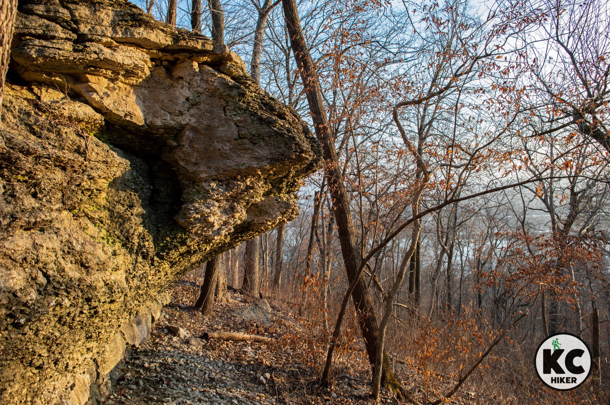
Cooley Lake is named after a still-existing oxbow lake that broke off from the Missouri River. Part of the conservation area is north of Highway 210 and part is south. The southern portion provides about a half-mile of riverfront access. The northern side is where the trails are located. Hikers will experience diverse environments. In the lowlands you’ll find extensive marsh areas, including those surrounding Cooley Lake. Sometimes it’s more marsh than lake, but it’s a beautiful area regardless. The 1,345-acre reserve also includes some cropland. A highlight is the 200-foot bluffs that rise from the lake and overlook the Missouri River Valley. The bluffs are heavily forested and peppered with limestone outcroppings. An observation platform is located atop the bluffs. It can be reached by driving up Ridge Road. Trails are scenic but challenging to navigate. See our notes below on conditions.
Conservation area warning
It’s best to wear orange during major hunting seasons. It’s also recommended to stay on trails and avoid dawn and dusk.
Length The bottomland trail is approximately one mile out-and-back (two miles total). The ridge trail is approximately 1.5-miles out-and-back (three miles total).
Address and location The conservation area is two miles east of Missouri City on 210 Highway. The address is Cooley Lake Conservation Area, Excelsior Springs, Mo., 64024. If you need street coordinates, take 210 Highway to Boyer Road and turn north. You’ll immediately enter the area.
Conditions Trails in Missouri Conservation areas, including this one, are often sporadically maintained and difficult to follow. This is especially true during seasons of thick foliage. On paper, there are several miles of trails here. The reality is that a significant portion are overgrown from May-October. This can be frustrating, because trail signs are still posted, but often seem to lead to nowhere. Because this is a beautiful area and worth seeing, we’ve reconfigured the Missouri Department of Conservation map to illustrate navigable trails (see map below)
Ridge Trail Access this natural surface trail from Ridge Road, where there is a small, gravel parking area. Cross the street (south) and begin where a trail sign is posted. This will lead about 1.5-miles east before trail markers stop and you can return the way you came. This trail is best enjoyed from late fall to early spring.
Bottomland Trail This trail begins at a parking lot and parallels the marsh. It’s essentially a dirt road and is easy to follow. It ends abruptly in a crop field. This trail is best enjoyed from late fall to early spring.
Exploring off trail is rewarding. Climbing the rock bluffs and wandering the lowlands unearths many surprises. You’ll need sturdy footwear because the area ranges from marshy, to muddy to rocky. The bluffs are extremely steep.
Kid friendly? Small children will enjoy exploring nature but may find the trails challenging. With several small lakes, parents should also be mindful of water safety and exercise safety during popular hunting seasons. If you visit the river frontage, extra care must be given to water safety.
How busy? This conservation area is a place of solitude – except during deer and turkey season.
Pets Yes, on a leash (unless otherwise designated); hunting dogs can be off leash, but see all regulations here.
Bikes Prohibited except on roadways.
Restrooms are available at the Missouri River access part of the conservation area.