Flint Hills Trail: 100+ miles of pastoral delight

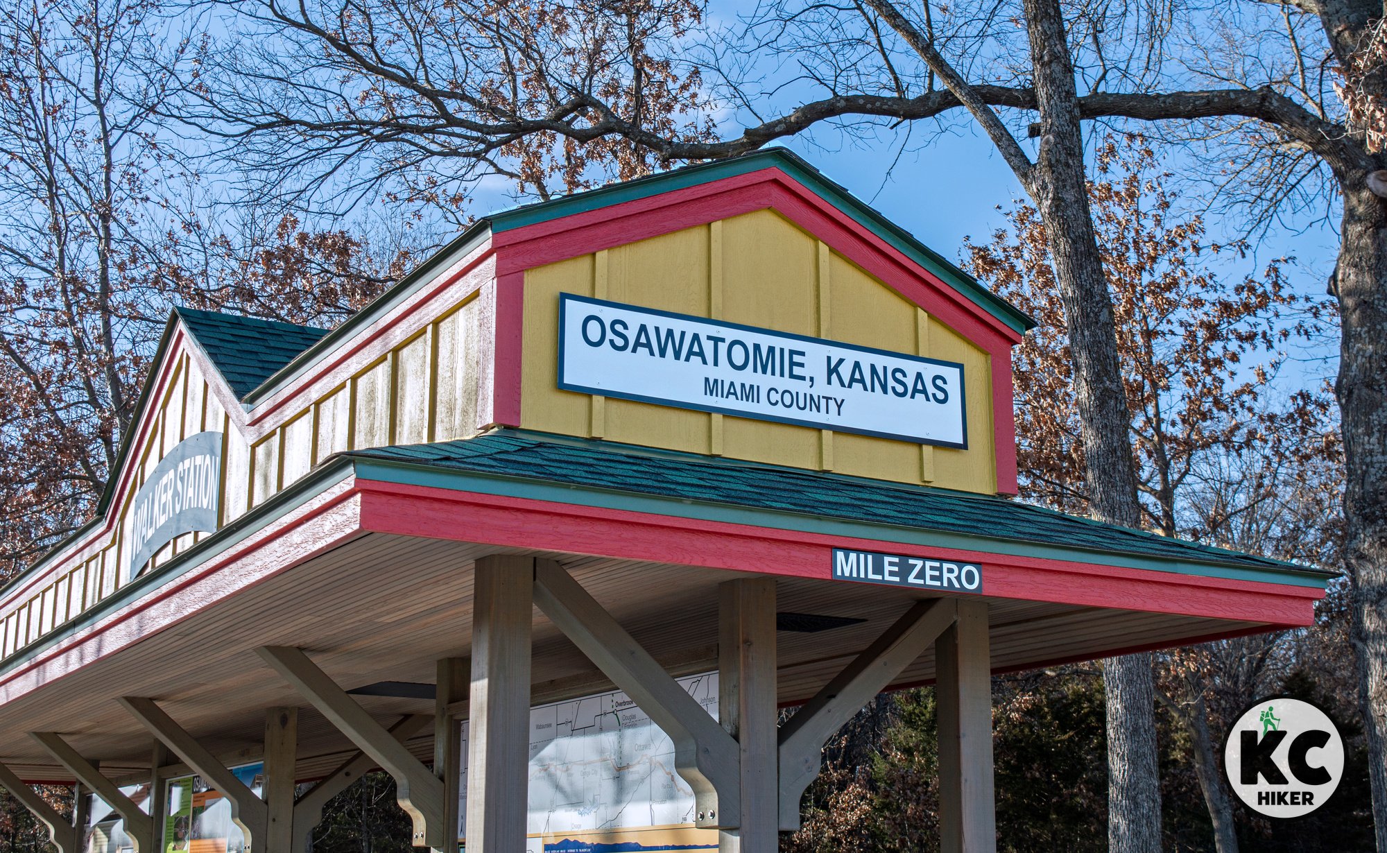
Flint Hills Trail, mile zero, Osawatomie, Kansas
Kansas’ longest trail stretches from Osawatomie to Council Grove.
Trail Flint Hills Trail
Overview
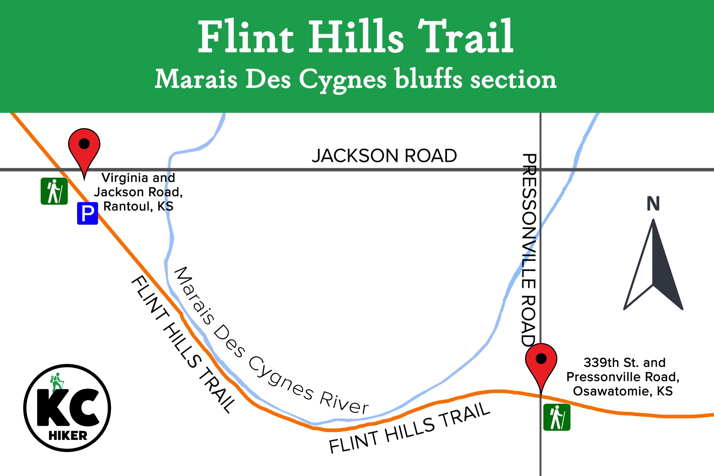
The Flint Hills Trail begins in Osawatomie, Kansas, in Miami County and will ultimately end in the small town of Herrington. It currently ends at the 92-mile marker in Council Grove. There’s plenty of serenity between Osawatomie and Council Grove, with the topography growing more rolling and scenic as you head west. This 118-mile rails-to-trail hiking and biking path was developed by the Kanza Conservancy. In addition to being Kansas’ longest trail, it is the seventh-longest rail-trail in the United States. One of its most-scenic sections runs along the Marais Des Cygnes River under towering, wooded bluffs (head west at the trailhead at 339th St. and Pressonville Road, Osawatomie as shown below).
The river, which runs near the trail for miles, is a beautiful natural fixture in and of itself. The trail’s environment ranges from lonely pastoral landscapes, to farmer’s backyards to wooded enclaves. The area is rich in both Native American and United States history and figured centrally in the Civil War. The “mile zero” trailhead in Osawatomie is about 10 miles from Ottawa, population 12,000. Ottawa is the largest city along the trail and provides ample services. If you’re biking, then riding to Ottawa, eating lunch and returning is a reasonable plan for the day. Bikes can also be rented in Ottawa.
The trail encounters increasingly hilly terrain as it progresses west. Highlights include scenic views west of the Bushong Trailhead and an offramp at the Kaw Nation Memorial.
The trail runs through communities including Rantoul, Ottawa, Pomona, Vassar, Osage City, Miller, Admire, Allen, Bushong, and Council Grove. It passes through five counties: Miami, Franklin, Osage, Lyon, and Morris.
Read more about different sections of the trail in our blog post on the Flint Hills Trail.
External links
Drive Time The easternmost trailhead, in Osawatomie, Kan., is 59 minutes from Downtown Kansas City. If you choose to start on the western side, in Council Grove, the drive is about two hours.
Length 118 miles
Address and location The trail can be accessed at 13 points from Osawatomie in the east to Herrington in the west. (Note: If you are planning to begin in Osawatomie and using Google Maps, it will take you to a residential address with no trail access. Instead, plug in the coordinates for Karl E. Cole Sports Complex, 900 12th St, Osawatomie, Kan., 66064. The trailhead is marked and can be found on the southwest side of the park. You can leave your vehicle right next to it.)
Conditions The trail is made of crushed gravel and is well marked and maintained. Elevation changes are minor. In wet weather, the trail is still passable and open, but will be soggy. The only “hazard” may be the occasional excited farm dog.
Kid friendly? This is a quiet, flat trail with no obstacles for children.
How busy? Much of this area is rural and remote so traffic is sparse. In populated areas traffic may be moderate.
Pets Yes, on a leash.
Bikes Yes (and horses).


Osawatomie, Kansas, Trailhead